Hermine “Minnie” Bunjer Grues
| Birth | : | 8 Oct 1873 Cleves, Hardin County, Iowa, USA |
| Death | : | 15 Jul 1906 Renville, Renville County, Minnesota, USA |
| Burial | : | Upper Indian Creek Cemetery, Viburnum, Iron County, USA |
| Coordinate | : | 37.7215900, -91.0954700 |
| Plot | : | 2A-58-E1 |
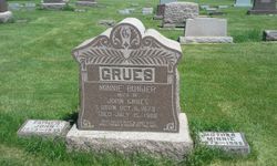
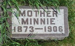
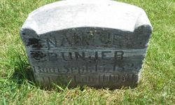
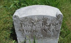
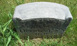
| Inscription | : | WIFE OF JOHN GRUES REST, MOTHER, REST, IN QUIET SLEEP, WHILE FRIENDS IN SORROW O'ER THEE WEEP. MOTHER MINNIE |
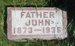
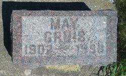
| Description | : | Hermine Grues (19839634) Suggested edit: Hermine "Minnie" Bunjer Grues and John Jan Grues had a total of five children. Firstborn was Lillian (my maternal grandmother), second was Lena, third was Nantje (Nanny), fourth was Mary (May), fifth was namesake Minnie. Mother Minnie died in childbed after giving birth to Minnie. Contributor: PenGates |
frequently asked questions (FAQ):
-
Where is Hermine “Minnie” Bunjer Grues's memorial?
Hermine “Minnie” Bunjer Grues's memorial is located at: Upper Indian Creek Cemetery, Viburnum, Iron County, USA.
-
When did Hermine “Minnie” Bunjer Grues death?
Hermine “Minnie” Bunjer Grues death on 15 Jul 1906 in Renville, Renville County, Minnesota, USA
-
Where are the coordinates of the Hermine “Minnie” Bunjer Grues's memorial?
Latitude: 37.7215900
Longitude: -91.0954700
Family Members:
Parent
Spouse
Siblings
Children
Flowers:
Nearby Cemetories:
1. Upper Indian Creek Cemetery
Viburnum, Iron County, USA
Coordinate: 37.7215900, -91.0954700
2. First Baptist Church Cemetery
Viburnum, Iron County, USA
Coordinate: 37.7194700, -91.1349100
3. Chandler Cemetery
Iron County, USA
Coordinate: 37.6810989, -91.1018982
4. Czar Cemetery
Czar, Crawford County, USA
Coordinate: 37.7584800, -91.1225800
5. Abbott Cemetery
Iron County, USA
Coordinate: 37.7103004, -91.0335999
6. Richards Cemetery
Iron County, USA
Coordinate: 37.6768990, -91.1378021
7. Sam Crocker Cemetery
Good Water, Iron County, USA
Coordinate: 37.6921997, -91.0353012
8. Hedrick Cemetery
Iron County, USA
Coordinate: 37.6805992, -91.1457977
9. Maple Grove Cemetery
Crawford County, USA
Coordinate: 37.7083015, -91.1800003
10. Pump Cemetery
Iron County, USA
Coordinate: 37.6497002, -91.0789032
11. Sellers Cemetery
Davisville, Crawford County, USA
Coordinate: 37.7696590, -91.1684480
12. Old Dillard Cemetery
Crawford County, USA
Coordinate: 37.7200010, -91.2043990
13. Turner Cemetery
Iron County, USA
Coordinate: 37.6453018, -91.0436020
14. Dillard Cemetery
Dillard, Crawford County, USA
Coordinate: 37.7393990, -91.2069020
15. Thompson Cemetery
Banner, Iron County, USA
Coordinate: 37.6335983, -91.0317001
16. Boss Cemetery
Boss, Dent County, USA
Coordinate: 37.6444470, -91.1912010
17. Turnbough Cemetery
Crawford County, USA
Coordinate: 37.7914009, -91.2033005
18. Mount Pleasant Cemetery
Goodland, Iron County, USA
Coordinate: 37.6376700, -91.0038400
19. Woodlock Cemetery
Crawford County, USA
Coordinate: 37.8119011, -91.1817017
20. Stricklin Cemetery
Iron County, USA
Coordinate: 37.6211014, -91.0274963
21. Rocky Ford Cemetery
Dent County, USA
Coordinate: 37.6788600, -91.2319300
22. Davisville Cemetery
Davisville, Crawford County, USA
Coordinate: 37.8039513, -91.2067795
23. Hill Cemetery
Crawford County, USA
Coordinate: 37.7930984, -91.2221985
24. Shoal Creek Cemetery
Steelville, Crawford County, USA
Coordinate: 37.8446520, -91.1266840

