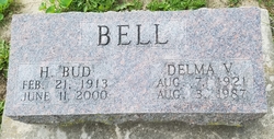
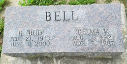
Horace “Bud” Bell
| Birth | : | 21 Feb 1913 Kansas, USA |
| Death | : | 11 Jun 2000 Danville, Des Moines County, Iowa, USA |
| Burial | : | Hillcrest Cemetery, Thedford, Thomas County, USA |
| Coordinate | : | 41.9673000, -100.5756000 |
| Description | : | The Burlington Hawkeye, June 17, 2000 Horace Bell Horace "Bud" Bell, 87, of Danville, died at 5:30 p.m. Sunday, June 11, 2000, at Danville Care Center. Born Feb. 21, 1913, in Coffeeville, Kan., he was the son of William and Blanche King Bell. On Oct. 25, 1941, he married Delma Morison in Bloomfield. She died Aug. 3, 1987. Mr. Bell worked as a city engineer and street commissioner for the city of Danville for 27 years, retiring in 1978. He also was in charge of track preparation at 34 Raceway for 30 years. He worked for the Danville Volunteer Fire Department... Read More |
frequently asked questions (FAQ):
-
Where is Horace “Bud” Bell's memorial?
Horace “Bud” Bell's memorial is located at: Hillcrest Cemetery, Thedford, Thomas County, USA.
-
When did Horace “Bud” Bell death?
Horace “Bud” Bell death on 11 Jun 2000 in Danville, Des Moines County, Iowa, USA
-
Where are the coordinates of the Horace “Bud” Bell's memorial?
Latitude: 41.9673000
Longitude: -100.5756000
Family Members:
Spouse
Flowers:
Nearby Cemetories:
1. Hillcrest Cemetery
Thedford, Thomas County, USA
Coordinate: 41.9673000, -100.5756000
2. Seneca Cemetery
Seneca, Thomas County, USA
Coordinate: 42.0364990, -100.8328018
3. Jimtown Cemetery
Brownlee, Cherry County, USA
Coordinate: 42.1174000, -100.8014500
4. Purdum Cemetery
Purdum, Blaine County, USA
Coordinate: 42.0638190, -100.2574890
5. Lone Star Cemetery
McPherson County, USA
Coordinate: 41.7106000, -100.7129000
6. Brownlee Cemetery
Brownlee, Cherry County, USA
Coordinate: 42.2889100, -100.6234710
7. Virginia Cemetery
Valentine, Cherry County, USA
Coordinate: 42.1432000, -100.9761000
8. James Cemetery
Cherry County, USA
Coordinate: 42.1436005, -100.9760971
9. Giles Cemetery
Cherry County, USA
Coordinate: 42.1603012, -100.1828003
10. Cedarview Cemetery
Mullen, Hooker County, USA
Coordinate: 42.0439491, -101.0372009
11. Long Cemetery
Cherry County, USA
Coordinate: 42.2932000, -100.8156000
12. Dunning Cemetery
Dunning, Blaine County, USA
Coordinate: 41.8213110, -100.0984530
13. Hawley Flats Cemetery
Blaine County, USA
Coordinate: 42.0003014, -100.0203018
14. Emanuel Gravesite
Brownlee, Cherry County, USA
Coordinate: 42.3514000, -100.8021500
15. Valley View Cemetery
Brown County, USA
Coordinate: 42.1217003, -100.0488968
16. Hartgrave Cemetery
Cherry County, USA
Coordinate: 42.3244500, -100.2680800
17. Miller Cemetery
Tryon, McPherson County, USA
Coordinate: 41.5892960, -100.8585770
18. DeWitty Cemetery
Brownlee, Cherry County, USA
Coordinate: 42.3714000, -100.8296000
19. Dry Valley Cemetery
Cherry County, USA
Coordinate: 42.2640300, -101.0857200
20. Hecla Graves
Hecla, Hooker County, USA
Coordinate: 42.0376840, -101.2346040
21. Shady Rest Cemetery
Valentine, Cherry County, USA
Coordinate: 42.4598160, -100.6837050
22. Loup Valley Cemetery
Logan County, USA
Coordinate: 41.4700012, -100.6841965
23. Saint Johns Cemetery
Gandy, Logan County, USA
Coordinate: 41.4655991, -100.4828033
24. Eclipse Cemetery
Mullen, Hooker County, USA
Coordinate: 41.7705500, -101.2592000


