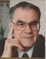
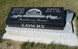
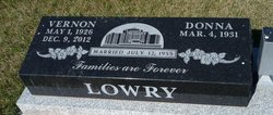
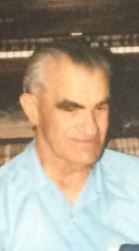
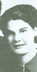
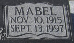
Horace Vernon Lowry
| Birth | : | 1 May 1926 Alberta, Canada |
| Death | : | 9 Dec 2012 Edmonton, Edmonton Census Division, Alberta, Canada |
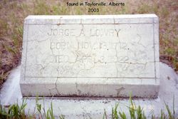
| Burial | : | Taylorville Cemetery, Taylorville, Claresholm Census Division, Canada |
| Coordinate | : | 49.0498100, -113.1404000 |
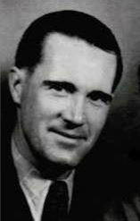
| Description | : | LOWRY, Horace Vernon Vernon was born in Taylorville, Alberta, on May 1, 1926. He died on December 9, 2012, in Edmonton. He grew up on a farm in the Taylorville area, south of Cardston, Alberta. Vernon was always an active member of the Church of Jesus Christ of Latter-day Saints, and as a young man served as a missionary in New Zealand for 30 months. He attended the University of Alberta, where he obtained a Bachelor of Education degree, and where he met his wife, Donna. After teaching school for a few years, he returned to the U of A and obtained... Read More |
frequently asked questions (FAQ):
-
Where is Horace Vernon Lowry's memorial?
Horace Vernon Lowry's memorial is located at: Taylorville Cemetery, Taylorville, Claresholm Census Division, Canada.
-
When did Horace Vernon Lowry death?
Horace Vernon Lowry death on 9 Dec 2012 in Edmonton, Edmonton Census Division, Alberta, Canada
-
Where are the coordinates of the Horace Vernon Lowry's memorial?
Latitude: 49.0498100
Longitude: -113.1404000
Family Members:
Parent
Siblings
Flowers:
Nearby Cemetories:
1. Taylorville Cemetery
Taylorville, Claresholm Census Division, Canada
Coordinate: 49.0498100, -113.1404000
2. Kimball Cemetery
Kimball, Claresholm Census Division, Canada
Coordinate: 49.0949000, -113.2077000
3. Aetna Cemetery
Aetna, Claresholm Census Division, Canada
Coordinate: 49.1163000, -113.2707000
4. Big Bend Hutterite Colony
Cardston, Claresholm Census Division, Canada
Coordinate: 49.1636110, -113.1411110
5. Woolford Cemetery
Woolford, Claresholm Census Division, Canada
Coordinate: 49.1945800, -113.1652300
6. East Cardston Hutterite Cemetery
Cardston, Claresholm Census Division, Canada
Coordinate: 49.1908348, -113.2258004
7. Saint Stephen's Cemetery
Beazer, Claresholm Census Division, Canada
Coordinate: 49.0937300, -113.3852700
8. Cardston Cemetery
Cardston, Claresholm Census Division, Canada
Coordinate: 49.1906900, -113.3415300
9. Beazer Cemetery
Beazer, Claresholm Census Division, Canada
Coordinate: 49.1097500, -113.4975800
10. West Raley Hutterite Cemetery
Raley, Claresholm Census Division, Canada
Coordinate: 49.2908857, -113.2283616
11. Crystal Spring Hutterite Colony Cemetery
Magrath, Claresholm Census Division, Canada
Coordinate: 49.1702490, -112.8048290
12. Leavitt Cemetery
Leavitt, Claresholm Census Division, Canada
Coordinate: 49.1830500, -113.4768200
13. Babb Cemetery
Babb, Glacier County, USA
Coordinate: 48.8630000, -113.4438000
14. Spring Coulee Cemetery
Spring Coulee, Claresholm Census Division, Canada
Coordinate: 49.3412100, -113.0541400
15. Spring Valley Hutterite Colony Cemetery
Spring Coulee, Claresholm Census Division, Canada
Coordinate: 49.3517043, -113.0551519
16. Mountain View Cemetery
Mountain View, Claresholm Census Division, Canada
Coordinate: 49.1293300, -113.5986300
17. Rockport Colony Cemetery
Magrath, Claresholm Census Division, Canada
Coordinate: 49.3027780, -112.8136110
18. Denzel Ray Brown Ranch Cemetery
Blackfeet Indian Reservation, Glacier County, USA
Coordinate: 48.7200102, -113.1930311
19. Crown Butte/Connolly Family Cemetery
Glacier County, USA
Coordinate: 48.8229991, -112.7427882
20. Black Family Cemetery
Saint Mary, Glacier County, USA
Coordinate: 48.7436670, -113.4301670
21. Pioneer Cemetery
Levern, Claresholm Census Division, Canada
Coordinate: 49.3489700, -113.4642000
22. Blue Ridge Hutterite Cemetery
Hill Spring, Claresholm Census Division, Canada
Coordinate: 49.2320117, -113.6305672
23. Saint Paul's Cemetery
Claresholm Census Division, Canada
Coordinate: 49.0405700, -113.7215400
24. Hutterville Hutterite Cemetery
Magrath, Claresholm Census Division, Canada
Coordinate: 49.3503165, -112.7701038

