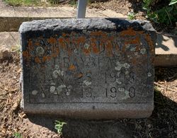
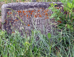
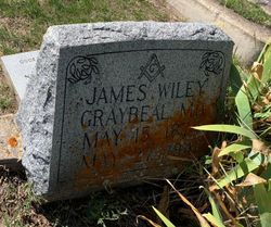
Howard W Graybeal
| Birth | : | 25 Jan 1908 Chouteau County, Montana, USA |
| Death | : | 13 Mar 1930 Belt, Cascade County, Montana, USA |
| Burial | : | Timaru Cemetery, Timaru, Timaru District, New Zealand |
| Coordinate | : | -44.4122320, 171.2574270 |
| Description | : | Belt Youth Killed by Electric Shock Howard Graybeal, 24, an employee of the Montana Power Company was electrocuted at 9:30 A.M., Thursday, March 13, (1930)while working on power lines in Belt, Montana. Howard was one of a crew working on lines near the Calone-Johnson mine on the east side hill. Montana Power Company and telephone lines were being adjusted to a single set of poles when Howard came in contact with a power line carrying 2,200 volts of electricity. The Great Falls fire department responded to the call made soon after the tragedy and arrived in Belt within 35... Read More |
frequently asked questions (FAQ):
-
Where is Howard W Graybeal's memorial?
Howard W Graybeal's memorial is located at: Timaru Cemetery, Timaru, Timaru District, New Zealand.
-
When did Howard W Graybeal death?
Howard W Graybeal death on 13 Mar 1930 in Belt, Cascade County, Montana, USA
-
Where are the coordinates of the Howard W Graybeal's memorial?
Latitude: -44.4122320
Longitude: 171.2574270
Family Members:
Parent
Flowers:
Nearby Cemetories:
1. Timaru Cemetery
Timaru, Timaru District, New Zealand
Coordinate: -44.4122320, 171.2574270
2. Salisbury Park Crematorium
Timaru, Timaru District, New Zealand
Coordinate: -44.4292400, 171.2080200
3. Pareora West Cemetery
Pareora West, Timaru District, New Zealand
Coordinate: -44.4383120, 171.1343000
4. Otaio Cemetery
Otaio, Waimate District, New Zealand
Coordinate: -44.5535220, 171.1790260
5. Whareki Cemetery
Temuka, Timaru District, New Zealand
Coordinate: -44.2558600, 171.2734500
6. Temuka Cemetery
Temuka, Timaru District, New Zealand
Coordinate: -44.2499010, 171.3014390
7. St. Mary's Church Cemetery
Esk Valley, Waimate District, New Zealand
Coordinate: -44.5244000, 171.0836000
8. Pleasant Point Cemetery
Pleasant Point, Timaru District, New Zealand
Coordinate: -44.2615490, 171.1237320
9. Burnett Family Cemetery
Cave, Timaru District, New Zealand
Coordinate: -44.3156830, 170.9457270
10. Saint Aidan's Churchyard
Geraldine, Timaru District, New Zealand
Coordinate: -44.1544420, 171.0980340
11. St David’s Anglican Churchyard
Mackenzie District, New Zealand
Coordinate: -44.1706380, 170.9887810
12. Geraldine Cemetery
Geraldine, Timaru District, New Zealand
Coordinate: -44.0982600, 171.2407000
13. Albury Cemetery
Albury, Mackenzie District, New Zealand
Coordinate: -44.2371220, 170.8736570
14. St. Anne's Churchyard
Geraldine, Timaru District, New Zealand
Coordinate: -44.0836111, 171.1994444
15. Waimate Lawn Cemetery
Waimate, Waimate District, New Zealand
Coordinate: -44.7401200, 171.0614100
16. Waimate Old Cemetery
Waimate, Waimate District, New Zealand
Coordinate: -44.7410700, 171.0601300
17. Te Waimatemate Urupā
Waimate, Waimate District, New Zealand
Coordinate: -44.7367311, 171.0277419
18. Woodbury Cemetery
Woodbury, Timaru District, New Zealand
Coordinate: -44.0360900, 171.2127000
19. Fairlie Cemetery
Fairlie, Mackenzie District, New Zealand
Coordinate: -44.1075700, 170.8301500
20. Arundel Cemetery
Arundel, Timaru District, New Zealand
Coordinate: -43.9785690, 171.2838900
21. Longbeach Estate Chapel
Longbeach, Ashburton District, New Zealand
Coordinate: -44.0941090, 171.6884504
22. Hinds Cemetery
Hinds, Ashburton District, New Zealand
Coordinate: -44.0075580, 171.5735400
23. Morven Cemetery
Morven, Waimate District, New Zealand
Coordinate: -44.8658369, 171.0852820
24. Cracroft Cemetery
Ruapuna, Ashburton District, New Zealand
Coordinate: -43.9341900, 171.2989500


