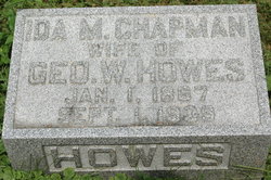
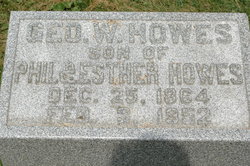
Ida M. Chapman Howes
| Birth | : | 1 Jan 1867 Iowa, USA |
| Death | : | 1 Sep 1939 Iowa, USA |
| Burial | : | Salisbury National Cemetery Annex, Salisbury, Rowan County, USA |
| Coordinate | : | 35.6879710, -80.4912790 |
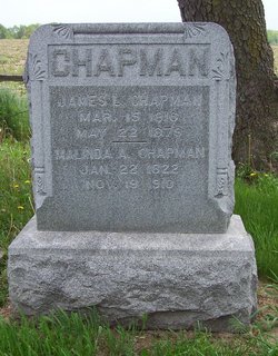
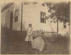
| Description | : | Ida is the daughter of James & Melinda (Carson) Chapman. James Laurence Chapman married Malinda Carson in Virginia. They had 14 children. They moved to Iowa when their daughter Ann was a baby. On their way they stopped at Harpers Ferry, John Norman was in charge of this crossing. The Chapmans moved by the Wapsipinicon River and took their claim in Clinton County, Iowa. They build a bridge about 2 miles east of Harpers Ferry. It was called Stevens Bridge. It was taken out in 1973. The Chapmans moved here in covered wagons and when they settled it was... Read More |
frequently asked questions (FAQ):
-
Where is Ida M. Chapman Howes's memorial?
Ida M. Chapman Howes's memorial is located at: Salisbury National Cemetery Annex, Salisbury, Rowan County, USA.
-
When did Ida M. Chapman Howes death?
Ida M. Chapman Howes death on 1 Sep 1939 in Iowa, USA
-
Where are the coordinates of the Ida M. Chapman Howes's memorial?
Latitude: 35.6879710
Longitude: -80.4912790
Family Members:
Parent
Spouse
Siblings
Children
Flowers:
Nearby Cemetories:
1. Salisbury National Cemetery Annex
Salisbury, Rowan County, USA
Coordinate: 35.6879710, -80.4912790
2. Oakwood Cemetery
Salisbury, Rowan County, USA
Coordinate: 35.6789040, -80.4985750
3. Oakdale Union Hill Cemetery
Salisbury, Rowan County, USA
Coordinate: 35.6763130, -80.4905630
4. Memorial Park Cemetery
Salisbury, Rowan County, USA
Coordinate: 35.6784680, -80.4800140
5. Gloria Dei Lutheran Church Columbarium
Salisbury, Rowan County, USA
Coordinate: 35.6938358, -80.5110054
6. First Baptist Church of Salisbury Columbarium
Salisbury, Rowan County, USA
Coordinate: 35.6710000, -80.4710400
7. Sacred Heart Roman Catholic Cemetery
Salisbury, Rowan County, USA
Coordinate: 35.7077500, -80.5074440
8. Presbyterian Session House Burial Ground
Salisbury, Rowan County, USA
Coordinate: 35.6690550, -80.4720260
9. Saint John's Lutheran Columbarium and Garden
Salisbury, Rowan County, USA
Coordinate: 35.6688340, -80.4715850
10. Old English Cemetery
Salisbury, Rowan County, USA
Coordinate: 35.6699982, -80.4697037
11. Oak Grove Freedman's Cemetery
Salisbury, Rowan County, USA
Coordinate: 35.6697700, -80.4693000
12. Ardis Chapel AME Zion Church Cemetery
Salisbury, Rowan County, USA
Coordinate: 35.7038918, -80.4660721
13. Old Lutheran Church Cemetery
Salisbury, Rowan County, USA
Coordinate: 35.6699867, -80.4633102
14. Salisbury National Cemetery
Salisbury, Rowan County, USA
Coordinate: 35.6612282, -80.4746475
15. Rowan Memorial Park Cemetery
Salisbury, Rowan County, USA
Coordinate: 35.7178001, -80.4955978
16. Owen Family Cemetery
Salisbury, Rowan County, USA
Coordinate: 35.6652985, -80.5159988
17. Chestnut Hill Cemetery
Salisbury, Rowan County, USA
Coordinate: 35.6577300, -80.4853900
18. Dixonville Cemetery
Salisbury, Rowan County, USA
Coordinate: 35.6599998, -80.4721985
19. Bethel Lutheran Church Cemetery
Franklin, Rowan County, USA
Coordinate: 35.7212500, -80.4909410
20. Enon Baptist Church Cemetery
Salisbury, Rowan County, USA
Coordinate: 35.7082291, -80.5275421
21. Franklin Presbyterian Church Cemetery
Franklin, Rowan County, USA
Coordinate: 35.7246880, -80.5032580
22. Old Lebanon Methodist Church Cemetery
Salisbury, Rowan County, USA
Coordinate: 35.7248800, -80.4752750
23. Calvary Lutheran Church Columbarium
Spencer, Rowan County, USA
Coordinate: 35.6906720, -80.4373860
24. Calvary Baptist Church Cemetery
Salisbury, Rowan County, USA
Coordinate: 35.7240510, -80.4600340

