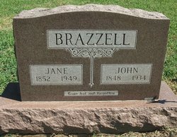
Ida Surrilda Brazzell Quillen
| Birth | : | 28 Oct 1871 Harrison County, Missouri, USA |
| Death | : | 15 Oct 1929 Harper County, Kansas, USA |
| Burial | : | Ben Lomond Catholic Cemetery, Ben Lomond, Armidale Regional Council, Australia |
| Coordinate | : | -30.0184870, 151.6608740 |
| Description | : | OBITUARY Ida Surrilda Brazzel was born in Harrison county, Missouri, on October 28, 1871. She died October 15, 1929, at the age of 57 years, 11 months, and 17 days. She was married to Francis Marion Quillen on March 2, 1898. To this union two sons were born: Walter Roy Roy and Jessie Verl. The Quillen family moved to Harper county, Kansas, on January 18, 1915. She obeyed the gospel of Christ at the age of 25 years, and was a faithful member of the Church of Christ for 32 years. She had been in failing health for several years,... Read More |
frequently asked questions (FAQ):
-
Where is Ida Surrilda Brazzell Quillen's memorial?
Ida Surrilda Brazzell Quillen's memorial is located at: Ben Lomond Catholic Cemetery, Ben Lomond, Armidale Regional Council, Australia.
-
When did Ida Surrilda Brazzell Quillen death?
Ida Surrilda Brazzell Quillen death on 15 Oct 1929 in Harper County, Kansas, USA
-
Where are the coordinates of the Ida Surrilda Brazzell Quillen's memorial?
Latitude: -30.0184870
Longitude: 151.6608740
Family Members:
Parent
Spouse
Siblings
Flowers:
Nearby Cemetories:
1. Ben Lomond General Cemetery
Ben Lomond, Armidale Regional Council, Australia
Coordinate: -30.0168430, 151.6575690
2. Lone Graves
Llangothlin, Armidale Regional Council, Australia
Coordinate: -30.1231550, 151.6865160
3. Moredun Cemetery
Moredun, Armidale Regional Council, Australia
Coordinate: -29.9981700, 151.5390080
4. Wandsworth General Cemetery
Wandsworth, Armidale Regional Council, Australia
Coordinate: -30.0591590, 151.5291450
5. Ollera Cemetery
Ollera, Armidale Regional Council, Australia
Coordinate: -30.1184960, 151.5220000
6. Mount Mitchell Cemetery
Mount Mitchell, Armidale Regional Council, Australia
Coordinate: -29.9461590, 151.8219570
7. Oban Station Cemetery
Backwater, Armidale Regional Council, Australia
Coordinate: -30.0756300, 151.8804070
8. Lone Graves
Guyra, Armidale Regional Council, Australia
Coordinate: -30.2178390, 151.6731260
9. Lone Graves
Tenterden, Armidale Regional Council, Australia
Coordinate: -30.1252340, 151.4340020
10. Guyra General Cemetery
Guyra, Armidale Regional Council, Australia
Coordinate: -30.2520890, 151.6787800
11. Pinkett Catholic Cemetery
Glen Innes, Glen Innes Severn Council, Australia
Coordinate: -29.8733220, 151.9466690
12. Black Mountain General Cemetery
Black Mountain, Armidale Regional Council, Australia
Coordinate: -30.3075220, 151.6573710
13. Glen Innes War Cemetery
Glen Innes, Glen Innes Severn Council, Australia
Coordinate: -29.7326889, 151.7530975
14. Glen Innes General Cemetery
Glen Innes, Glen Innes Severn Council, Australia
Coordinate: -29.7265950, 151.7533780
15. Kookabookra General Cemetery
Kookabookra, Armidale Regional Council, Australia
Coordinate: -30.0044490, 152.0147320
16. Red Range Cemetery
Red Range, Glen Innes Severn Council, Australia
Coordinate: -29.7643120, 151.8826040
17. Boorolong General Cemetery
Boorolong, Armidale Regional Council, Australia
Coordinate: -30.3299530, 151.5333510
18. Puddledock Goldfield Cemetery
Puddledock, Armidale Regional Council, Australia
Coordinate: -30.3555130, 151.7515920
19. Lone Graves
Puddledock, Armidale Regional Council, Australia
Coordinate: -30.3842780, 151.7490010
20. Lone Graves
Aberfoyle, Armidale Regional Council, Australia
Coordinate: -30.2412730, 152.0126720
21. Wattle Valley Cemetery
Aberfoyle, Armidale Regional Council, Australia
Coordinate: -30.2485390, 152.0065780
22. Wellingrove Presbyterian Cemetery
Wellingrove, Glen Innes Severn Council, Australia
Coordinate: -29.6436030, 151.5663530
23. Lone Graves
Tingha, Armidale Regional Council, Australia
Coordinate: -29.9556040, 151.2124730
24. Tingha Cemetery
Tingha, Armidale Regional Council, Australia
Coordinate: -29.9610310, 151.2111390


