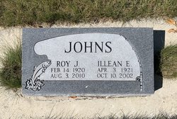
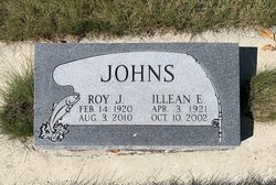
Illean Esther Morey Johns
| Birth | : | 3 Apr 1921 Sioux City, Woodbury County, Iowa, USA |
| Death | : | 10 Oct 2002 Missoula, Missoula County, Montana, USA |
| Burial | : | Choteau Cemetery, Choteau, Teton County, USA |
| Coordinate | : | 47.8121986, -112.1631012 |
| Description | : | Daughter of George A. and Winifred (Shepherd) Morey. Married Roy James Johns Feb. 23, 1941, in Choteau. __________ MISSOULA—Former Simms resident Illean Esther (Morey) Johns, 81, of Missoula, who along with her husband, Roy owned and operated Simms Mercantile from 1960 to 1978, died Thursday at a Missoula care facility. A memorial service is 1 p.m. Saturday at United Methodist Church in Simms. There will be a private burial of ashes. Cremation has taken place. Cremation and Burial Society of the Rockies in Missoula is handling the arrangements. Survivors include her husband, Roy Johns of Florence; daughters Linda Walt of Missoula and Eunice McClure... Read More |
frequently asked questions (FAQ):
-
Where is Illean Esther Morey Johns's memorial?
Illean Esther Morey Johns's memorial is located at: Choteau Cemetery, Choteau, Teton County, USA.
-
When did Illean Esther Morey Johns death?
Illean Esther Morey Johns death on 10 Oct 2002 in Missoula, Missoula County, Montana, USA
-
Where are the coordinates of the Illean Esther Morey Johns's memorial?
Latitude: 47.8121986
Longitude: -112.1631012
Family Members:
Spouse
Children
Flowers:
Nearby Cemetories:
1. Choteau Cemetery
Choteau, Teton County, USA
Coordinate: 47.8121986, -112.1631012
2. Trinity Lutheran Cemetery
Farmington, Teton County, USA
Coordinate: 47.8843994, -112.0764008
3. New Rockport Colony Cemetery
New Rockport Colony, Teton County, USA
Coordinate: 47.8648000, -112.0199000
4. Miller Colony Cemetery
Miller Colony, Teton County, USA
Coordinate: 47.9258000, -112.2943000
5. Bynum Cemetery
Bynum, Teton County, USA
Coordinate: 47.9710007, -112.3059998
6. Saint Paul Cemetery
Fairfield, Teton County, USA
Coordinate: 47.6758000, -111.9014000
7. United Church of Christ Columbarium
Fairfield, Teton County, USA
Coordinate: 47.6158400, -111.9784300
8. Fairfield Mennonite Cemetery
Fairfield, Teton County, USA
Coordinate: 47.6149840, -111.9804050
9. Beck Cemetery
Teton County, USA
Coordinate: 47.7844009, -111.8163986
10. Sunset Hills Cemetery
Fairfield, Teton County, USA
Coordinate: 47.5946400, -111.9870900
11. Midway Hutterite Colony Cemetery
Conrad, Pondera County, USA
Coordinate: 48.0669000, -111.9959000
12. Pondera Valley Lutheran Cemetery
Conrad, Pondera County, USA
Coordinate: 48.1085000, -112.1126000
13. Dutton Cemetery
Dutton, Teton County, USA
Coordinate: 47.8504000, -111.7100000
14. Power Community Cemetery
Teton County, USA
Coordinate: 47.7421989, -111.6913986
15. Rockport Colony Cemetery
Rockport Colony, Teton County, USA
Coordinate: 48.0677000, -112.4783000
16. Teton Canyon Metis Cemetery
Choteau, Teton County, USA
Coordinate: 47.8695750, -112.6675680
17. Augusta Cemetery
Augusta, Lewis and Clark County, USA
Coordinate: 47.4961014, -112.4039001
18. Indian Burial Ground
Teton County, USA
Coordinate: 47.9719009, -112.6539001
19. Elk Creek Colony Cemetery
Augusta, Lewis and Clark County, USA
Coordinate: 47.4620000, -112.3218000
20. Fort Shaw Military Cemetery
Fort Shaw, Cascade County, USA
Coordinate: 47.5065700, -111.8358500
21. Hillside Cemetery
Conrad, Pondera County, USA
Coordinate: 48.1768990, -111.9835968
22. New Miami Colony Cemetery
New Miami Colony, Pondera County, USA
Coordinate: 48.1911000, -112.2832000
23. Sun River Cemetery
Sun River, Cascade County, USA
Coordinate: 47.5242004, -111.7166977
24. Dupuyer Cemetery
Pondera County, USA
Coordinate: 48.1857986, -112.5083008


