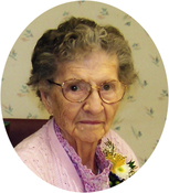
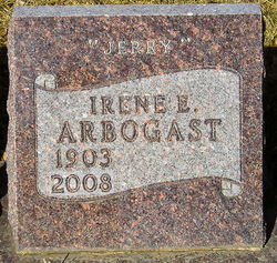
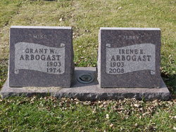
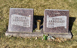
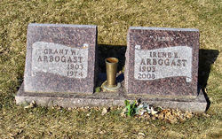
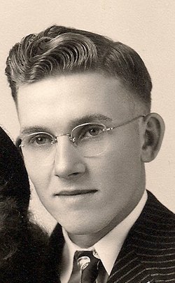
Irene E “Jerry” Morton Arbogast
| Birth | : | 17 Nov 1903 Coin, Page County, Iowa, USA |
| Death | : | 11 Apr 2008 Watertown, Codington County, South Dakota, USA |
| Burial | : | Holy Sepulchre Cemetery, Sault Sainte Marie, Algoma District, Canada |
| Coordinate | : | 46.5668420, -84.3491220 |
| Description | : | Irene E. Arbogast, age 104, of Watertown, SD passed away on April 11, 2008 at the hospital in Watertown. She was the widow of Grant "Mike" W.R. Arbogast. Irene was born on November 17, 1903 to Oscar and Alma (McCord) Morton at Coin, IA. She attended school in Tarkio, MO and moved to SD in 1919. She attended college in Aberdeen, SD. Irene married Grant "Mike" W.R. Arbogast on September 20, 1923 at Clark, SD. The couple farmed west of Watertown, SD most of their life. They later moved to Grover, SD where they owned the grocery store. In 1948,... Read More |
frequently asked questions (FAQ):
-
Where is Irene E “Jerry” Morton Arbogast's memorial?
Irene E “Jerry” Morton Arbogast's memorial is located at: Holy Sepulchre Cemetery, Sault Sainte Marie, Algoma District, Canada.
-
When did Irene E “Jerry” Morton Arbogast death?
Irene E “Jerry” Morton Arbogast death on 11 Apr 2008 in Watertown, Codington County, South Dakota, USA
-
Where are the coordinates of the Irene E “Jerry” Morton Arbogast's memorial?
Latitude: 46.5668420
Longitude: -84.3491220
Family Members:
Parent
Spouse
Siblings
Children
Flowers:
Nearby Cemetories:
1. Holy Sepulchre Cemetery
Sault Sainte Marie, Algoma District, Canada
Coordinate: 46.5668420, -84.3491220
2. Sault Ste Marie City of
Sault Sainte Marie, Algoma District, Canada
Coordinate: 46.5668260, -84.3496200
3. Greenwood Cemetery
Sault Sainte Marie, Algoma District, Canada
Coordinate: 46.5664510, -84.3513270
4. West Korah Cemetery
Sault Sainte Marie, Algoma District, Canada
Coordinate: 46.5582390, -84.4051666
5. Pine Grove Cemetery
Sault Sainte Marie, Algoma District, Canada
Coordinate: 46.5895195, -84.2800903
6. Ancient Anishinaabek Burial Ground
Sault Sainte Marie, Chippewa County, USA
Coordinate: 46.5007570, -84.3428720
7. Queen Street Cemetery
Sault Sainte Marie, Algoma District, Canada
Coordinate: 46.5048800, -84.3055800
8. Fort Brady Cemetery
Sault Sainte Marie, Chippewa County, USA
Coordinate: 46.4976540, -84.3427970
9. Shingwauk-Bishop Fauquier Memorial Cemetery
Sault Sainte Marie, Algoma District, Canada
Coordinate: 46.5016667, -84.2852778
10. Maple Ridge Cemetery
Sault Sainte Marie, Chippewa County, USA
Coordinate: 46.4852780, -84.3527780
11. Brasser Road Cemetery
Brassar, Chippewa County, USA
Coordinate: 46.5055556, -84.2361111
12. Freedman Family Remembrance Area
Sault Sainte Marie, Chippewa County, USA
Coordinate: 46.4747800, -84.4428700
13. Riverside Cemetery
Sault Sainte Marie, Chippewa County, USA
Coordinate: 46.4571810, -84.2856820
14. Sugar Island Cemetery
Sault Sainte Marie, Chippewa County, USA
Coordinate: 46.4613890, -84.2333330
15. Payment Cemetery
Sugar Island Township, Chippewa County, USA
Coordinate: 46.5242004, -84.1505966
16. Pine Grove Cemetery
Sault Sainte Marie, Chippewa County, USA
Coordinate: 46.4213982, -84.3886032
17. Goulais River Cemetery
Goulais River, Algoma District, Canada
Coordinate: 46.7178421, -84.3924255
18. Gem Island Cemetery
Sugar Island Township, Chippewa County, USA
Coordinate: 46.4333333, -84.1916667
19. Garden River Indian Reservation Anglican Cemetery
Garden River, Algoma District, Canada
Coordinate: 46.5500600, -84.0999300
20. Goulais Mission Cemetery
Goulais Mission, Algoma District, Canada
Coordinate: 46.7005501, -84.5226288
21. Rosedale Mount Zion Cemetery
Rosedale, Chippewa County, USA
Coordinate: 46.3903008, -84.2996979
22. Cottage Park Cemetery
Dafter, Chippewa County, USA
Coordinate: 46.3999912, -84.4666614
23. Will Walk Native American Cemetery
Baie de Wasai, Chippewa County, USA
Coordinate: 46.3938890, -84.2069440
24. Finnish Cemetery
Sault Sainte Marie, Chippewa County, USA
Coordinate: 46.3905900, -84.1897200

