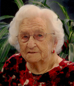
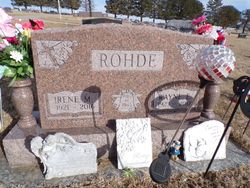
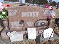
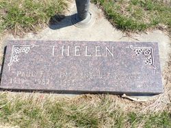
Irene Marie Thelen Rohde
| Birth | : | 30 Jul 1921 Randolph, Cedar County, Nebraska, USA |
| Death | : | 23 Apr 2016 Randolph, Cedar County, Nebraska, USA |
| Burial | : | Saint Frances Cemetery, Randolph, Cedar County, USA |
| Coordinate | : | 42.3946991, -97.3482971 |
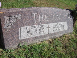
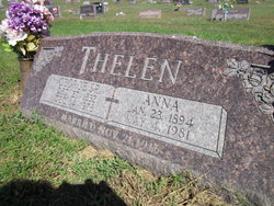
| Description | : | Irene Marie Rohde, age 94 of Randolph, died Saturday April 23, 2016 at Colonial Manor of Randolph. She was born July 30, 1921 at Randolph, Nebraska the daughter of George and Anna (Hoffmann) Thelen. She attended Cedar county rural school near Randolph. On August 14, 1945 Irene married Wayne Eldon Rohde at St. Jane Frances de Chantal Catholic Church in Randolph. The couple made their home near McLean where they farmed until 1953 when they moved to a farm east of Wausa. In 1960 the couple moved to Magnet and operated Magnet Grocery Store until 1975. Irene worked at Peter's... Read More |
frequently asked questions (FAQ):
-
Where is Irene Marie Thelen Rohde's memorial?
Irene Marie Thelen Rohde's memorial is located at: Saint Frances Cemetery, Randolph, Cedar County, USA.
-
When did Irene Marie Thelen Rohde death?
Irene Marie Thelen Rohde death on 23 Apr 2016 in Randolph, Cedar County, Nebraska, USA
-
Where are the coordinates of the Irene Marie Thelen Rohde's memorial?
Latitude: 42.3946991
Longitude: -97.3482971
Family Members:
Parent
Spouse
Siblings
Flowers:
Nearby Cemetories:
1. Saint Frances Cemetery
Randolph, Cedar County, USA
Coordinate: 42.3946991, -97.3482971
2. Randolph Cemetery
Randolph, Cedar County, USA
Coordinate: 42.3873900, -97.3501700
3. Rose Hill Cemetery
McLean, Pierce County, USA
Coordinate: 42.3518982, -97.4666977
4. Magnet Cemetery
Magnet, Cedar County, USA
Coordinate: 42.4644012, -97.4655991
5. Belden Cemetery
Belden, Cedar County, USA
Coordinate: 42.4104100, -97.1992200
6. Olive Grove Cemetery
Cedar County, USA
Coordinate: 42.5264015, -97.4167023
7. Coleridge Cemetery
Coleridge, Cedar County, USA
Coordinate: 42.5030600, -97.2100180
8. Bethany Presbyterian Cemetery
Carroll, Wayne County, USA
Coordinate: 42.2562600, -97.2710300
9. Saint Michael Cemetery
Coleridge, Cedar County, USA
Coordinate: 42.5022011, -97.2052994
10. Elmwood Cemetery
Carroll, Wayne County, USA
Coordinate: 42.2719002, -97.1928024
11. Woodlawn Cemetery
Wausa, Knox County, USA
Coordinate: 42.5102997, -97.5330963
12. Osmond Cemetery
Osmond, Pierce County, USA
Coordinate: 42.3457985, -97.5821991
13. Laurel Cemetery
Laurel, Cedar County, USA
Coordinate: 42.4227982, -97.1046982
14. Lawn Ridge Cemetery
Coleridge, Cedar County, USA
Coordinate: 42.5266991, -97.1772003
15. Norris Cemetery
Cedar County, USA
Coordinate: 42.5010986, -97.1333008
16. Saint Marys Cemetery
Osmond, Pierce County, USA
Coordinate: 42.3661003, -97.6102982
17. Immanuel Lutheran Cemetery
Osmond, Pierce County, USA
Coordinate: 42.3650017, -97.6106033
18. Koehler Cemetery
Pierce, Pierce County, USA
Coordinate: 42.2248500, -97.4854500
19. Thabor Lutheran Cemetery
Wausa, Knox County, USA
Coordinate: 42.5102997, -97.5671997
20. Zion Lutheran Cemetery
Hoskins, Wayne County, USA
Coordinate: 42.1920100, -97.3593700
21. Zion Lutheran Cemetery
Pierce, Pierce County, USA
Coordinate: 42.2075005, -97.4813995
22. Saint Johns Lutheran Cemetery
Pierce, Pierce County, USA
Coordinate: 42.2067000, -97.4820000
23. Swedish Cemetery
Winside, Wayne County, USA
Coordinate: 42.1706400, -97.3297400
24. Saint Michaels Cemetery
Hartington, Cedar County, USA
Coordinate: 42.6119003, -97.2699966

