
| Birth | : | 31 Jul 1924 Loup County, Nebraska, USA |
| Death | : | 23 Feb 2001 Burwell, Garfield County, Nebraska, USA |
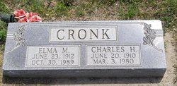
| Burial | : | Kent Cemetery, Taylor, Loup County, USA |
| Coordinate | : | 41.7416992, -99.3088989 |
| Description | : | Irma Dimmitt BURWELL - Irma May Dimmitt, 76, of Burwell, died Friday, Feb. 23, 2001, at the Community Memorial Health Center in Burwell of cancer. Services will be at 10:30 a.m. Tuesday at the United Methodist Church in Burwell. The Rev. Michael Laing will officiate. Burial will be in the Kent Cemetery near Burwell. Memorials are suggested to the Community Memorial Health Center or the Burwell Rural Fire Department. Hitchcock Funeral Home in Burwell is in charge of arrangements. Mrs. Dimmitt was born July 31, 1924, in Loup County to William and Mable (Butts) Cronk. |
frequently asked questions (FAQ):
-
Where is Irma Mae Cronk Dimmitt's memorial?
Irma Mae Cronk Dimmitt's memorial is located at: Kent Cemetery, Taylor, Loup County, USA.
-
When did Irma Mae Cronk Dimmitt death?
Irma Mae Cronk Dimmitt death on 23 Feb 2001 in Burwell, Garfield County, Nebraska, USA
-
Where are the coordinates of the Irma Mae Cronk Dimmitt's memorial?
Latitude: 41.7416992
Longitude: -99.3088989
Family Members:
Parent
Spouse

Siblings
Flowers:


Nearby Cemetories:
1. Kent Cemetery
Taylor, Loup County, USA
Coordinate: 41.7416992, -99.3088989
2. Taylor Cemetery
Taylor, Loup County, USA
Coordinate: 41.7571983, -99.3861008
3. Mount Hope Cemetery
Sargent, Custer County, USA
Coordinate: 41.6768990, -99.3855972
4. Saint Marys Cemetery
Sargent, Custer County, USA
Coordinate: 41.6768990, -99.4044037
5. Bohemian Brotherhood Cemetery
Elyria, Valley County, USA
Coordinate: 41.6618996, -99.1866989
6. Jack Shafer Memorial Cemetery
Burwell, Garfield County, USA
Coordinate: 41.8202200, -99.1835500
7. Parker Cemetery
Burwell, Garfield County, USA
Coordinate: 41.8203011, -99.1821976
8. Cottonwood Cemetery
Burwell, Garfield County, USA
Coordinate: 41.7681007, -99.1418991
9. West Union Cemetery
Sargent, Custer County, USA
Coordinate: 41.6763992, -99.4608002
10. Littlefield Cemetery
Burwell, Garfield County, USA
Coordinate: 41.8093987, -99.1389008
11. Boleszyn Cemetery
Elyria, Valley County, USA
Coordinate: 41.6691000, -99.1315000
12. Banner Cemetery
Burwell, Garfield County, USA
Coordinate: 41.8031006, -99.1235962
13. Longwood Cemetery
Comstock, Custer County, USA
Coordinate: 41.5966988, -99.2356033
14. Czech National Cemetery
Valley County, USA
Coordinate: 41.6250000, -99.1537000
15. Madison Square Cemetery
Taylor, Loup County, USA
Coordinate: 41.7694016, -99.5314026
16. Almeria Cemetery
Almeria, Loup County, USA
Coordinate: 41.8177986, -99.5128021
17. Potter Brown Cemetery
Burwell, Garfield County, USA
Coordinate: 41.7489000, -99.0668500
18. Saint Wenceslaus Catholic Cemetery
Valley County, USA
Coordinate: 41.6103000, -99.1336000
19. Somerford Cemetery
Sargent, Custer County, USA
Coordinate: 41.5793991, -99.4328003
20. Douglas Grove Cemetery
Comstock, Custer County, USA
Coordinate: 41.5489006, -99.2881012
21. Predmore Cemetery
Walworth, Custer County, USA
Coordinate: 41.6755981, -99.5674973
22. Round Park Cemetery
Valley County, USA
Coordinate: 41.5525017, -99.1825027
23. Fort Hartsuff Post Cemetery
Valley County, USA
Coordinate: 41.7225000, -99.0248000
24. West Side Cemetery
Garfield County, USA
Coordinate: 41.8128014, -99.0282974