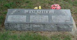
| Birth | : | 1 Jun 1840 Allen County, Ohio, USA |
| Death | : | 11 Jun 1921 Central City, Linn County, Iowa, USA |
| Burial | : | Oxford Cemetery, Oxford, Talbot County, USA |
| Coordinate | : | 38.6892014, -76.1600037 |
| Description | : | Married: Melissa Cook Isaac Hall married Melissa Cook on Mar 22, 1860 in Allen County, OH. She was born Jan 28, 1841, daughter of Jacob Cook. In 1865 the moved to Linn County, IA making the journey in a covered wagon. Within 2 years they purchased 240 acres (which became the Hall homestead). Their children were: WIlliam H, Charles F, Mary Melissa and Annie Elizabeth. They also had a foster daughter, Lena Harriott. In 1901 Isaac retired to Central City. He died June 11, 1921. Melissa died Feb 18, 1924. |
frequently asked questions (FAQ):
-
Where is Isaac Hall's memorial?
Isaac Hall's memorial is located at: Oxford Cemetery, Oxford, Talbot County, USA.
-
When did Isaac Hall death?
Isaac Hall death on 11 Jun 1921 in Central City, Linn County, Iowa, USA
-
Where are the coordinates of the Isaac Hall's memorial?
Latitude: 38.6892014
Longitude: -76.1600037
Family Members:
Parent
Spouse
Siblings
Children
Flowers:
Nearby Cemetories:
1. Oxford Cemetery
Oxford, Talbot County, USA
Coordinate: 38.6892014, -76.1600037
2. Church of the Holy Trinity
Oxford, Talbot County, USA
Coordinate: 38.6843400, -76.1722300
3. Old John Wesley Cemetery
Talbot County, USA
Coordinate: 38.6856003, -76.1397018
4. Harrison Burial Ground
Bellevue, Talbot County, USA
Coordinate: 38.7081000, -76.1836600
5. Walnut Grove Cemetery
Talbot County, USA
Coordinate: 38.6680984, -76.1316986
6. Banning Graveyard
Easton, Talbot County, USA
Coordinate: 38.7205353, -76.1647339
7. Orems Delight
Royal Oak, Talbot County, USA
Coordinate: 38.6867500, -76.2028200
8. Rattlesnake Point Cemetery
Talbot County, USA
Coordinate: 38.6678009, -76.1168976
9. Royal Oak Cemetery
Bellevue, Talbot County, USA
Coordinate: 38.7421989, -76.1774979
10. Saint Pauls Cemetery
Talbot County, USA
Coordinate: 38.7439003, -76.1624985
11. Locust Grove Cemetery
Locust Grove, Talbot County, USA
Coordinate: 38.6657500, -76.0906200
12. Hammond Family Plot
Saint Michaels, Talbot County, USA
Coordinate: 38.7495600, -76.1988400
13. White Marsh Cemetery
Trappe, Talbot County, USA
Coordinate: 38.6970329, -76.0600662
14. Dickinson Cemetery
Trappe, Talbot County, USA
Coordinate: 38.6263500, -76.0922100
15. Peachblossom Meeting House Cemetery
Easton, Talbot County, USA
Coordinate: 38.7332900, -76.0681500
16. Kemp Cemetery
Trappe, Talbot County, USA
Coordinate: 38.6547012, -76.0560989
17. Old Paradise Cemetery
Trappe, Talbot County, USA
Coordinate: 38.6518390, -76.0565420
18. Stoney Point Graveyard - Neck District
Lloyds, Dorchester County, USA
Coordinate: 38.5998000, -76.1761500
19. Piney Hill Cemetery
Trappe, Talbot County, USA
Coordinate: 38.6617012, -76.0488968
20. Readly Cemetery
Trappe, Talbot County, USA
Coordinate: 38.6363983, -76.0643997
21. Roberts Cemetery
Talbot County, USA
Coordinate: 38.7192001, -76.0488968
22. Mitchell's Graveyard
Kilmaurie, Dorchester County, USA
Coordinate: 38.6089510, -76.2169690
23. Queen Esther Cemetery
Talbot County, USA
Coordinate: 38.7132988, -76.0456009
24. Landing Neck Cemetery
Trappe Landing, Talbot County, USA
Coordinate: 38.7000008, -76.0402985


