
| Birth | : | 16 Jun 1909 Herreid, Campbell County, South Dakota, USA |
| Death | : | 24 Oct 2005 Bismarck, Burleigh County, North Dakota, USA |
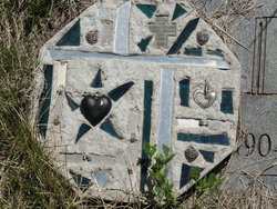
| Burial | : | Liverpool Cemetery and Crematorium, Liverpool, Liverpool City, Australia |
| Coordinate | : | -33.9195850, 150.9109280 |
| Description | : | Obituary Bismarck Tribune (Oct 27, 2005) Isabel Helm, 96, McClusky, died Oct. 24, 2005, at Medcenter One, Bismarck. Services will be held at 2 p.m. Friday, Oct. 28, at United Methodist Church, McClusky. Burial will be at McClusky City Cemetery. Visitation will be held from 2 to 7:30 p.m. today at Hertz Funeral Home, McClusky. Isabel Dorothy (Broeckel) Helm was born June 16, 1909, at Herreid, S.D., to John K. and Alvina (Jaton) Broeckel. The family moved to Broadus, Mont, and then to McClusky. She married Adolph Helm at McClusky. They lived and farmed in Sheridan County until... Read More |
frequently asked questions (FAQ):
-
Where is Isabella Dorothy Broeckel Helm's memorial?
Isabella Dorothy Broeckel Helm's memorial is located at: Liverpool Cemetery and Crematorium, Liverpool, Liverpool City, Australia.
-
When did Isabella Dorothy Broeckel Helm death?
Isabella Dorothy Broeckel Helm death on 24 Oct 2005 in Bismarck, Burleigh County, North Dakota, USA
-
Where are the coordinates of the Isabella Dorothy Broeckel Helm's memorial?
Latitude: -33.9195850
Longitude: 150.9109280
Family Members:
Parent

Spouse
Siblings
Children
Flowers:


Nearby Cemetories:
1. Liverpool Cemetery and Crematorium
Liverpool, Liverpool City, Australia
Coordinate: -33.9195850, 150.9109280
2. Liverpool Apex Park
Liverpool, Liverpool City, Australia
Coordinate: -33.9193000, 150.9200000
3. Liverpool Pioneer Memorial Park
Liverpool, Liverpool City, Australia
Coordinate: -33.9172190, 150.9241740
4. Forest Lawn Memorial Park
Leppington, Camden Council, Australia
Coordinate: -33.9503100, 150.8435200
5. Smithfield Anglican
Smithfield, Fairfield City, Australia
Coordinate: -33.8536220, 150.9383850
6. Smithfield Baptist Churchyard
Smithfield, Fairfield City, Australia
Coordinate: -33.8529380, 150.9374430
7. Smithfield Uniting Church Cemetery
Smithfield, Fairfield City, Australia
Coordinate: -33.8525100, 150.9373500
8. Smithfield General Cemetery
Smithfield, Fairfield City, Australia
Coordinate: -33.8497800, 150.9252800
9. Badgerys Creek Memorial Cemetery
Leppington, Camden Council, Australia
Coordinate: -33.9567900, 150.8371920
10. Panania Diggers RSL Memorial Garden
Panania, Canterbury-Bankstown Council, Australia
Coordinate: -33.9543618, 150.9882449
11. St. Mary's Anglican Church Cemetery
Denham Court, Campbelltown City, Australia
Coordinate: -33.9817100, 150.8431300
12. Ingleburn RSL Soldiers Memorial Park
Ingleburn, Campbelltown City, Australia
Coordinate: -34.0094121, 150.8698700
13. Merrylands Anglican Church Columbarium
Merrylands, Cumberland Council, Australia
Coordinate: -33.8401100, 150.9870800
14. Saint Felix de Valois-Catholic Church Cemetery
Bankstown, Canterbury-Bankstown Council, Australia
Coordinate: -33.9076100, 151.0351850
15. Kemps Creek Cemetery and Crematorium
Kemps Creek, Liverpool City, Australia
Coordinate: -33.8958260, 150.7793870
16. St. Bartholomew's Anglican Church Cemetery
Prospect, Blacktown City, Australia
Coordinate: -33.8045110, 150.9175750
17. Granville Anglican Columbarium
Granville, City of Parramatta Council, Australia
Coordinate: -33.8333500, 151.0084450
18. St. Saviour's Church of England Cemetery
Punchbowl, Canterbury-Bankstown Council, Australia
Coordinate: -33.9311480, 151.0552250
19. Mays Hill Cemetery
Cumberland Council, Australia
Coordinate: -33.8193430, 150.9934850
20. Lone Graves
Parramatta, City of Parramatta Council, Australia
Coordinate: -33.8186610, 150.9967800
21. Holy Innocents Cemetery
Rossmore, Liverpool City, Australia
Coordinate: -33.9435350, 150.7641028
22. St. John's Cemetery
Parramatta, City of Parramatta Council, Australia
Coordinate: -33.8168010, 150.9983310
23. Rookwood Catholic Cemeteries and Crematoria
Rookwood, Cumberland Council, Australia
Coordinate: -33.8793500, 151.0547850
24. Rookwood Memorial Gardens and Crematorium
Rookwood, Cumberland Council, Australia
Coordinate: -33.8768500, 151.0598900