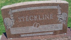
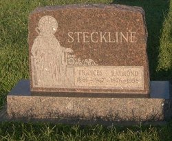
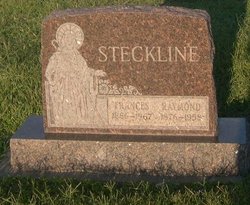
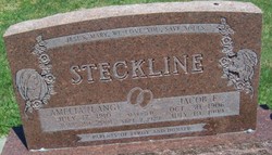
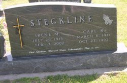
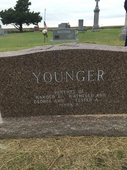
Jacob Frank “Jake” Steckline
| Birth | : | 30 Oct 1906 Ellis County, Kansas, USA |
| Death | : | 10 Jul 1999 Ellis, Ellis County, Kansas, USA |
| Burial | : | Vine Hills Cemetery, Plymouth, Plymouth County, USA |
| Coordinate | : | 41.9556200, -70.6792800 |
| Description | : | STECKLINE, Jacob ELLIS, KANSAS: Jacob Frank Steckline, 92, died July 10, 1999 at his residence. He was born October 30, 1906 in Ellis County to Raymond and Frances Koppel Steckline. He was a retired farmer and stockman, and came to Ellis in 1957. He attended St. Mary's Catholic Church, and was a member of the Knights of Columbus for over 50 years. Survivors include his wife, Amelia Lang Steckline; two sons, Don of Ellis and LeRoy of Ogallah; a sister, Rosie Younger; a brother, Tony; 8 grandchildren; and 18 great-grandchildren. He was preceded in death by two sisters, Pauline Meier and... Read More |
frequently asked questions (FAQ):
-
Where is Jacob Frank “Jake” Steckline's memorial?
Jacob Frank “Jake” Steckline's memorial is located at: Vine Hills Cemetery, Plymouth, Plymouth County, USA.
-
When did Jacob Frank “Jake” Steckline death?
Jacob Frank “Jake” Steckline death on 10 Jul 1999 in Ellis, Ellis County, Kansas, USA
-
Where are the coordinates of the Jacob Frank “Jake” Steckline's memorial?
Latitude: 41.9556200
Longitude: -70.6792800
Family Members:
Parent
Spouse
Siblings
Children
Flowers:
Nearby Cemetories:
1. Vine Hills Cemetery
Plymouth, Plymouth County, USA
Coordinate: 41.9556200, -70.6792800
2. Beth Jacob Cemetery
Plymouth, Plymouth County, USA
Coordinate: 41.9553300, -70.6792600
3. Saint Josephs Cemetery
Plymouth, Plymouth County, USA
Coordinate: 41.9507700, -70.6775600
4. Oak Grove Cemetery
Plymouth, Plymouth County, USA
Coordinate: 41.9516900, -70.6745500
5. Christ Episcopal Church Columbarium
Plymouth, Plymouth County, USA
Coordinate: 41.9625100, -70.6737500
6. Burial Hill
Plymouth, Plymouth County, USA
Coordinate: 41.9559822, -70.6656876
7. Church of the Pilgrimage
Plymouth, Plymouth County, USA
Coordinate: 41.9557310, -70.6647230
8. Pleasant Mountain Pet Rest
Plymouth, Plymouth County, USA
Coordinate: 41.9630360, -70.6918110
9. Coles Hill Burial Ground
Plymouth, Plymouth County, USA
Coordinate: 41.9573330, -70.6624000
10. Brailey Burial Ground
Plymouth, Plymouth County, USA
Coordinate: 41.9410100, -70.6644500
11. Chiltonville Cemetery
Plymouth, Plymouth County, USA
Coordinate: 41.9381142, -70.6289291
12. Parting Ways Cemetery
Plymouth, Plymouth County, USA
Coordinate: 41.9458008, -70.7332993
13. Our Lady of Divine Providence Cemetery
Kingston, Plymouth County, USA
Coordinate: 41.9509780, -70.7352920
14. Saint Joseph Cemetery
Kingston, Plymouth County, USA
Coordinate: 41.9846992, -70.7380981
15. Evergreen Cemetery
Kingston, Plymouth County, USA
Coordinate: 41.9944800, -70.7317400
16. Old Burying Ground
Kingston, Plymouth County, USA
Coordinate: 41.9943800, -70.7321300
17. Russell Mills Cemetery
Plymouth, Plymouth County, USA
Coordinate: 41.9182500, -70.6216000
18. Lucas Cemetery
Plymouth, Plymouth County, USA
Coordinate: 41.9276350, -70.7474790
19. South Pond Cemetery
Plymouth, Plymouth County, USA
Coordinate: 41.9035988, -70.6446991
20. Plymouth County Cemetery
Plymouth, Plymouth County, USA
Coordinate: 41.9113890, -70.7350000
21. Wenham Cemetery
Carver, Plymouth County, USA
Coordinate: 41.9225000, -70.7541670
22. Watson Cemetery
Plymouth, Plymouth County, USA
Coordinate: 42.0119490, -70.6358560
23. Standish Burial Ground
Duxbury, Plymouth County, USA
Coordinate: 42.0250664, -70.6875076
24. Mayflower Cemetery
Duxbury, Plymouth County, USA
Coordinate: 42.0331001, -70.6952972

