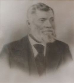
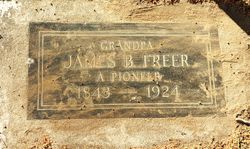
James Bascome Freer
| Birth | : | 15 Apr 1843 Missouri, USA |
| Death | : | 16 Jan 1924 Monrovia, Los Angeles County, California, USA |
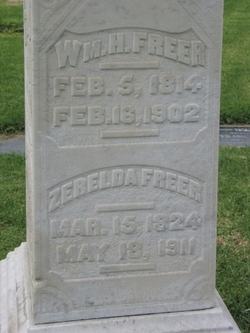
| Burial | : | Stanley Cemetery, Stanley, Buchanan County, USA |
| Coordinate | : | 42.6371994, -91.8146973 |
| Plot | : | Plot D Lot 009 Grave 02 |
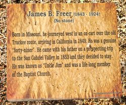
| Description | : | Los Angeles Times January 18, 1924 pg 10 Monrovian Forty-Niner "Goes West" "Uncle Jim" Freer Came over Old Truckee Route in Ox-Cart at age of 6. EL MONTE Jan. 17 - James Bascome Freer, pioneer resident of El Monte, known many years as "Uncle Jim," died at his home in Monrovia Wednesday, 81 years of age. Mr. Freer was 6 years of age when he came with his parents to California, so that he was a genuine forty-niner, and had lived in this State for almost three-quarters of a century. He was born in Missouri on April 15, 1843, and journeyed West in... Read More |
frequently asked questions (FAQ):
-
Where is James Bascome Freer's memorial?
James Bascome Freer's memorial is located at: Stanley Cemetery, Stanley, Buchanan County, USA.
-
When did James Bascome Freer death?
James Bascome Freer death on 16 Jan 1924 in Monrovia, Los Angeles County, California, USA
-
Where are the coordinates of the James Bascome Freer's memorial?
Latitude: 42.6371994
Longitude: -91.8146973
Family Members:
Parent
Spouse
Siblings
Children
Flowers:
Nearby Cemetories:
1. Stanley Cemetery
Stanley, Buchanan County, USA
Coordinate: 42.6371994, -91.8146973
2. Otsego Cemetery
Fayette County, USA
Coordinate: 42.6467018, -91.8778000
3. Kint Cemetery
Hazleton, Buchanan County, USA
Coordinate: 42.6357994, -91.8799973
4. Saint Marys Cemetery
Hazleton, Buchanan County, USA
Coordinate: 42.6164017, -91.8983002
5. Spangler Cemetery
Aurora, Buchanan County, USA
Coordinate: 42.5811900, -91.7620000
6. Floral Hills Memorial Gardens
Hazleton, Buchanan County, USA
Coordinate: 42.6293983, -91.9103012
7. Fontana Cemetery
Hazleton, Buchanan County, USA
Coordinate: 42.6046982, -91.9052963
8. Union Cemetery
Putnam, Fayette County, USA
Coordinate: 42.6720900, -91.7209200
9. Oakdale Cemetery
Oelwein, Fayette County, USA
Coordinate: 42.6732000, -91.9164500
10. Old Catholic Cemetery
Oelwein, Fayette County, USA
Coordinate: 42.6728000, -91.9169000
11. Madison Cemetery
Aurora, Buchanan County, USA
Coordinate: 42.5896988, -91.7063980
12. Woodlawn Cemetery
Oelwein, Fayette County, USA
Coordinate: 42.6805992, -91.9356003
13. Garden Prairie Cemetery
Fayette County, USA
Coordinate: 42.7310982, -91.7647018
14. Oran Township Cemetery
Oran, Fayette County, USA
Coordinate: 42.6571999, -91.9721985
15. North Amish Cemetery
Buchanan County, USA
Coordinate: 42.6171989, -91.9832993
16. Byron Township Cemetery
Buchanan County, USA
Coordinate: 42.5271988, -91.7275009
17. Payne Cemetery
Winthrop, Buchanan County, USA
Coordinate: 42.5203018, -91.7453003
18. Madison Cemetery
Lamont, Buchanan County, USA
Coordinate: 42.6028200, -91.6447650
19. Arlington Cemetery
Arlington, Fayette County, USA
Coordinate: 42.7380981, -91.6856003
20. Long Grove Cemetery
Maynard, Fayette County, USA
Coordinate: 42.7708000, -91.8766000
21. Fremont Township Cemetery
Winthrop, Buchanan County, USA
Coordinate: 42.5046997, -91.7264023
22. Buchanan County Home Cemetery
Independence, Buchanan County, USA
Coordinate: 42.4903050, -91.8596350
23. Otterville Cemetery
Buchanan County, USA
Coordinate: 42.5158005, -91.9392014
24. County Corners Cemetery
Cass Township, Clayton County, USA
Coordinate: 42.6441994, -91.6055984

