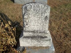
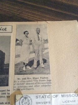
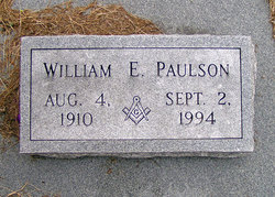
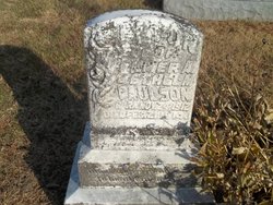
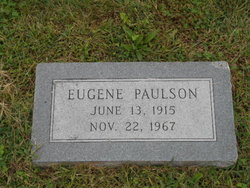
James Bogart Paulson
| Birth | : | 2 Sep 1908 Orrick, Ray County, Missouri, USA |
| Death | : | 3 Jan 1911 Orrick, Ray County, Missouri, USA |
| Burial | : | Riverside Cemetery, Shelton, Fairfield County, USA |
| Coordinate | : | 41.2956009, -73.0725021 |
| Plot | : | Top/Sect.5 |
frequently asked questions (FAQ):
-
Where is James Bogart Paulson's memorial?
James Bogart Paulson's memorial is located at: Riverside Cemetery, Shelton, Fairfield County, USA.
-
When did James Bogart Paulson death?
James Bogart Paulson death on 3 Jan 1911 in Orrick, Ray County, Missouri, USA
-
Where are the coordinates of the James Bogart Paulson's memorial?
Latitude: 41.2956009
Longitude: -73.0725021
Family Members:
Parent
Siblings
Nearby Cemetories:
1. Riverside Cemetery
Shelton, Fairfield County, USA
Coordinate: 41.2956009, -73.0725021
2. Temple Emanuel Cemetery
Shelton, Fairfield County, USA
Coordinate: 41.2988052, -73.0711823
3. Beth Israel Cemetery of Congregation Or Shalom
Shelton, Fairfield County, USA
Coordinate: 41.2989197, -73.0711594
4. Mount Saint Peter Catholic Cemetery
Derby, New Haven County, USA
Coordinate: 41.3050003, -73.0682983
5. Congregation Beth El of Ansonia Cemetery
Orange, New Haven County, USA
Coordinate: 41.2982903, -73.0592422
6. Coram Cemetery
Shelton, Fairfield County, USA
Coordinate: 41.2863998, -73.0817032
7. Long Hill Burial Ground
Shelton, Fairfield County, USA
Coordinate: 41.3054504, -73.0976563
8. Oak Cliff Cemetery
Derby, New Haven County, USA
Coordinate: 41.3231010, -73.0950012
9. Old Derby Uptown Burying Ground
Derby, New Haven County, USA
Coordinate: 41.3294792, -73.0783615
10. Elm Street Cemetery
Ansonia, New Haven County, USA
Coordinate: 41.3306007, -73.0753021
11. Orange Center Cemetery
Orange, New Haven County, USA
Coordinate: 41.2806015, -73.0286026
12. Good Shepherd Memorial Gardens
Orange, New Haven County, USA
Coordinate: 41.2923220, -73.0155640
13. Saint Marys Catholic Cemetery
Ansonia, New Haven County, USA
Coordinate: 41.3382988, -73.0899963
14. Saint Peter and Saint Paul UGC Cemetery
Derby, New Haven County, USA
Coordinate: 41.3386116, -73.0946426
15. Three Saints Russian Orthodox Cemetery
Derby, New Haven County, USA
Coordinate: 41.3393593, -73.0929871
16. Bare Plains Cemetery
Ansonia, New Haven County, USA
Coordinate: 41.3421800, -73.0904200
17. Pine Grove Cemetery
Ansonia, New Haven County, USA
Coordinate: 41.3440590, -73.0872269
18. Old Saint Marys Cemetery
Ansonia, New Haven County, USA
Coordinate: 41.3441315, -73.0909805
19. Huntington Lawn Cemetery South
Huntington, Fairfield County, USA
Coordinate: 41.2874210, -73.1388740
20. Milford Side Cemetery
Woodbridge, New Haven County, USA
Coordinate: 41.3335991, -73.0274963
21. Huntington Lawn Cemetery East
Huntington, Fairfield County, USA
Coordinate: 41.2933050, -73.1409250
22. Huntington Lawn Cemetery West
Huntington, Fairfield County, USA
Coordinate: 41.2942009, -73.1436005
23. Saint Michaels Cemetery
Derby, New Haven County, USA
Coordinate: 41.3457985, -73.1014023
24. Old Cemetery of Huntington
Huntington, Fairfield County, USA
Coordinate: 41.2941017, -73.1458511

