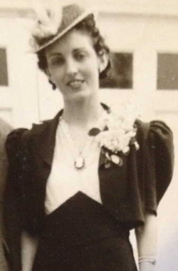
| Birth | : | 28 Apr 1883 Morganville, Clay County, Kansas, USA |
| Death | : | 28 Jul 1970 Bridgeport, Morrill County, Nebraska, USA |
| Burial | : | Oregon Trail Memorial Park Cemetery, Bridgeport, Morrill County, USA |
| Coordinate | : | 41.6699982, -103.1449966 |
| Description | : | Name: James Curtis Dugger Gering Courier 07-30-1970 Funeral services for James Curtis Dugger, 87, of Bridgeport who died Tuesday in the Bridgeport hospital at the First Baptist Church in Bridgeport. Burial will be in the Oregon Trail Memorial cemetery. Born April 28, 1883 at Morganville, KS. Dugger came to Bayard in 1887. He was married to Ethel Satchell Aug 31, 1910 at Bridgeport. He retired in 1961 and before that time, he worked as a farmhand in the Bridgeport and Redington areas. Holechek Funeral Home of Bridgeport. Survived by his widow and 3 daughters, 1 brother, 7 grandchildren and 9... Read More |
frequently asked questions (FAQ):
-
Where is James Curtis Dugger's memorial?
James Curtis Dugger's memorial is located at: Oregon Trail Memorial Park Cemetery, Bridgeport, Morrill County, USA.
-
When did James Curtis Dugger death?
James Curtis Dugger death on 28 Jul 1970 in Bridgeport, Morrill County, Nebraska, USA
-
Where are the coordinates of the James Curtis Dugger's memorial?
Latitude: 41.6699982
Longitude: -103.1449966
Family Members:
Parent
Spouse
Siblings
Children
Flowers:
Nearby Cemetories:
1. Oregon Trail Memorial Park Cemetery
Bridgeport, Morrill County, USA
Coordinate: 41.6699982, -103.1449966
2. Morrill County Rural Burial Site
Bayard, Morrill County, USA
Coordinate: 41.7312100, -103.2353100
3. Redington Cemetery
Redington, Morrill County, USA
Coordinate: 41.5697760, -103.2425540
4. Chimney Rock Cemetery
Morrill County, USA
Coordinate: 41.6991997, -103.3399963
5. Green Mound Cemetery
Bridgeport, Morrill County, USA
Coordinate: 41.5389500, -103.0229500
6. Bayard Cemetery
Bayard, Morrill County, USA
Coordinate: 41.7666910, -103.3236600
7. Angora Cemetery
Angora, Morrill County, USA
Coordinate: 41.8577995, -103.1306000
8. Chaulk Creek Cemetery
Harrisburg, Banner County, USA
Coordinate: 41.5496560, -103.3781240
9. High Butte Cemetery
McGrew, Scotts Bluff County, USA
Coordinate: 41.7289009, -103.4353027
10. Rose Hill Cemetery
Broadwater, Morrill County, USA
Coordinate: 41.6067009, -102.8488998
11. Sanders Cemetery
Cheyenne County, USA
Coordinate: 41.4085999, -103.2157974
12. Kirk Cemetery
Harrisburg, Banner County, USA
Coordinate: 41.5103480, -103.4653220
13. Archibald Chitwood Gravesite
Broadwater, Morrill County, USA
Coordinate: 41.5670300, -102.7748700
14. Dalton Cemetery
Dalton, Cheyenne County, USA
Coordinate: 41.4030991, -102.9649963
15. Saint Marys Catholic Cemetery
Dalton, Cheyenne County, USA
Coordinate: 41.4028015, -102.9630966
16. Creighton Valley Cemetery
Melbeta, Scotts Bluff County, USA
Coordinate: 41.7482300, -103.5580400
17. Silverthorne Cemetery
Morrill County, USA
Coordinate: 41.5264015, -102.7530975
18. East Lawn Cemetery
Minatare, Scotts Bluff County, USA
Coordinate: 41.8591995, -103.5177994
19. Saint Pauls Lutheran Church Cemetery
Gurley, Cheyenne County, USA
Coordinate: 41.3154000, -103.2045000
20. Evergreen Cemetery
Alliance, Box Butte County, USA
Coordinate: 42.0244000, -103.0542000
21. Union Valley Cemetery
Gurley, Cheyenne County, USA
Coordinate: 41.3513985, -102.9156036
22. Lone Pine Cemetery
Harrisburg, Banner County, USA
Coordinate: 41.4665300, -103.5489900
23. Salem Cemetery
Cheyenne County, USA
Coordinate: 41.3081017, -103.0410995
24. Smyrna Cemetery
Potter, Cheyenne County, USA
Coordinate: 41.3078000, -103.2785000


