| Birth | : | 15 Feb 1872 Maryville, Nodaway County, Missouri, USA |
| Death | : | 11 Aug 1939 Thunder Hawk, Corson County, South Dakota, USA |
| Burial | : | Greenhill Cemetery, Lemmon, Perkins County, USA |
| Coordinate | : | 45.9328003, -102.1568985 |
| Plot | : | Block 3 lot 37 |
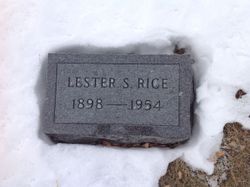
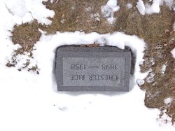
| Description | : | Pool Hall & Cafe Owner James Daniel Rice, husband of Grace Mae Jones and father to Chester, Lester, William, and Bessie. Son of James Monroe Rice and Mary Catherine (Thompson) James and Grace were married on 23 Dec 1897 in Maryville, MO and lived in White Cloud, Mo in 1900 thru 1910, 1920 they lived in Orange, ND thru 1925. 1930 they moved to Thunder Hawk, SD until his death in 1939. |
frequently asked questions (FAQ):
-
Where is James Daniel Rice's memorial?
James Daniel Rice's memorial is located at: Greenhill Cemetery, Lemmon, Perkins County, USA.
-
When did James Daniel Rice death?
James Daniel Rice death on 11 Aug 1939 in Thunder Hawk, Corson County, South Dakota, USA
-
Where are the coordinates of the James Daniel Rice's memorial?
Latitude: 45.9328003
Longitude: -102.1568985
Family Members:
Parent
Spouse
Siblings
Children
Flowers:
Nearby Cemetories:
1. Greenhill Cemetery
Lemmon, Perkins County, USA
Coordinate: 45.9328003, -102.1568985
2. North Lemmon Cemetery
Petrel, Adams County, USA
Coordinate: 45.9959900, -102.2458800
3. Petrel Cemetery
Adams County, USA
Coordinate: 45.9455986, -102.3088989
4. Stowers Cemetery
Adams County, USA
Coordinate: 46.0564400, -102.1029000
5. Prince of Peace Cemetery
Adams County, USA
Coordinate: 46.0677986, -102.1014023
6. Holy Family Catholic Cemetery
North Lemmon, Adams County, USA
Coordinate: 46.0603700, -102.0611200
7. Scholaas Cemetery
Shadehill, Perkins County, USA
Coordinate: 45.7984600, -102.3116100
8. Spring Butte Cemetery
Adams County, USA
Coordinate: 46.1192017, -102.1964035
9. Hugh Glass Memorial
Perkins County, USA
Coordinate: 45.7402900, -102.2319500
10. Cedar Valley Cemetery
Adams County, USA
Coordinate: 46.1183014, -102.3313980
11. Haynes Cemetery
Haynes, Adams County, USA
Coordinate: 45.9728012, -102.4955978
12. Long Butte Cemetery
Adams County, USA
Coordinate: 46.1618996, -102.2677994
13. Rosebud Lutheran Cemetery
Shadehill, Perkins County, USA
Coordinate: 45.7356500, -102.3629000
14. Selma Union Cemetery
Grant County, USA
Coordinate: 46.1264000, -101.9143982
15. Seim Cemetery
Perkins County, USA
Coordinate: 45.6819000, -102.3118973
16. Saint Peters Cemetery
Adams County, USA
Coordinate: 46.1055984, -102.4653015
17. Norwegian Cemetery
Perkins County, USA
Coordinate: 45.6972008, -102.3735962
18. Sacred Heart Cemetery
Hettinger County, USA
Coordinate: 46.2188988, -102.0830994
19. Pilgerheim Cemetery
Hettinger County, USA
Coordinate: 46.2206001, -102.0400009
20. Goeres Family Cemetery
Grant County, USA
Coordinate: 46.1396230, -101.8343250
21. Morristown Cemetery
Morristown, Corson County, USA
Coordinate: 45.9413290, -101.7066460
22. Zoar Methodist Cemetery
Bentley, Hettinger County, USA
Coordinate: 46.2351456, -102.0086899
23. Hettinger Cemetery
Hettinger, Adams County, USA
Coordinate: 46.0018997, -102.6232986
24. Pleasant Ridge Cemetery
Shadehill, Perkins County, USA
Coordinate: 45.6974983, -102.5177994


