| Birth | : | 1841 Duns, Scottish Borders, Scotland |
| Death | : | 25 Jun 1883 Hamilton County, Iowa, USA |
| Burial | : | Waitara Cemetery, Waitara, New Plymouth District, New Zealand |
| Coordinate | : | -38.9953000, 174.2537000 |
| Plot | : | Lot 40, Block 2, Section A |
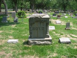
| Inscription | : | James Hoag DIED June 25, 1883 AGED 41y, 8m, & 5d |
| Description | : | Civil War service - 28th Wis. Inf. B Co. Published in the Hamilton Freeman 27 Jun 1883 James Hoag Dead.-James Hoag, a well-to-do farmer near Blairsburg, dies last Monday afternoon , of hemorhage of the lungs. He was about 40 years of age, and leaves a wife and two children to mourn his death. He was a soldier in the rebellion, and was expecting a pension. He has been a resident of Blairsburg for about 15 years, and was much respected by his neighbors and friends, and the whole community will greatly feel the loss of so good a... Read More |
frequently asked questions (FAQ):
-
Where is James Dunham Hoag's memorial?
James Dunham Hoag's memorial is located at: Waitara Cemetery, Waitara, New Plymouth District, New Zealand.
-
When did James Dunham Hoag death?
James Dunham Hoag death on 25 Jun 1883 in Hamilton County, Iowa, USA
-
Where are the coordinates of the James Dunham Hoag's memorial?
Latitude: -38.9953000
Longitude: 174.2537000
Family Members:
Parent
Spouse
Siblings
Children
Flowers:
Nearby Cemetories:
1. Waitara Cemetery
Waitara, New Plymouth District, New Zealand
Coordinate: -38.9953000, 174.2537000
2. Waipapa Māori Cemetery
Motunui, New Plymouth District, New Zealand
Coordinate: -38.9872800, 174.2702100
3. Tikorangi Cemetery
Tikorangi, New Plymouth District, New Zealand
Coordinate: -39.0291440, 174.2967880
4. O'Carroll Family Cemetery
New Plymouth District, New Zealand
Coordinate: -39.0465210, 174.2651080
5. Huirangi Cemetery
Huirangi, New Plymouth District, New Zealand
Coordinate: -39.0500060, 174.2513380
6. Lepperton Cemetery
Lepperton, New Plymouth District, New Zealand
Coordinate: -39.0575500, 174.2086000
7. Taumata Historic Reserve
Bell Block, New Plymouth District, New Zealand
Coordinate: -39.0478297, 174.1720073
8. St Lukes Churchyard
New Plymouth, New Plymouth District, New Zealand
Coordinate: -39.0332876, 174.1539411
9. St Luke's Methodist Church Cemetery
Bell Block, New Plymouth District, New Zealand
Coordinate: -39.0331650, 174.1537750
10. St. Luke's Cemetery Biblical Garden and Labyrinth
Bell Block, New Plymouth District, New Zealand
Coordinate: -39.0348800, 174.1475250
11. Urenui Cemetery
Urenui, New Plymouth District, New Zealand
Coordinate: -38.9988300, 174.3921800
12. Urenui Pa Urupā
Urenui, New Plymouth District, New Zealand
Coordinate: -38.9909130, 174.4058160
13. Henui Primitive Methodist Burial Ground
Fitzroy, New Plymouth District, New Zealand
Coordinate: -39.0502937, 174.0987132
14. Okoki Pa Urupā
Urenui, New Plymouth District, New Zealand
Coordinate: -38.9869340, 174.4261760
15. Te Henui Cemetery
New Plymouth, New Plymouth District, New Zealand
Coordinate: -39.0558000, 174.0910000
16. Awanui Cemetery
New Plymouth, New Plymouth District, New Zealand
Coordinate: -39.0670040, 174.0972140
17. St Mary's Anglican Churchyard
New Plymouth, New Plymouth District, New Zealand
Coordinate: -39.0601390, 174.0734240
18. Marsland Hill
New Plymouth, New Plymouth District, New Zealand
Coordinate: -39.0607490, 174.0733470
19. Inglewood Cemetery
Inglewood, New Plymouth District, New Zealand
Coordinate: -39.1554140, 174.2145930
20. Taranaki Crematorium
New Plymouth, New Plymouth District, New Zealand
Coordinate: -39.1216900, 174.1149500
21. Mangapouri Cemetery
Egmont Village, New Plymouth District, New Zealand
Coordinate: -39.1347278, 174.1282396
22. McClutchie Tomatu Urupā
New Plymouth District, New Zealand
Coordinate: -38.9600680, 174.4741370
23. Tarata Cemetery
Tarata, New Plymouth District, New Zealand
Coordinate: -39.1496000, 174.3658200
24. Port Taranaki
New Plymouth, New Plymouth District, New Zealand
Coordinate: -39.0615099, 174.0420725


