James Ferguson
| Birth | : | 28 Feb 1883 Inverness, Highland, Scotland |
| Death | : | 7 Sep 1944 Magrath, Claresholm Census Division, Alberta, Canada |
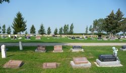
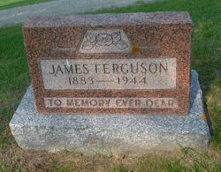
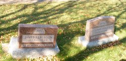
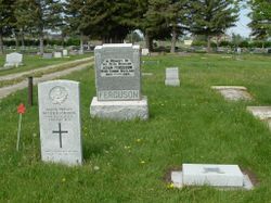
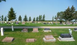
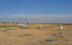
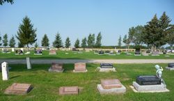
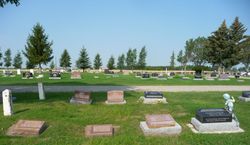
| Burial | : | Magrath Cemetery, Magrath, Claresholm Census Division, Canada |
| Coordinate | : | 49.3985700, -112.8648700 |
| Plot | : | Block 7 |
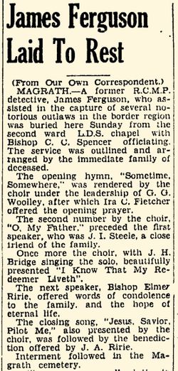
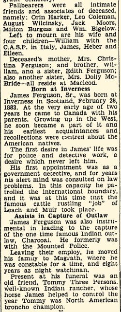
| Description | : | LETHBRIDGE HERALD SEP 13 1944 MAGRATH - James Ferguson assisted in the capture of several notorious outlaws in the border region including Charcoal - survived by his mother, Christine Ferguson; siblings, William Ferguson, Edith Ferguson & Dolly McBride all of Macleod, AB - born at Inverness Scotland Feb 28 1883 (sic) - came to Canada at age 2 yrs - government detective and patrolled the International Border - he was a North West Mounted Policeman - after he was discharged the family moved to Margrath, where he was a constable for some time and then 8 years as a night watchman. |
frequently asked questions (FAQ):
-
Where is James Ferguson's memorial?
James Ferguson's memorial is located at: Magrath Cemetery, Magrath, Claresholm Census Division, Canada.
-
When did James Ferguson death?
James Ferguson death on 7 Sep 1944 in Magrath, Claresholm Census Division, Alberta, Canada
-
Where are the coordinates of the James Ferguson's memorial?
Latitude: 49.3985700
Longitude: -112.8648700
Family Members:
Parent
Spouse
Siblings
Children
Flowers:
Nearby Cemetories:
1. Magrath Cemetery
Magrath, Claresholm Census Division, Canada
Coordinate: 49.3985700, -112.8648700
2. Hutterville Hutterite Cemetery
Magrath, Claresholm Census Division, Canada
Coordinate: 49.3503165, -112.7701038
3. Rockport Colony Cemetery
Magrath, Claresholm Census Division, Canada
Coordinate: 49.3027780, -112.8136110
4. Spring Valley Hutterite Colony Cemetery
Spring Coulee, Claresholm Census Division, Canada
Coordinate: 49.3517043, -113.0551519
5. Spring Coulee Cemetery
Spring Coulee, Claresholm Census Division, Canada
Coordinate: 49.3412100, -113.0541400
6. Temple Hill Cemetery
Raymond, Lethbridge Census Division, Canada
Coordinate: 49.4916300, -112.6605200
7. East Raymond Hutterite Colony Cemetery
Raymond, Lethbridge Census Division, Canada
Coordinate: 49.4185305, -112.5791329
8. Stirling Mennonite Church Cemetery
Stirling, Lethbridge Census Division, Canada
Coordinate: 49.4607570, -112.5387970
9. Wolf Creek Hutterite Colony Cemetery
Stirling, Lethbridge Census Division, Canada
Coordinate: 49.4119142, -112.5163705
10. Crystal Spring Hutterite Colony Cemetery
Magrath, Claresholm Census Division, Canada
Coordinate: 49.1702490, -112.8048290
11. Stirling Cemetery
Stirling, Lethbridge Census Division, Canada
Coordinate: 49.5093400, -112.5380000
12. West Raley Hutterite Cemetery
Raley, Claresholm Census Division, Canada
Coordinate: 49.2908857, -113.2283616
13. Mountain View Cemetery
Lethbridge, Lethbridge Census Division, Canada
Coordinate: 49.6800385, -112.8297729
14. Woolford Cemetery
Woolford, Claresholm Census Division, Canada
Coordinate: 49.1945800, -113.1652300
15. Wilson Siding Hutterite Cemetery
Wilson, Lethbridge Census Division, Canada
Coordinate: 49.6203914, -112.5781130
16. Indian Battle Park
Lethbridge, Lethbridge Census Division, Canada
Coordinate: 49.6928200, -112.8582900
17. Saint Catherine Cemetery
Stand Off, Claresholm Census Division, Canada
Coordinate: 49.4516900, -113.3112300
18. Big Bend Hutterite Colony
Cardston, Claresholm Census Division, Canada
Coordinate: 49.1636110, -113.1411110
19. Standoff Hutterite Colony Cemetery
Stand Off, Claresholm Census Division, Canada
Coordinate: 49.4829507, -113.3130885
20. Archmount Cemetery
Lethbridge, Lethbridge Census Division, Canada
Coordinate: 49.7057900, -112.9017500
21. Saint Patrick's Cemetery
Lethbridge, Lethbridge Census Division, Canada
Coordinate: 49.7084618, -112.8428726
22. East Cardston Hutterite Cemetery
Cardston, Claresholm Census Division, Canada
Coordinate: 49.1908348, -113.2258004
23. New Dayton Community Cemetery
New Dayton, Lethbridge Census Division, Canada
Coordinate: 49.4254300, -112.3601800
24. Royal View Memorial Cemetery
Lethbridge, Lethbridge Census Division, Canada
Coordinate: 49.7518540, -112.8242250

