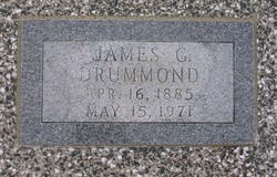
James Grover Drummond
| Birth | : | 16 Apr 1885 Cedar Point, Chase County, Kansas, USA |
| Death | : | 15 May 1971 Strong City, Chase County, Kansas, USA |
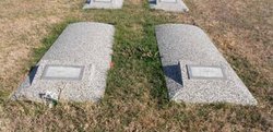
| Burial | : | Tuatapere Cemetery, Tuatapere, Southland District, New Zealand |
| Coordinate | : | -46.1089340, 167.6910580 |
| Plot | : | far south section |
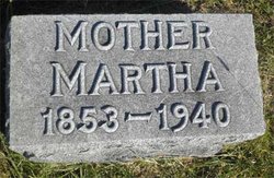
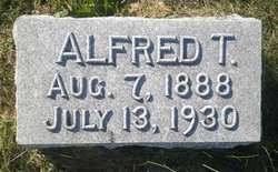
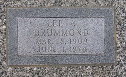
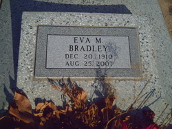
| Description | : | James married Bertha Birdie Rider on April 1, 1908. They had 2 children: Lee A. Drummond Eva M. Drummond who married Darrell C. Bradley. Son of William Drummond and Martha Mercer |
frequently asked questions (FAQ):
-
Where is James Grover Drummond's memorial?
James Grover Drummond's memorial is located at: Tuatapere Cemetery, Tuatapere, Southland District, New Zealand.
-
When did James Grover Drummond death?
James Grover Drummond death on 15 May 1971 in Strong City, Chase County, Kansas, USA
-
Where are the coordinates of the James Grover Drummond's memorial?
Latitude: -46.1089340
Longitude: 167.6910580
Family Members:
Parent
Spouse
Siblings
Children
Flowers:
Nearby Cemetories:
1. Tuatapere Cemetery
Tuatapere, Southland District, New Zealand
Coordinate: -46.1089340, 167.6910580
2. Eastern Bush Cemetery
Eastern Bush, Southland District, New Zealand
Coordinate: -45.9822530, 167.7751810
3. Orepuki Cemetery
Orepuki, Southland District, New Zealand
Coordinate: -46.3028250, 167.7240360
4. Otautau Old Cemetery
Otautau, Southland District, New Zealand
Coordinate: -46.1471300, 167.9940500
5. Otautau New Cemetery
Otautau, Southland District, New Zealand
Coordinate: -46.1307300, 168.0066400
6. Wairio Cemetery
Nightcaps, Southland District, New Zealand
Coordinate: -45.9617230, 168.0078750
7. Wakapatu Cemetery
Wakapatu, Southland District, New Zealand
Coordinate: -46.3806050, 167.8060970
8. Colac Bay Cemetery
Colac Bay, Southland District, New Zealand
Coordinate: -46.3679806, 167.8798528
9. Wreys Bush Cemetery
Wreys Bush, Southland District, New Zealand
Coordinate: -45.9941900, 168.0974500
10. Calcium Cemetery
Isla Bank, Southland District, New Zealand
Coordinate: -46.2035710, 168.1279070
11. Riverton Cemetery
Riverton, Southland District, New Zealand
Coordinate: -46.3316900, 168.0215500
12. Winton Cemetery
Winton, Southland District, New Zealand
Coordinate: -46.1289300, 168.3250400
13. East Winton Cemetery
Winton, Southland District, New Zealand
Coordinate: -46.1374640, 168.3557030
14. Wallacetown Old Cemetery
Wallacetown, Southland District, New Zealand
Coordinate: -46.3321840, 168.2861670
15. Wallacetown New Cemetery
Wallacetown, Southland District, New Zealand
Coordinate: -46.3374900, 168.2835700
16. Ryal Bush
Ryal Bush, Southland District, New Zealand
Coordinate: -46.2836700, 168.3256000
17. Forest Hill Cemetery
Southland District, New Zealand
Coordinate: -46.2049720, 168.3969970
18. Dipton Cemetery
Dipton, Southland District, New Zealand
Coordinate: -45.8957730, 168.3508000
19. Saint Johns Cemetery
Invercargill, Invercargill City, New Zealand
Coordinate: -46.3748600, 168.3431480
20. All Saints Anglican Church
Invercargill, Invercargill City, New Zealand
Coordinate: -46.3906042, 168.3476728
21. Centre Hill Cemetery
Mossburn, Southland District, New Zealand
Coordinate: -45.6973670, 168.1959000
22. Holy Trinity Anglican Church
Invercargill, Invercargill City, New Zealand
Coordinate: -46.3984736, 168.3660057
23. Eastern Cemetery
Invercargill, Invercargill City, New Zealand
Coordinate: -46.4070770, 168.3961480
24. Southland Crematorium
Invercargill, Invercargill City, New Zealand
Coordinate: -46.4109100, 168.3961330

