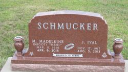
James Ival “Shrivel” Schmucker
| Birth | : | 17 Nov 1917 Brock, Nemaha County, Nebraska, USA |
| Death | : | 5 Aug 2013 Lincoln, Lancaster County, Nebraska, USA |
| Burial | : | Lafayette Cemetery, Brock, Nemaha County, USA |
| Coordinate | : | 40.5127983, -95.9543991 |
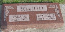
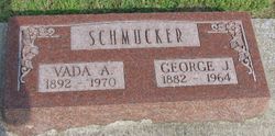
| Description | : | James Ival Schmucker, younger of two sons of George and Vada (Young) Schmucker, born in Brock, Ne. on Nov. 17, 1917. He attended Rosewood School through the 3rd grade and then was bussed to the Brock School. He graduated from Brock HIgh School in 1935. Ival hleped on his parents' farm southeast of Brock as he was growing up and also helped fill the ice house in the winter with cakes of ice from the river. On June 18, 1938, Ival was united in marriage to Mary Madeleine Migot on the Ernest Rotter farm west of Brock. To... Read More |
frequently asked questions (FAQ):
-
Where is James Ival “Shrivel” Schmucker's memorial?
James Ival “Shrivel” Schmucker's memorial is located at: Lafayette Cemetery, Brock, Nemaha County, USA.
-
When did James Ival “Shrivel” Schmucker death?
James Ival “Shrivel” Schmucker death on 5 Aug 2013 in Lincoln, Lancaster County, Nebraska, USA
-
Where are the coordinates of the James Ival “Shrivel” Schmucker's memorial?
Latitude: 40.5127983
Longitude: -95.9543991
Family Members:
Parent
Spouse
Siblings
Flowers:
Nearby Cemetories:
1. Lafayette Cemetery
Brock, Nemaha County, USA
Coordinate: 40.5127983, -95.9543991
2. Saint Pauls Cemetery
Talmage, Otoe County, USA
Coordinate: 40.5448810, -95.9919480
3. Fairview Cemetery
Talmage, Otoe County, USA
Coordinate: 40.5525017, -96.0102997
4. Saint Joseph Catholic Cemetery
Paul, Otoe County, USA
Coordinate: 40.5806530, -95.9339190
5. Grant Evergreen Cemetery
Nemaha County, USA
Coordinate: 40.5065430, -96.0472250
6. Saint Bernards Church Cemetery
Julian, Nemaha County, USA
Coordinate: 40.5078000, -95.8592000
7. Coryell Park Mausoleum
Johnson, Nemaha County, USA
Coordinate: 40.4371150, -95.9548690
8. Glenrock Cemetery
Glenrock, Nemaha County, USA
Coordinate: 40.4644012, -95.8764038
9. Clifton Cemetery
Johnson, Nemaha County, USA
Coordinate: 40.4333000, -95.9563980
10. Bloomingdale Cemetery
Otoe County, USA
Coordinate: 40.5685997, -95.8783035
11. Zion Lutheran Church Cemetery
Johnson, Nemaha County, USA
Coordinate: 40.4287000, -96.0099000
12. Saint Johns Cemetery
Talmage, Otoe County, USA
Coordinate: 40.5820847, -96.0474625
13. Linden Cemetery
Nemaha County, USA
Coordinate: 40.4216995, -95.9032974
14. Biggs Cemetery
Lorton, Otoe County, USA
Coordinate: 40.6025009, -96.0105972
15. Johnson Cemetery
Johnson, Nemaha County, USA
Coordinate: 40.4142000, -96.0052300
16. Heuser Cemetery
Otoe County, USA
Coordinate: 40.6223259, -95.9318848
17. Saint Matthews Lutheran Cemetery
Johnson, Nemaha County, USA
Coordinate: 40.4073060, -96.0086500
18. Highland Baptist Cemetery
Auburn, Nemaha County, USA
Coordinate: 40.4578018, -95.8191986
19. Highland Methodist Cemetery
Nemaha County, USA
Coordinate: 40.4581850, -95.8097140
20. Karn Cemetery
Glenrock, Nemaha County, USA
Coordinate: 40.4789000, -95.7917000
21. Camp Creek Cemetery
Otoe County, USA
Coordinate: 40.5681000, -95.8019028
22. Livingston Cemetery
Cook, Johnson County, USA
Coordinate: 40.5080986, -96.1235962
23. Mount Hope Church Cemetery
Cook, Johnson County, USA
Coordinate: 40.4775000, -96.1233000
24. Schacht Cemetery
Otoe County, USA
Coordinate: 40.5447006, -96.1271973


