


James L. Stroud
| Birth | : | 1810 North Carolina, USA |
| Death | : | 1888 Van Buren County, Arkansas, USA |
| Burial | : | Sacred Heart Cemetery, Park, Gove County, USA |
| Coordinate | : | 39.1147003, -100.3555984 |
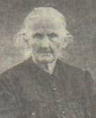
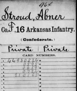
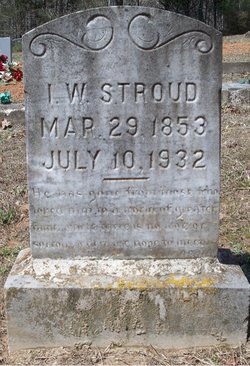
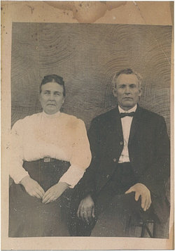
| Description | : | James L. Stroud was the son of William L. and Delilah Stroud. James married Anne "Aney" Morgan on February 10, 1840 in Rutherford Co., North Carolina. James and Aney were the parents of 1.Martha Morgan Stroud, b, 1841. 2.Abner William, b. 1843 d.1879, Abner married Esther Susannah Bost. 3.John Hicks "Hick", b.4/9/1845 d.1/30/. Hick married 1.Nancy Jane Cunningham, 2.Laura Ann Jackson(All three are interred at Cedar Creek Cemetery, near Jerusalem, Conway Co., Arkansas). 4.Nancy Jane, b.1849. Nancy married Alexander W. Morgan. 5.James C. "Uncle Jim", b.3/28/1851 d.8/18/1929. Jim married Georgia Ann Cordelia "Aunt Delia" Mills(They... Read More |
frequently asked questions (FAQ):
-
Where is James L. Stroud's memorial?
James L. Stroud's memorial is located at: Sacred Heart Cemetery, Park, Gove County, USA.
-
When did James L. Stroud death?
James L. Stroud death on 1888 in Van Buren County, Arkansas, USA
-
Where are the coordinates of the James L. Stroud's memorial?
Latitude: 39.1147003
Longitude: -100.3555984
Family Members:
Spouse
Children
Flowers:


Nearby Cemetories:
1. Sacred Heart Cemetery
Park, Gove County, USA
Coordinate: 39.1147003, -100.3555984
2. West Park Cemetery
Gove County, USA
Coordinate: 39.1107100, -100.3688300
3. Grainfield Cemetery
Grainfield, Gove County, USA
Coordinate: 39.1180992, -100.4708023
4. Quinter Cemetery
Quinter, Gove County, USA
Coordinate: 39.0736008, -100.2236023
5. Old Order German Baptist Cemetery
Quinter, Gove County, USA
Coordinate: 39.0299988, -100.2052994
6. Bethel Christian Cemetery
Studley, Sheridan County, USA
Coordinate: 39.2334100, -100.2051300
7. Red Top Cemetery
Quinter, Gove County, USA
Coordinate: 38.9449997, -100.2431030
8. Gove Cemetery
Gove, Gove County, USA
Coordinate: 38.9467010, -100.4847031
9. Saint Michaels Cemetery
Collyer, Trego County, USA
Coordinate: 39.0318985, -100.1153030
10. Mount Pleasant Community Cemetery
Studley, Sheridan County, USA
Coordinate: 39.2550011, -100.1635971
11. Union Cemetery
Collyer, Trego County, USA
Coordinate: 39.0299988, -100.1125031
12. Immaculate Conception Cemetery
Grinnell, Gove County, USA
Coordinate: 39.1282997, -100.6316986
13. Grinnell Cemetery
Grinnell, Gove County, USA
Coordinate: 39.1300011, -100.6352997
14. Baugher Cemetery
Studley, Sheridan County, USA
Coordinate: 39.3205600, -100.2560800
15. Gove County Cemetery
Gove Township, Gove County, USA
Coordinate: 38.9376127, -100.5277188
16. Saint Anthony Cemetery
Graham County, USA
Coordinate: 39.1892014, -100.0805969
17. Saint Frances Cemetery
Hoxie, Sheridan County, USA
Coordinate: 39.3541985, -100.4597015
18. Saint Pauls Catholic Cemetery
Angelus, Sheridan County, USA
Coordinate: 39.1912810, -100.6854250
19. Hoxie Cemetery
Hoxie, Sheridan County, USA
Coordinate: 39.3736000, -100.4421997
20. Morning Star Cemetery
Gove County, USA
Coordinate: 38.8431015, -100.3349991
21. Studley Cemetery
Studley, Sheridan County, USA
Coordinate: 39.3568993, -100.1631012
22. Leland Cemetery
Penokee, Graham County, USA
Coordinate: 39.2256012, -100.0149994
23. Saint Martins Cemetery
Seguin, Sheridan County, USA
Coordinate: 39.3396988, -100.5907974
24. Saline Valley Cemetery
Trego County, USA
Coordinate: 39.1180992, -99.9610977