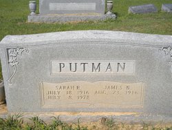
| Birth | : | 1936 Bonicord, Dyer County, Tennessee, USA |
| Death | : | 27 Nov 2009 Bonicord, Dyer County, Tennessee, USA |
| Burial | : | Knollwood Memorial Park, Canton, Norfolk County, USA |
| Coordinate | : | 42.1478004, -71.1669006 |
| Description | : | Dyersburg State Gazette Obituary November 29, 2009 James Lewis "Jimmy" Putman, 73, of Bonicord, died Friday, Nov. 27, 2009 at his residence. He was a dairy farmer, a member of Miller's Chapel Church of Christ, past president and coach in Dixie Youth Baseball programs for 29 years, chairman of the Dyer County Zoning Board, chief of Bonicord Fire Department and former Dyer County Commissioner. Services will be at 11 a.m. Monday at Dyersburg Funeral Home with Dr. Phillip Cook and Jason Sadler officiating. Burial will be in Friendship Cemetery. The family will receive visitors from 5-8 p.m. today at the funeral home.... Read More |
frequently asked questions (FAQ):
-
Where is James Lewis “Jimmy” Putman's memorial?
James Lewis “Jimmy” Putman's memorial is located at: Knollwood Memorial Park, Canton, Norfolk County, USA.
-
When did James Lewis “Jimmy” Putman death?
James Lewis “Jimmy” Putman death on 27 Nov 2009 in Bonicord, Dyer County, Tennessee, USA
-
Where are the coordinates of the James Lewis “Jimmy” Putman's memorial?
Latitude: 42.1478004
Longitude: -71.1669006
Family Members:
Parent
Flowers:
Nearby Cemetories:
1. Knollwood Memorial Park
Canton, Norfolk County, USA
Coordinate: 42.1478004, -71.1669006
2. Knollwood Cemetery
Canton, Norfolk County, USA
Coordinate: 42.1463670, -71.1635760
3. Sharon Memorial Park
Sharon, Norfolk County, USA
Coordinate: 42.1434200, -71.1742200
4. Chestnut Tree Cemetery
Sharon, Norfolk County, USA
Coordinate: 42.1408005, -71.1753006
5. Gridley Cemetery
Canton, Norfolk County, USA
Coordinate: 42.1444200, -71.1483400
6. Methodist Meeting House Cemetery
Stoughton, Norfolk County, USA
Coordinate: 42.1316110, -71.1319770
7. Moose Hill Cemetery
Sharon, Norfolk County, USA
Coordinate: 42.1410700, -71.2096900
8. Charles Sumner Bird Memorial Cemetery
Norwood, Norfolk County, USA
Coordinate: 42.1639600, -71.2082900
9. Rock Ridge Cemetery
Sharon, Norfolk County, USA
Coordinate: 42.1116982, -71.1663971
10. St. Mary's Cemetery
Canton, Norfolk County, USA
Coordinate: 42.1764000, -71.1290700
11. Canton Corner Cemetery
Canton, Norfolk County, USA
Coordinate: 42.1796989, -71.1314011
12. Holy Sepulchre Cemetery
Stoughton, Norfolk County, USA
Coordinate: 42.1361008, -71.1053009
13. Oliver Lothrop Yard
Sharon, Norfolk County, USA
Coordinate: 42.1090900, -71.2102900
14. Pearl Street Cemetery
Stoughton, Norfolk County, USA
Coordinate: 42.1281013, -71.1044006
15. Dry Pond Cemetery
Stoughton, Norfolk County, USA
Coordinate: 42.1045700, -71.1314900
16. Oldest Burying Ground
Canton, Norfolk County, USA
Coordinate: 42.1875500, -71.1203400
17. Old Parish Cemetery
Norwood, Norfolk County, USA
Coordinate: 42.1963997, -71.1988983
18. Guild Burial Ground
Walpole, Norfolk County, USA
Coordinate: 42.1255989, -71.2339020
19. Maple Grove Cemetery
Walpole, Norfolk County, USA
Coordinate: 42.1493988, -71.2410965
20. Drake Cemetery
Sharon, Norfolk County, USA
Coordinate: 42.0915500, -71.1563900
21. Evergreen Cemetery
Stoughton, Norfolk County, USA
Coordinate: 42.1160088, -71.0987473
22. Old Burial Place
Walpole, Norfolk County, USA
Coordinate: 42.1517780, -71.2486450
23. Highland Cemetery
Norwood, Norfolk County, USA
Coordinate: 42.1955986, -71.2177963
24. Rural Cemetery
Walpole, Norfolk County, USA
Coordinate: 42.1555400, -71.2504400


