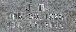
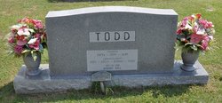
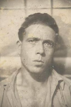
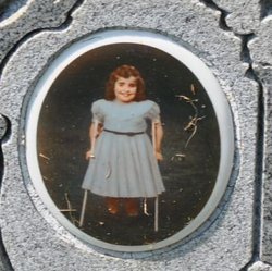
James Manuel “J.M.” Todd
| Birth | : | 20 May 1920 Conway, Horry County, South Carolina, USA |
| Death | : | 22 Oct 2000 Myrtle Beach, Horry County, South Carolina, USA |
| Burial | : | IOOF Mountain View Cemetery, Goldendale, Klickitat County, USA |
| Coordinate | : | 45.8304600, -120.8211600 |
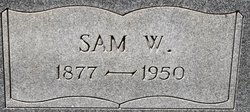
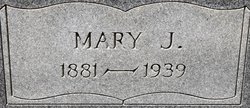
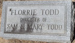
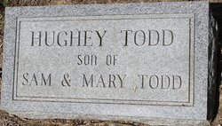
| Description | : | James Manuel "J -M." Todd, 80, died Sunday, Oct. 2,- 2000, at home after an illness. He was born in Conway, a son of the late Sam Woodbury and Mary Jane Skipper Todd. He was a World War II Army veteran, served in the L Company of the 40th Infantry and received five bronze service stars, a Good Conduct medal, an American Defense Service medal and the Purple Heart. He had many occupations throughout his life, but retired after owning and operating the Comet Motor inn for 31 years. He was a loving friend and will be missed by... Read More |
frequently asked questions (FAQ):
-
Where is James Manuel “J.M.” Todd's memorial?
James Manuel “J.M.” Todd's memorial is located at: IOOF Mountain View Cemetery, Goldendale, Klickitat County, USA.
-
When did James Manuel “J.M.” Todd death?
James Manuel “J.M.” Todd death on 22 Oct 2000 in Myrtle Beach, Horry County, South Carolina, USA
-
Where are the coordinates of the James Manuel “J.M.” Todd's memorial?
Latitude: 45.8304600
Longitude: -120.8211600
Family Members:
Parent
Spouse
Siblings
Children
Flowers:
Nearby Cemetories:
1. IOOF Mountain View Cemetery
Goldendale, Klickitat County, USA
Coordinate: 45.8304600, -120.8211600
2. Holy Trinity Cemetery
Goldendale, Klickitat County, USA
Coordinate: 45.8095000, -120.8486000
3. Woodland Cemetery
Goldendale, Klickitat County, USA
Coordinate: 45.8536600, -120.7893700
4. Spring Creek Cemetery
Goldendale, Klickitat County, USA
Coordinate: 45.8606000, -120.9166000
5. Hugh Caldwell Gravesite
Blockhouse, Klickitat County, USA
Coordinate: 45.8461200, -120.9492400
6. Number 6 Cemetery
Goldendale, Klickitat County, USA
Coordinate: 45.7954300, -120.6878700
7. Centerville Cemetery
Centerville, Klickitat County, USA
Coordinate: 45.7313995, -120.9044037
8. Stonehenge Monument
Maryhill, Klickitat County, USA
Coordinate: 45.6944695, -120.8062973
9. Ghost Horse Family Cemetery
Goldendale, Klickitat County, USA
Coordinate: 45.9100000, -120.9809200
10. Maryhill-Columbus Cemetery
Maryhill, Klickitat County, USA
Coordinate: 45.6928215, -120.8112030
11. Rufus Cemetery
Rufus, Sherman County, USA
Coordinate: 45.6891540, -120.7344410
12. Pleasant Valley Cemetery
Goodnoe Hills, Klickitat County, USA
Coordinate: 45.8310394, -120.5941162
13. White Eagle Memorial Preserve
Goldendale, Klickitat County, USA
Coordinate: 45.8960890, -120.6108330
14. Celilo Indian Cemetery
Wasco County, USA
Coordinate: 45.6502991, -120.9456024
15. Herland Forest Natural Burial Cemetery
Klickitat County, USA
Coordinate: 45.8571990, -121.1202690
16. Seventh Day Adventist Church Cemetery
Wahkiacus, Klickitat County, USA
Coordinate: 45.8665460, -121.1237490
17. Sun Rise Cemetery
Wasco, Sherman County, USA
Coordinate: 45.6068993, -120.7285995
18. Wasco Methodist Cemetery
Wasco, Sherman County, USA
Coordinate: 45.6068993, -120.7264023
19. Crawford Family Cemetery
Glenwood, Klickitat County, USA
Coordinate: 45.6791000, -121.0928300
20. Hartland Cemetery
Klickitat County, USA
Coordinate: 45.7380981, -121.1521988
21. Blackwolf Cemetery
Yakima County, USA
Coordinate: 45.7957900, -120.4649000
22. Farris Cemetery
Klickitat County, USA
Coordinate: 45.7400513, -120.4517899
23. Emigrant Springs Cemetery
Wasco, Sherman County, USA
Coordinate: 45.6193000, -120.5510000
24. Petersburg Cemetery
Wasco County, USA
Coordinate: 45.6094017, -121.0830994

