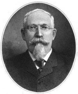
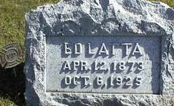
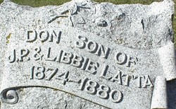
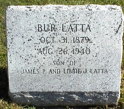
James Polk Latta Famous memorial
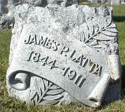
| Birth | : | 31 Oct 1844 Ashland County, Ohio, USA |
| Death | : | 11 Sep 1911 Rochester, Olmsted County, Minnesota, USA |
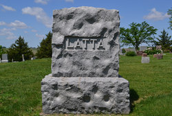
| Burial | : | Chapel of the Roses Cemetery, Atascadero, San Luis Obispo County, USA |
| Coordinate | : | 35.5027340, -120.6881430 |
| Description | : | U.S. Congressman. Moving with his parents to Jackson County, Iowa in 1846, he worked on a farm and moved to the Territory of Nebraska in 1863. There he taught school in Tekamah, plus engaged in agricultural and raised cattle. He organized the First National Bank of Tekamah, Nebraska, in 1890 and served as President for the rest of his life. Entering politics, he was a member of the Nebraska State House of Representatives in 1887 and served in the Nebraska State Senate in 1907. In 1909, he was elected as a Democrat to the Sixty-first and Sixty-second Congresses, serving until... Read More |
frequently asked questions (FAQ):
-
Where is James Polk Latta Famous memorial's memorial?
James Polk Latta Famous memorial's memorial is located at: Chapel of the Roses Cemetery, Atascadero, San Luis Obispo County, USA.
-
When did James Polk Latta Famous memorial death?
James Polk Latta Famous memorial death on 11 Sep 1911 in Rochester, Olmsted County, Minnesota, USA
-
Where are the coordinates of the James Polk Latta Famous memorial's memorial?
Latitude: 35.5027340
Longitude: -120.6881430
Family Members:
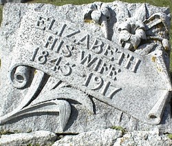
Spouse
Children
Flowers:
Nearby Cemetories:
1. Chapel of the Roses Cemetery
Atascadero, San Luis Obispo County, USA
Coordinate: 35.5027340, -120.6881430
2. Atascadero Pine Mountain Cemetery
Atascadero, San Luis Obispo County, USA
Coordinate: 35.4960835, -120.6565582
3. Templeton Cemetery
Templeton, San Luis Obispo County, USA
Coordinate: 35.5714455, -120.7022095
4. Dove Cemetery
San Luis Obispo County, USA
Coordinate: 35.4482231, -120.6344299
5. Saint James Episcopal Church Inurnment Garden
Paso Robles, San Luis Obispo County, USA
Coordinate: 35.6283460, -120.6929780
6. Santa Margarita Cemetery
Santa Margarita, San Luis Obispo County, USA
Coordinate: 35.3913994, -120.5880966
7. Willow Creek Mennonite Cemetery
Wilson Corner, San Luis Obispo County, USA
Coordinate: 35.5890410, -120.8215860
8. Paso Robles District Cemetery
Paso Robles, San Luis Obispo County, USA
Coordinate: 35.6424700, -120.7035000
9. Creston Cemetery
Creston, San Luis Obispo County, USA
Coordinate: 35.5328640, -120.5121450
10. Canet Cemetery
San Luis Obispo County, USA
Coordinate: 35.3522840, -120.7901660
11. Cayucos-Morro Bay District Cemetery
Cayucos, San Luis Obispo County, USA
Coordinate: 35.4371986, -120.8850021
12. Adelaida Cemetery
Adelaida, San Luis Obispo County, USA
Coordinate: 35.5632085, -120.8956170
13. St. Peter’s By-the-Sea Episcopal Church Memo
Morro Bay, San Luis Obispo County, USA
Coordinate: 35.3628700, -120.8467400
14. Estrella Adobe Cemetery
Paso Robles, San Luis Obispo County, USA
Coordinate: 35.6975080, -120.6399460
15. San Marcos Mennonite Cemetery
San Luis Obispo County, USA
Coordinate: 35.6874570, -120.7995160
16. Adelaida Cemetery
San Luis Obispo County, USA
Coordinate: 35.6563988, -120.8728027
17. Los Osos Valley Memorial Park
Los Osos, San Luis Obispo County, USA
Coordinate: 35.3053017, -120.8011017
18. Pleasant Valley Cemetery
San Miguel, San Luis Obispo County, USA
Coordinate: 35.7181892, -120.6228485
19. Mission San Luis Obispo Cemetery
San Luis Obispo, San Luis Obispo County, USA
Coordinate: 35.2806600, -120.6645200
20. Old Mission Cemetery
San Luis Obispo, San Luis Obispo County, USA
Coordinate: 35.2670660, -120.6692150
21. San Miguel District Cemetery
San Miguel, San Luis Obispo County, USA
Coordinate: 35.7392006, -120.7013550
22. San Luis Cemetery
San Luis Obispo, San Luis Obispo County, USA
Coordinate: 35.2644192, -120.6712830
23. Mission San Miguel Cemetery
San Miguel, San Luis Obispo County, USA
Coordinate: 35.7452610, -120.6977370
24. Ballagh Family Cemetery
Pozo, San Luis Obispo County, USA
Coordinate: 35.3695640, -120.4081780

