

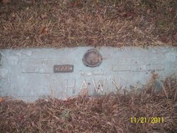
James William Hawn
| Birth | : | 12 Mar 1914 Ste. Genevieve County, Missouri, USA |
| Death | : | 22 Sep 1998 Farmington, St. Francois County, Missouri, USA |
| Burial | : | Maple Hill Cemetery, Osceola, Clarke County, USA |
| Coordinate | : | 41.0278015, -93.7794037 |
| Description | : | Of Farmington, died Sept. 22 at Farmington Presbyterian Manor. Member of Farmington First Baptist Church and Farmington Knights of Pythias Lodge. Married Mary Kathryn Denman Oct. 24, 1937. She died in 1967. Survived by his second wife, Gwen Esther (Black); sons, Donald and William; brothers, Emmett, Melvin and Don Hawn; four grandchildren and two great grandchildren. Preceded in death by his first wife; sizsters, Lura gordon and Mildred Cupples; and brothers, Robert, Irvin, Charles, Harry, Julius and Lester Hawn. Taylor Funeral Service. Burial at Hillview Memorial Gardens. |
frequently asked questions (FAQ):
-
Where is James William Hawn's memorial?
James William Hawn's memorial is located at: Maple Hill Cemetery, Osceola, Clarke County, USA.
-
When did James William Hawn death?
James William Hawn death on 22 Sep 1998 in Farmington, St. Francois County, Missouri, USA
-
Where are the coordinates of the James William Hawn's memorial?
Latitude: 41.0278015
Longitude: -93.7794037
Family Members:


Nearby Cemetories:
1. Maple Hill Cemetery
Osceola, Clarke County, USA
Coordinate: 41.0278015, -93.7794037
2. Pierson Cemetery
Osceola, Clarke County, USA
Coordinate: 40.9954491, -93.8131104
3. Cox Cemetery
Osceola, Clarke County, USA
Coordinate: 41.0722008, -93.8142014
4. Vawn Cemetery
Osceola, Clarke County, USA
Coordinate: 41.0760498, -93.7514648
5. Union Chapel Cemetery
Osceola, Clarke County, USA
Coordinate: 41.0811005, -93.7213974
6. Jones Plot
Osceola, Clarke County, USA
Coordinate: 40.9692726, -93.7288284
7. Ellis Family Cemetery
Osceola, Clarke County, USA
Coordinate: 40.9353027, -93.7380981
8. Lewis Cemetery
Woodburn, Clarke County, USA
Coordinate: 40.9975014, -93.6485977
9. Fremont Cemetery
Clarke County, USA
Coordinate: 41.1330000, -93.7705000
10. Green Bay Cemetery
Clarke County, USA
Coordinate: 40.9215000, -93.7765000
11. Jamison Cemetery
Jamison, Clarke County, USA
Coordinate: 41.1265000, -93.7263000
12. Lacelle Cemetery
Clarke County, USA
Coordinate: 40.9446500, -93.8690300
13. Sanders Cemetery
Doyle Township, Clarke County, USA
Coordinate: 40.9730000, -93.9016000
14. Bell Family Cemetery
Murray, Clarke County, USA
Coordinate: 41.0625267, -93.9240036
15. Twyford Cemetery
Liberty, Clarke County, USA
Coordinate: 41.1083295, -93.6670303
16. Chaney Cemetery
Clarke County, USA
Coordinate: 40.9207993, -93.7161026
17. Hebron Cemetery
Clarke County, USA
Coordinate: 40.9291992, -93.6911011
18. Horton Cemetery
Smyrna, Clarke County, USA
Coordinate: 40.9734192, -93.6321793
19. Murray Cemetery
Murray, Clarke County, USA
Coordinate: 41.0278015, -93.9456024
20. Saint Marys Cemetery
Woodburn, Clarke County, USA
Coordinate: 41.0190000, -93.6045000
21. Woodburn Cemetery
Woodburn, Clarke County, USA
Coordinate: 41.0080000, -93.6000000
22. Field Cemetery
Clarke County, USA
Coordinate: 41.1506004, -93.8606033
23. Kline Cemetery
Weldon, Decatur County, USA
Coordinate: 40.8916660, -93.7418870
24. Union Cemetery
Murray, Clarke County, USA
Coordinate: 41.1265000, -93.9115000