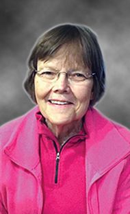
Jean Ruth Osterberg Schmeeckle
| Birth | : | 8 Jun 1947 Sioux Falls, Lincoln County, South Dakota, USA |
| Death | : | 26 May 2020 Hastings, Adams County, Nebraska, USA |
| Burial | : | Erik Olson Cemetery, Salem, McCook County, USA |
| Coordinate | : | 43.8189011, -97.4278030 |
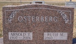
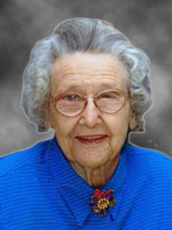
| Description | : | On May 26, 2020, Jean Ruth Schmeeckle passed away peacefully in her home surrounded by family. She was 72. Jean was born on June 8, 1947, in Sioux Falls, South Dakota, the daughter of Arnold and Ruth (Weld) Osterberg. She grew up on the family farm north of Salem, South Dakota. Jean graduated from Salem High School with the class of 1965 and graduated from General Beadle College, today know as Dakota State College. She married Norman Schmeeckle in 1978 near Salem, South Dakota and moved to Hastings, Nebraska. Jean worked for the Evangelical Covenant Church headquarters in... Read More |
frequently asked questions (FAQ):
-
Where is Jean Ruth Osterberg Schmeeckle's memorial?
Jean Ruth Osterberg Schmeeckle's memorial is located at: Erik Olson Cemetery, Salem, McCook County, USA.
-
When did Jean Ruth Osterberg Schmeeckle death?
Jean Ruth Osterberg Schmeeckle death on 26 May 2020 in Hastings, Adams County, Nebraska, USA
-
Where are the coordinates of the Jean Ruth Osterberg Schmeeckle's memorial?
Latitude: 43.8189011
Longitude: -97.4278030
Family Members:
Parent
Flowers:
Nearby Cemetories:
1. Erik Olson Cemetery
Salem, McCook County, USA
Coordinate: 43.8189011, -97.4278030
2. Unityville Cemetery
McCook County, USA
Coordinate: 43.8182900, -97.4693900
3. Sun Prairie Baptist Cemetery
Salem, McCook County, USA
Coordinate: 43.8466988, -97.4080963
4. Salem Lutheran Cemetery
Salem, McCook County, USA
Coordinate: 43.8333015, -97.3480988
5. Salem Lutheran Cemetery
Salem, McCook County, USA
Coordinate: 43.8334348, -97.3479809
6. Immanuel Lutheran Church Cemetery
McCook County, USA
Coordinate: 43.8338100, -97.5092500
7. Canova Cemetery
Canova, Miner County, USA
Coordinate: 43.8925018, -97.4888992
8. Saint Marys Cemetery
Salem, McCook County, USA
Coordinate: 43.7178001, -97.4096985
9. Wildwood Cemetery
Salem, McCook County, USA
Coordinate: 43.7178001, -97.4075012
10. Pleasant Hill Cemetery
McCook County, USA
Coordinate: 43.8044014, -97.5702972
11. Pleasant Hill Cemetery
Miner County, USA
Coordinate: 43.9248800, -97.4092650
12. Hillside Cemetery
Spencer, McCook County, USA
Coordinate: 43.7681007, -97.5681000
13. Saint Pauls Cemetery
Miner County, USA
Coordinate: 43.8774986, -97.5691986
14. Ramsey Baptist Church Cemetery
Montrose, McCook County, USA
Coordinate: 43.8333015, -97.2410965
15. Gracevale Colony Cemetery
Winfred, Lake County, USA
Coordinate: 43.9260500, -97.2814600
16. Ramsey Pioneer Cemetery
McCook County, USA
Coordinate: 43.8428001, -97.2166977
17. Our Savior Danish Evangelical Lutheran Cemetery
Howard, Miner County, USA
Coordinate: 43.9426537, -97.5663223
18. Lakeside Cemetery
Edgerton Township, Hanson County, USA
Coordinate: 43.7308006, -97.6138992
19. Spencer Cemetery
Spencer, McCook County, USA
Coordinate: 43.7085991, -97.5899963
20. Orland Colony Cemetery
Montrose, McCook County, USA
Coordinate: 43.8189730, -97.1970890
21. Holy Three Kings Cemetery
Epiphany, Hanson County, USA
Coordinate: 43.8491100, -97.6603900
22. Saint Peter Lutheran Cemetery
Orland, Lake County, USA
Coordinate: 43.8611200, -97.1694800
23. Winfred Cemetery
Winfred, Lake County, USA
Coordinate: 44.0078011, -97.3606033
24. Graceland Cemetery
Howard, Miner County, USA
Coordinate: 44.0003014, -97.5289001


