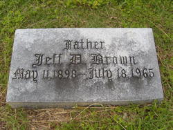
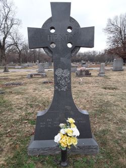
Jefferson Davis “Jeff” Brown Jr.
| Birth | : | 11 May 1898 Lowell, Benton County, Arkansas, USA |
| Death | : | 18 Jul 1965 Springdale, Washington County, Arkansas, USA |
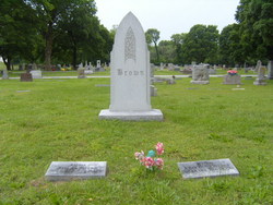
| Burial | : | Hills of Rest Memorial Park, Sioux Falls, Minnehaha County, USA |
| Coordinate | : | 43.5483017, -96.6821976 |
| Plot | : | Addition:1946;Section:3-A;Plot:4 |
| Inscription | : | Father |
| Description | : | Jeff D. Brown, 67, of East Amma Avenue, died yesterday in the Springdale Hospital. He was known as the father of the poultry industry in Arkansas, and in the past received a number of honors for his efforts in expanding and boostng the chicken business. He was born May 11, 1898 at Lowell. He was a member of the board of Stewards of the Methodist church, a member of the Rotary Club, a director of the First National Bank, served two terms as president of the Springdale Chamber of Commerce, and was president of the Midwest Feed Manufacturing Association. He was... Read More |
frequently asked questions (FAQ):
-
Where is Jefferson Davis “Jeff” Brown Jr.'s memorial?
Jefferson Davis “Jeff” Brown Jr.'s memorial is located at: Hills of Rest Memorial Park, Sioux Falls, Minnehaha County, USA.
-
When did Jefferson Davis “Jeff” Brown Jr. death?
Jefferson Davis “Jeff” Brown Jr. death on 18 Jul 1965 in Springdale, Washington County, Arkansas, USA
-
Where are the coordinates of the Jefferson Davis “Jeff” Brown Jr.'s memorial?
Latitude: 43.5483017
Longitude: -96.6821976
Family Members:
Parent
Spouse
Siblings
Children
Flowers:
Nearby Cemetories:
1. Hills of Rest Memorial Park
Sioux Falls, Minnehaha County, USA
Coordinate: 43.5483017, -96.6821976
2. Sons of Israel Cemetery
Minnehaha County, USA
Coordinate: 43.5435410, -96.6966400
3. Mount Zion Cemetery
Minnehaha County, USA
Coordinate: 43.5438423, -96.6973495
4. Mount Pleasant Cemetery
Sioux Falls, Minnehaha County, USA
Coordinate: 43.5421982, -96.6988983
5. Woodlawn Cemetery
Sioux Falls, Minnehaha County, USA
Coordinate: 43.5257988, -96.7133026
6. Calvary Episcopal Cathedral Cemetery
Sioux Falls, Minnehaha County, USA
Coordinate: 43.5423000, -96.7279100
7. Saint Michael Catholic Cemetery
Sioux Falls, Minnehaha County, USA
Coordinate: 43.5786018, -96.7117004
8. Minnehaha County Cemetery
Sioux Falls, Minnehaha County, USA
Coordinate: 43.6025009, -96.7003021
9. Monson Cemetery
Sioux Falls, Minnehaha County, USA
Coordinate: 43.5146970, -96.5990070
10. Hokenson Cemetery
East Sioux Falls, Minnehaha County, USA
Coordinate: 43.5338650, -96.5854450
11. South Dakota Veterans Cemetery
Sioux Falls, Minnehaha County, USA
Coordinate: 43.6228800, -96.6776300
12. Brandon Cemetery
Brandon, Minnehaha County, USA
Coordinate: 43.5877991, -96.5919037
13. Berg Cemetery
Sioux Falls, Minnehaha County, USA
Coordinate: 43.6122017, -96.7514038
14. Forest Home Cemetery
Sioux Falls, Minnehaha County, USA
Coordinate: 43.5328382, -96.8054295
15. Springdale Cemetery
Harrisburg, Lincoln County, USA
Coordinate: 43.4746590, -96.5944595
16. Swedona Covenant Cemetery
Brandon, Minnehaha County, USA
Coordinate: 43.6394100, -96.6311500
17. Bethel Cemetery
Minnehaha County, USA
Coordinate: 43.5872002, -96.8107986
18. Peterson Cemetery
Renner, Minnehaha County, USA
Coordinate: 43.6403900, -96.7534300
19. South Beaver Valley Cemetery
Brandon, Minnehaha County, USA
Coordinate: 43.5592003, -96.5366974
20. Beaver Valley Lutheran Cemetery
Valley Springs, Minnehaha County, USA
Coordinate: 43.5871680, -96.5324020
21. Grandview Cemetery
Lyon County, USA
Coordinate: 43.4482994, -96.5811005
22. Pleasant View Cemetery
Harrisburg, Lincoln County, USA
Coordinate: 43.4247017, -96.7067032
23. Split Rock Lutheran Church Cemetery
Garretson, Minnehaha County, USA
Coordinate: 43.6460500, -96.5519000
24. Dalemoe Cemetery
Crooks, Minnehaha County, USA
Coordinate: 43.6698000, -96.7715600

