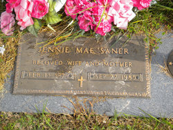
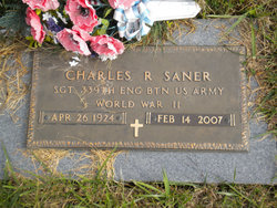
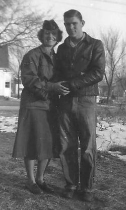
Jennie Mae Van Der Horst Saner
| Birth | : | 13 Feb 1929 Mahaska County, Iowa, USA |
| Death | : | 22 Sep 1985 Olmsted County, Minnesota, USA |
| Burial | : | Citizens Cemetery, Clarendon, Donley County, USA |
| Coordinate | : | 34.9192009, -100.8803024 |
frequently asked questions (FAQ):
-
Where is Jennie Mae Van Der Horst Saner's memorial?
Jennie Mae Van Der Horst Saner's memorial is located at: Citizens Cemetery, Clarendon, Donley County, USA.
-
When did Jennie Mae Van Der Horst Saner death?
Jennie Mae Van Der Horst Saner death on 22 Sep 1985 in Olmsted County, Minnesota, USA
-
Where are the coordinates of the Jennie Mae Van Der Horst Saner's memorial?
Latitude: 34.9192009
Longitude: -100.8803024
Family Members:
Parent
Spouse
Siblings
Flowers:
Nearby Cemetories:
1. Citizens Cemetery
Clarendon, Donley County, USA
Coordinate: 34.9192009, -100.8803024
2. Saint Marys Cemetery
Clarendon, Donley County, USA
Coordinate: 34.9188995, -100.8833008
3. Odd Fellows Cemetery
Clarendon, Donley County, USA
Coordinate: 34.9188995, -100.8863983
4. Rowe Cemetery
Hedley, Donley County, USA
Coordinate: 34.8869019, -100.6725006
5. Jericho Cemetery
Jericho, Donley County, USA
Coordinate: 35.1655998, -100.9203033
6. Boydston Cemetery
Donley County, USA
Coordinate: 35.1516991, -100.9914017
7. Goodnight Cemetery
Goodnight, Armstrong County, USA
Coordinate: 35.0463982, -101.1735992
8. Walls Family Cemetery
Hall County, USA
Coordinate: 34.6449710, -100.8643660
9. Liberty Cemetery
Lesley, Hall County, USA
Coordinate: 34.6477900, -100.8095400
10. Lakeview Cemetery
Lakeview, Hall County, USA
Coordinate: 34.6737350, -100.7160060
11. Alanreed Cemetery
Alanreed, Gray County, USA
Coordinate: 35.2114880, -100.7242870
12. Groom Cemetery
Groom, Carson County, USA
Coordinate: 35.1946983, -101.1327972
13. Fairview Cemetery North Section
Memphis, Hall County, USA
Coordinate: 34.7319630, -100.5276770
14. Fairview Cemetery South Section
Memphis, Hall County, USA
Coordinate: 34.7302830, -100.5255150
15. Saint Marys Cemetery
Groom, Carson County, USA
Coordinate: 35.2208100, -101.1169600
16. Eldridge Cemetery
Gray County, USA
Coordinate: 35.2771988, -100.7722015
17. Hillcrest Cemetery
McLean, Gray County, USA
Coordinate: 35.2400017, -100.6078033
18. Mount Pleasant Cemetery
Armstrong County, USA
Coordinate: 34.9446983, -101.3608017
19. Quail Cemetery
Quail, Collingsworth County, USA
Coordinate: 34.9211006, -100.3972015
20. Dozier Cemetery
Dozier, Collingsworth County, USA
Coordinate: 35.0518990, -100.3608017
21. Darsey Cemetery
Alanreed, Gray County, USA
Coordinate: 35.3597946, -100.7690887
22. Claude Cemetery
Claude, Armstrong County, USA
Coordinate: 35.1324997, -101.3799973
23. Newlin Cemetery
Newlin, Hall County, USA
Coordinate: 34.6055984, -100.4456024
24. Rolla Cemetery
Rolla, Collingsworth County, USA
Coordinate: 34.7939740, -100.3116540


