
| Birth | : | 20 Jun 1932 Horry County, South Carolina, USA |
| Death | : | 13 Feb 2011 Horry County, South Carolina, USA |
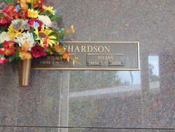
| Burial | : | Pleasant View Cemetery, Rock County, USA |
| Coordinate | : | 43.5882988, -96.2900009 |
| Description | : | June 20, 1932 - February 13, 2011 Conway Jennings "Jim" Richardson, 78 of Knotty Branch Road, passed away February 13, 2011 at Grand Strand Regional Medical Center surrounded by his family. Mr. Richardson was born June 20, 1932, a son of the late Hopson W. "Bill" and Sue Bell Roberts Richardson. He was a member of Mt. Herman Baptist Church and a lifetime member of Gunters Island Hunting Club, where he enjoyed his time hunting and fishing. He was predeceased by one son, Ronald Ashley Richardson; three brothers; and one sister. Mr. Richardson is survived by his wife, Angella Hucks Richardson of the home;... Read More |
frequently asked questions (FAQ):
-
Where is Jennings O'Neal “Jim” Richardson's memorial?
Jennings O'Neal “Jim” Richardson's memorial is located at: Pleasant View Cemetery, Rock County, USA.
-
When did Jennings O'Neal “Jim” Richardson death?
Jennings O'Neal “Jim” Richardson death on 13 Feb 2011 in Horry County, South Carolina, USA
-
Where are the coordinates of the Jennings O'Neal “Jim” Richardson's memorial?
Latitude: 43.5882988
Longitude: -96.2900009
Family Members:
Parent

Spouse
Siblings
Children
Flowers:


Nearby Cemetories:
1. Pleasant View Cemetery
Rock County, USA
Coordinate: 43.5882988, -96.2900009
2. Flowerfield Cemetery
Hills, Rock County, USA
Coordinate: 43.5289001, -96.3127975
3. Beaver Valley Cemetery
Beaver Creek, Rock County, USA
Coordinate: 43.6133003, -96.3705978
4. Trinity Cemetery
Steen, Rock County, USA
Coordinate: 43.5224991, -96.2530975
5. United Reformed Cemetery
Hills, Rock County, USA
Coordinate: 43.5294100, -96.3572900
6. Bethlehem Lutheran Church Cemetery
Hills, Rock County, USA
Coordinate: 43.5294200, -96.3577300
7. Maplewood Cemetery
Luverne, Rock County, USA
Coordinate: 43.6543999, -96.2307968
8. Eastside Cemetery
Steen, Rock County, USA
Coordinate: 43.5141983, -96.2328033
9. Memory Gardens
Luverne, Rock County, USA
Coordinate: 43.6741982, -96.2339020
10. Norwegian Cemetery
Luverne, Rock County, USA
Coordinate: 43.6699982, -96.2153015
11. Saint Catherine Cemetery
Luverne, Rock County, USA
Coordinate: 43.6699982, -96.2130966
12. Rock County Rural Cemetery
Rock County, USA
Coordinate: 43.6041985, -96.1542282
13. Palisade Prairie Cemetery
Luverne, Rock County, USA
Coordinate: 43.6597900, -96.4047800
14. Nerison Cemetery
Rock County, USA
Coordinate: 43.5005989, -96.4017029
15. Pleasant View Cemetery
Valley Springs, Minnehaha County, USA
Coordinate: 43.5752983, -96.4606018
16. East Palisades Cemetery
Rock County, USA
Coordinate: 43.6606100, -96.4309500
17. Ashwood Cemetery
Rock County, USA
Coordinate: 43.5630989, -96.1121979
18. Ebenezer Cemetery
Rock County, USA
Coordinate: 43.5008163, -96.1517410
19. Hillside Cemetery
Lester, Lyon County, USA
Coordinate: 43.4550018, -96.3305969
20. West Palisade Cemetery
Beaver Creek, Rock County, USA
Coordinate: 43.6608009, -96.4503021
21. Springwater Cemetery
Beaver Creek, Rock County, USA
Coordinate: 43.7181800, -96.3818900
22. Blue Mound Lutheran Cemetery
Luverne, Rock County, USA
Coordinate: 43.7315500, -96.1722200
23. Larchwood Cemetery
Larchwood, Lyon County, USA
Coordinate: 43.4613991, -96.4456024
24. Blue Mound Cemetery
Luverne, Rock County, USA
Coordinate: 43.7465200, -96.1911100