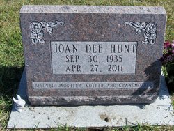
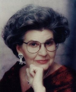
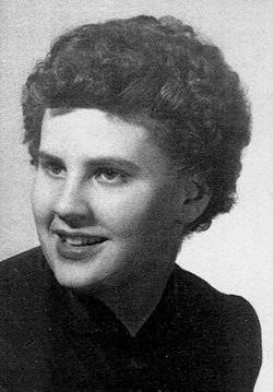
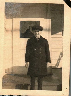
Joan Dee Kozak Hunt
| Birth | : | 30 Sep 1935 Maquoketa, Jackson County, Iowa, USA |
| Death | : | 27 Apr 2011 Maquoketa, Jackson County, Iowa, USA |
| Burial | : | Union Cemetery, Brookfield Township, Clinton County, USA |
| Coordinate | : | 42.0182991, -90.6694031 |
| Description | : | Joan Dee Hunt, 75, of Maquoketa, Iowa, died on Wednesday morning, April 27, 2011, at the Genesis Medical Center, East Campus in Davenport, Iowa. Friends and family may gather for "One Last Party" in remembrance of Joan on Saturday, April 30, 2011, from 11 A.M. to 1 P.M. in "The Bistro" at the Carson & Son Funeral And Cremation Services in Maquoketa. A private burial will be held at a later date in the Union Cemetery, rural Maquoketa, Iowa. Joan Dee Kozak was born on September 30, 1935 in Maquoketa, Iowa, to Charles DeWitt "Dee" and Marcella Marie "Tooty" (Hanson) Kozak. She... Read More |
frequently asked questions (FAQ):
-
Where is Joan Dee Kozak Hunt's memorial?
Joan Dee Kozak Hunt's memorial is located at: Union Cemetery, Brookfield Township, Clinton County, USA.
-
When did Joan Dee Kozak Hunt death?
Joan Dee Kozak Hunt death on 27 Apr 2011 in Maquoketa, Jackson County, Iowa, USA
-
Where are the coordinates of the Joan Dee Kozak Hunt's memorial?
Latitude: 42.0182991
Longitude: -90.6694031
Family Members:
Parent
Siblings
Flowers:
Nearby Cemetories:
1. Union Cemetery
Brookfield Township, Clinton County, USA
Coordinate: 42.0182991, -90.6694031
2. Sacred Heart Cemetery
Maquoketa, Jackson County, USA
Coordinate: 42.0583496, -90.6617966
3. Saint Patrick's Cemetery
Delmar, Clinton County, USA
Coordinate: 42.0036011, -90.6149979
4. Mount Hope Cemetery
Maquoketa, Jackson County, USA
Coordinate: 42.0615616, -90.6619720
5. Elwood Cemetery
Elwood, Clinton County, USA
Coordinate: 41.9935989, -90.7307968
6. Goddard Cemetery
Maquoketa, Jackson County, USA
Coordinate: 42.0391998, -90.7335968
7. Evergreen Cemetery
Delmar, Clinton County, USA
Coordinate: 41.9897003, -90.6057968
8. Buckhorn Waterford Cemetery
Buckhorn, Jackson County, USA
Coordinate: 42.0607986, -90.7517014
9. Bridgeport Cemetery
Maquoketa, Jackson County, USA
Coordinate: 42.0906000, -90.6267000
10. Bloomfield Cemetery
Clinton County, USA
Coordinate: 41.9458008, -90.6194000
11. Busch Cemetery
Clinton County, USA
Coordinate: 41.9996986, -90.7818985
12. Codfish Hollow Cemetery
Maquoketa, Jackson County, USA
Coordinate: 42.0727997, -90.5793991
13. Rathbun Cemetery
Maquoketa, Jackson County, USA
Coordinate: 42.0402000, -90.5570000
14. Pine Hill Cemetery
Bliedorn, Clinton County, USA
Coordinate: 41.9309300, -90.6836500
15. Saint Columbkille Cemetery
Bliedorn, Clinton County, USA
Coordinate: 41.9337330, -90.7039300
16. Tilton Cemetery
Jackson County, USA
Coordinate: 42.1236000, -90.6798000
17. Oakview Cemetery
Welton, Clinton County, USA
Coordinate: 41.9197930, -90.6031520
18. Union Center Cemetery
Maquoketa, Jackson County, USA
Coordinate: 42.0546989, -90.5246964
19. Immaculate Conception Cemetery
Petersville, Clinton County, USA
Coordinate: 41.9663000, -90.5332000
20. Rustic Park
Clinton County, USA
Coordinate: 41.9712334, -90.8088684
21. Esgate Cemetery
Maquoketa, Jackson County, USA
Coordinate: 42.1292000, -90.7142029
22. Seventh Day Baptist Cemetery
Welton, Clinton County, USA
Coordinate: 41.9130000, -90.6017000
23. Pence Cemetery
Baldwin, Jackson County, USA
Coordinate: 42.0746994, -90.8106003
24. Lost Nation Cemetery
Lost Nation, Clinton County, USA
Coordinate: 41.9654000, -90.8184000

