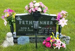
Joan Marie Bruggeman Fethkenher
| Birth | : | 10 Oct 1942 Carroll, Carroll County, Iowa, USA |
| Death | : | 10 Sep 2003 Glendale, Maricopa County, Arizona, USA |
| Burial | : | Immanuel Cemetery, Lidderdale, Carroll County, USA |
| Coordinate | : | 42.1389008, -94.8022003 |
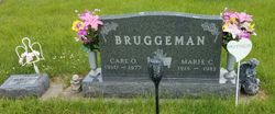
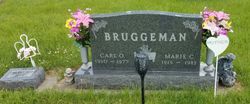
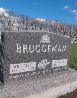
| Description | : | Daughter of Carl and Marie Wenck Bruggeman. Joan married Donald Fethkenher January, 24, 1964. The couple were parents of Dawn and Lisa. She taught school in Iowa, Nebraska and Arizona for 36 years. |
frequently asked questions (FAQ):
-
Where is Joan Marie Bruggeman Fethkenher's memorial?
Joan Marie Bruggeman Fethkenher's memorial is located at: Immanuel Cemetery, Lidderdale, Carroll County, USA.
-
When did Joan Marie Bruggeman Fethkenher death?
Joan Marie Bruggeman Fethkenher death on 10 Sep 2003 in Glendale, Maricopa County, Arizona, USA
-
Where are the coordinates of the Joan Marie Bruggeman Fethkenher's memorial?
Latitude: 42.1389008
Longitude: -94.8022003
Family Members:
Parent
Siblings
Flowers:
Nearby Cemetories:
1. Immanuel Cemetery
Lidderdale, Carroll County, USA
Coordinate: 42.1389008, -94.8022003
2. Holy Family Cemetery
Lidderdale, Carroll County, USA
Coordinate: 42.1178017, -94.7839966
3. East Liberty Cemetery
Lidderdale, Carroll County, USA
Coordinate: 42.1591988, -94.7636032
4. Lanesboro Cemetery
Lanesboro, Carroll County, USA
Coordinate: 42.1810989, -94.7230988
5. Our Lady Of Mount Carmel Cemetery
Mount Carmel, Carroll County, USA
Coordinate: 42.1547012, -94.9088974
6. Dickson Cemetery
Glidden Township, Carroll County, USA
Coordinate: 42.1074982, -94.6939011
7. West Lawn Cemetery
Glidden, Carroll County, USA
Coordinate: 42.0649986, -94.7406006
8. Carroll City Cemetery
Carroll, Carroll County, USA
Coordinate: 42.0560963, -94.8599856
9. Mount Olivet Cemetery
Carroll, Carroll County, USA
Coordinate: 42.0536340, -94.8595510
10. North Coon Cemetery
Carroll County, USA
Coordinate: 42.1260986, -94.6716995
11. Saint Francis Cemetery
Maple River, Carroll County, USA
Coordinate: 42.0969009, -94.9372025
12. Cottonwood Cemetery
Lake City, Calhoun County, USA
Coordinate: 42.2491989, -94.7936020
13. Luckow Cemetery
Auburn, Sac County, USA
Coordinate: 42.2168999, -94.9266968
14. Saint Bernards Cemetery
Breda, Carroll County, USA
Coordinate: 42.1786003, -94.9732971
15. Saint Marys Cemetery
Sac County, USA
Coordinate: 42.2611008, -94.8839035
16. Oak Lawn Cemetery
Auburn, Sac County, USA
Coordinate: 42.2611008, -94.8852997
17. Lake City Cemetery
Lake City, Calhoun County, USA
Coordinate: 42.2719002, -94.7574997
18. Saint Marys Catholic Cemetery
Lake City, Calhoun County, USA
Coordinate: 42.2730000, -94.7567000
19. Bishop Cemetery
Calhoun Township, Calhoun County, USA
Coordinate: 42.2230400, -94.6453190
20. Grant City Cemetery
Grant City, Sac County, USA
Coordinate: 42.2681007, -94.8908005
21. Dillavou Cemetery
Kendrick Township, Greene County, USA
Coordinate: 42.0802994, -94.6138992
22. Holy Angels Cemetery
Carroll County, USA
Coordinate: 42.0014000, -94.9141998
23. Arcadia Cemetery
Arcadia Township, Carroll County, USA
Coordinate: 42.1000680, -95.0130550
24. Saint Marys Catholic Cemetery
Willey, Carroll County, USA
Coordinate: 41.9783363, -94.8212204


