
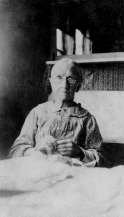

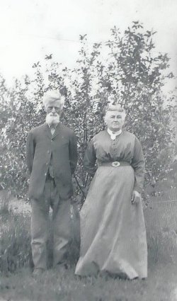
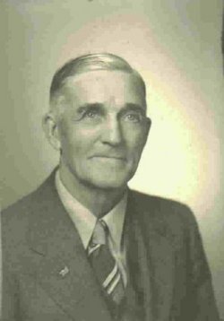
Johanna Osborn Brody
| Birth | : | 26 Nov 1826 Indianapolis, Marion County, Indiana, USA |
| Death | : | 3 Sep 1921 Urbana, Benton County, Iowa, USA |
| Burial | : | McCreary Roman Catholic Cemetery, McCreary, Dauphin Census Division, Canada |
| Coordinate | : | 50.7791190, -99.4995000 |
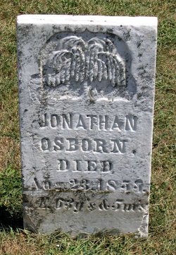
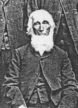
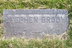
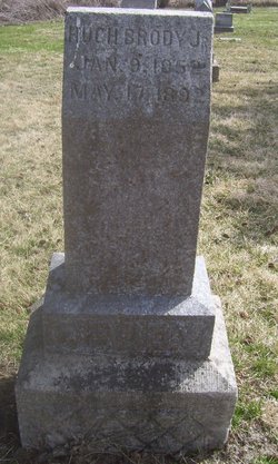
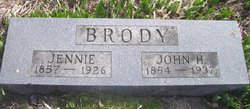
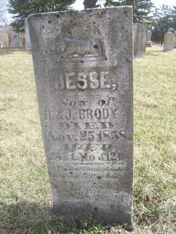
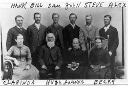
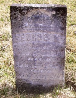
| Description | : | Daughter of Jonathan Osborn and Susanna Lewis Spouse of Hugh Brody Sr Mother of of Samuel Hugh, Stephen, Clarinda, Hugh Jr, John Hendrich, Jesse, William, Rebecca Jane, Henry, George M, and Alexander A JOANNA BRODY September 1921 "SPENT 78 YEARS ON SAME FARM" Eighty-one years a resident of Benton County, and seventy-eight of these lived on the same farm, is the record of Mrs. Joanna Brody, who died Saturday at 5:15 A.M., at the old Brody homestead in Polk Township, two miles South of Urbana. Had she lived until November 22, this year, she would have reached her 95th birthday. Her death was due to the... Read More |
frequently asked questions (FAQ):
-
Where is Johanna Osborn Brody's memorial?
Johanna Osborn Brody's memorial is located at: McCreary Roman Catholic Cemetery, McCreary, Dauphin Census Division, Canada.
-
When did Johanna Osborn Brody death?
Johanna Osborn Brody death on 3 Sep 1921 in Urbana, Benton County, Iowa, USA
-
Where are the coordinates of the Johanna Osborn Brody's memorial?
Latitude: 50.7791190
Longitude: -99.4995000
Family Members:
Parent
Spouse
Siblings

Children


Nearby Cemetories:
1. McCreary Roman Catholic Cemetery
McCreary, Dauphin Census Division, Canada
Coordinate: 50.7791190, -99.4995000
2. McCreary Cemetery
McCreary, Dauphin Census Division, Canada
Coordinate: 50.8009200, -99.5188300
3. St. Paul’s Lutheran Cemetery
McCreary, Dauphin Census Division, Canada
Coordinate: 50.7585900, -99.3693400
4. Notre Dame des Victoires Roman Catholic Cemetery
Laurier, Dauphin Census Division, Canada
Coordinate: 50.8895230, -99.5727730
5. Kelwood Community Cemetery
Kelwood, Western Manitoba Census Division, Canada
Coordinate: 50.6244100, -99.4568300
6. Sainte Amelie Roman Catholic Cemetery
Sainte-Amélie, Dauphin Census Division, Canada
Coordinate: 50.9844000, -99.3812700
7. Holy Resurrection Ukrainian Orthodox Church
Sunville, Dauphin Census Division, Canada
Coordinate: 50.6692700, -99.1843100
8. Riding Mountain Cemetery
Riding Mountain, Western Manitoba Census Division, Canada
Coordinate: 50.5424330, -99.4800260
9. Ukrainian Catholic Cemetery of St Peter & Paul
Sunville, Dauphin Census Division, Canada
Coordinate: 50.6550067, -99.1339756
10. Sainte Rose du Lac Cemetery
Sainte Rose du Lac, Dauphin Census Division, Canada
Coordinate: 51.0556790, -99.5231510
11. Ochre River Cemetery
Ochre River, Dauphin Census Division, Canada
Coordinate: 51.0463000, -99.7359500
12. Goodland Cemetery
Glenella, Central Manitoba Census Division, Canada
Coordinate: 50.5817520, -99.1244150
13. Mountain View Mennonite Church Cemetery
Birnie, Western Manitoba Census Division, Canada
Coordinate: 50.4620790, -99.4570190
14. Scandinavian Cemetery
Clanwilliam, Western Manitoba Census Division, Canada
Coordinate: 50.5071400, -99.8047400
15. Onanole Cemetery
Onanole, Western Manitoba Census Division, Canada
Coordinate: 50.6243700, -99.9745000
16. Turtle River Cemetery
Ochre River, Dauphin Census Division, Canada
Coordinate: 51.1039000, -99.6659900
17. St. Mary's Ukrainian Catholic Cemetery
Mountain Road, Western Manitoba Census Division, Canada
Coordinate: 50.4459159, -99.6326960
18. Birnie Cemetery
Birnie, Western Manitoba Census Division, Canada
Coordinate: 50.4346570, -99.4412040
19. Christ Lutheran Cemetery
Waldersee, Central Manitoba Census Division, Canada
Coordinate: 50.5617800, -99.0558050
20. Hilltop Baptist Cemetery
Erickson, Western Manitoba Census Division, Canada
Coordinate: 50.4826800, -99.8148600
21. Danvers Cemetery
Erickson, Western Manitoba Census Division, Canada
Coordinate: 50.5499600, -99.9336100
22. Crawford Park Community Cemetery
Crawford Park, Western Manitoba Census Division, Canada
Coordinate: 50.6875800, -100.0665300
23. Erickson Cemetery
Erickson, Western Manitoba Census Division, Canada
Coordinate: 50.4950400, -99.9086400
24. Saint Jude Roman Catholic Cemetery
Erickson, Western Manitoba Census Division, Canada
Coordinate: 50.4946670, -99.9094890