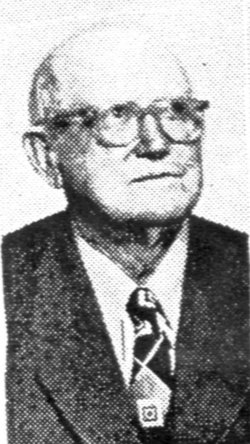
John Abner “Red” Norman
| Birth | : | 31 Oct 1870 |
| Death | : | 21 Jun 1953 |
| Burial | : | Forest Lawn Cemetery, Morrill, Scotts Bluff County, USA |
| Coordinate | : | 41.9919014, -103.9128036 |
| Description | : | John Abner Norman was an adventurer, infinitely looking for a different place to live and a new experience. In 1894 when he was 23 and had been married six months, he rode in the Cherokee Strip Run in the Indian Territories in Oklahoma. He left Missouri on horseback. His bride Lula, pregnant with her first child went down to the river crossing and kissed him good-bye and wished him good luck. He rode with his father Caleb P Norman and Lula's brother Bloomer White, three years older than she. They were looking for free land... Read More |
frequently asked questions (FAQ):
-
Where is John Abner “Red” Norman's memorial?
John Abner “Red” Norman's memorial is located at: Forest Lawn Cemetery, Morrill, Scotts Bluff County, USA.
-
When did John Abner “Red” Norman death?
John Abner “Red” Norman death on 21 Jun 1953 in
-
Where are the coordinates of the John Abner “Red” Norman's memorial?
Latitude: 41.9919014
Longitude: -103.9128036
Family Members:
Parent
Spouse
Children
Flowers:
Nearby Cemetories:
1. Forest Lawn Cemetery
Morrill, Scotts Bluff County, USA
Coordinate: 41.9919014, -103.9128036
2. Mitchell Cemetery
Mitchell, Scotts Bluff County, USA
Coordinate: 41.9585991, -103.8214035
3. Henry Crypt
Henry, Scotts Bluff County, USA
Coordinate: 42.0001000, -104.0454000
4. Caldwell Pioneer Graves
Scotts Bluff County, USA
Coordinate: 41.8911812, -103.9287087
5. Caldwell Cemetery
Scotts Bluff County, USA
Coordinate: 41.8997002, -103.9768982
6. Mitchell Valley Cemetery
Mitchell, Scotts Bluff County, USA
Coordinate: 41.8877983, -103.8311005
7. Sheep Creek Presbyterian Church Cemetery
Sioux County, USA
Coordinate: 42.0836290, -104.0283450
8. Sunset Memorial Park
Scottsbluff, Scotts Bluff County, USA
Coordinate: 41.8997002, -103.7166977
9. Pioneer Graves
Scotts Bluff County, USA
Coordinate: 41.8057785, -103.8303909
10. Valley View Cemetery
Torrington, Goshen County, USA
Coordinate: 42.0778008, -104.1782990
11. Fairview Cemetery
Scottsbluff, Scotts Bluff County, USA
Coordinate: 41.8857994, -103.6536026
12. Saint Francis Episcopal Church Columbarium
Scottsbluff, Scotts Bluff County, USA
Coordinate: 41.8665000, -103.6617500
13. West Lawn Cemetery
Gering, Scotts Bluff County, USA
Coordinate: 41.8167000, -103.6849976
14. Pierre Didier Papin Gravesite
Gering, Scotts Bluff County, USA
Coordinate: 41.7353783, -103.6983490
15. East Lawn Cemetery
Minatare, Scotts Bluff County, USA
Coordinate: 41.8591995, -103.5177994
16. Pleasant Hill Cemetery
Harrisburg, Banner County, USA
Coordinate: 41.6699982, -103.9449997
17. Grandview Cemetery
Yoder, Goshen County, USA
Coordinate: 41.9008000, -104.3450000
18. Hillcrest Cemetery
Lingle, Goshen County, USA
Coordinate: 42.1397000, -104.3340000
19. Lingle Cemetery
Lingle, Goshen County, USA
Coordinate: 42.1395100, -104.3344900
20. Creighton Valley Cemetery
Melbeta, Scotts Bluff County, USA
Coordinate: 41.7482300, -103.5580400
21. La Grange Cemetery
La Grange, Goshen County, USA
Coordinate: 41.6374800, -104.1465200
22. Gabe Rock Cemetery
Banner County, USA
Coordinate: 41.5668200, -103.8700200
23. Jensen Cemetery
Banner County, USA
Coordinate: 41.5719550, -103.8112790
24. High Butte Cemetery
McGrew, Scotts Bluff County, USA
Coordinate: 41.7289009, -103.4353027

