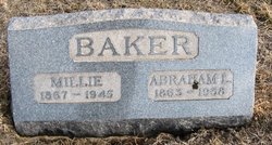
| Birth | : | 26 Jan 1867 Plano, Appanoose County, Iowa, USA |
| Death | : | 16 Dec 1919 Wichita, Sedgwick County, Kansas, USA |
| Burial | : | Branson Cemetery, Derby, Sedgwick County, USA |
| Coordinate | : | 37.6074982, -97.2067032 |
| Plot | : | Section D, Row 3, Grave 14 |
| Description | : | The Wichita Beacon Wichita, Kansas Tuesday, December 16, 1919 page 9 Baker: - John B. Baker, 52 years old, died last night at a local hospital. His home was three miles northwest of Rose Hill, where he had lived since coming to this state in 1885. He was a member of the Odd Fellows. He is survived by his wife, two sons and one daughter, four brothers and one sister. The body is at the Wichita Undertaking Parlors awaiting funeral arrangements. (transcribed by Judy Mayfield) |
frequently asked questions (FAQ):
-
Where is John Bolster Baker's memorial?
John Bolster Baker's memorial is located at: Branson Cemetery, Derby, Sedgwick County, USA.
-
When did John Bolster Baker death?
John Bolster Baker death on 16 Dec 1919 in Wichita, Sedgwick County, Kansas, USA
-
Where are the coordinates of the John Bolster Baker's memorial?
Latitude: 37.6074982
Longitude: -97.2067032
Family Members:
Parent
Spouse
Siblings
Children
Flowers:
Nearby Cemetories:
1. Branson Cemetery
Derby, Sedgwick County, USA
Coordinate: 37.6074982, -97.2067032
2. Reflection Pointe Cemetery
Wichita, Sedgwick County, USA
Coordinate: 37.6344800, -97.2264100
3. Prairie Home Scattering Garden
Derby, Sedgwick County, USA
Coordinate: 37.5482715, -97.1903412
4. Seltzer Cemetery
Wichita, Sedgwick County, USA
Coordinate: 37.6652000, -97.1672700
5. El Paso Cemetery
Derby, Sedgwick County, USA
Coordinate: 37.5418015, -97.2624969
6. Rose Hill Cemetery
Rose Hill, Butler County, USA
Coordinate: 37.5633011, -97.1177979
7. Dunlap Cemetery
Rose Hill, Butler County, USA
Coordinate: 37.5993996, -97.0975037
8. Hillcrest Cemetery
Derby, Sedgwick County, USA
Coordinate: 37.5194435, -97.2202759
9. Union Cemetery
Derby, Sedgwick County, USA
Coordinate: 37.5271988, -97.1532974
10. Mount Saint Mary Convent Cemetery
Wichita, Sedgwick County, USA
Coordinate: 37.6704000, -97.2904000
11. Pierpont Cemetery
Sedgwick County, USA
Coordinate: 37.7011400, -97.2077500
12. Saint Stephen's Episcopal Church Columbarium
Wichita, Sedgwick County, USA
Coordinate: 37.6999272, -97.2505590
13. East Heights United Methodist Memorial Garden
Wichita, Sedgwick County, USA
Coordinate: 37.6854100, -97.2845500
14. Calvary Cemetery
Wichita, Sedgwick County, USA
Coordinate: 37.6781006, -97.2949982
15. Lakeview Cemetery & Mausoleum
Wichita, Sedgwick County, USA
Coordinate: 37.7086601, -97.1978989
16. Friends Cemetery
Rose Hill, Butler County, USA
Coordinate: 37.5625000, -97.0896988
17. Saint James Episcopal Church Columbarium
Wichita, Sedgwick County, USA
Coordinate: 37.6865600, -97.2930000
18. Kensington Gardens Cemetery
Wichita, Sedgwick County, USA
Coordinate: 37.7230988, -97.2040024
19. Maple Grove Cemetery
Wichita, Sedgwick County, USA
Coordinate: 37.7036018, -97.2949982
20. Temple Emanuel Cemetery
Wichita, Sedgwick County, USA
Coordinate: 37.7014000, -97.3008000
21. Highland Cemetery
Wichita, Sedgwick County, USA
Coordinate: 37.7028008, -97.3007965
22. White Chapel Memorial Gardens
Wichita, Sedgwick County, USA
Coordinate: 37.7162018, -97.2806015
23. Wichita Hebrew Cemetery
Wichita, Sedgwick County, USA
Coordinate: 37.7201004, -97.2798004
24. Saint Johns Episcopal Church Columbarium
Wichita, Sedgwick County, USA
Coordinate: 37.6918950, -97.3339670


