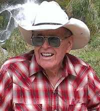
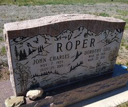
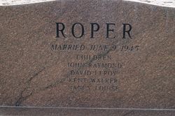
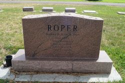
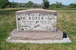
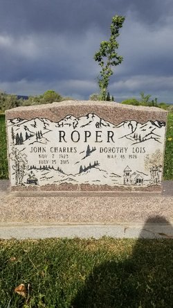
John Charles Roper
| Birth | : | 7 Nov 1923 Gunnison, Gunnison County, Colorado, USA |
| Death | : | 25 Jul 2015 Grand Junction, Mesa County, Colorado, USA |
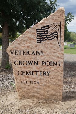
| Burial | : | Crown Point Cemetery, Grand Junction, Mesa County, USA |
| Coordinate | : | 39.1425018, -108.6175003 |
| Plot | : | Lot 189 Grave 3 |
| Description | : | John Charles Roper was born to Gunnison pioneer parents Albert and Mable Roper in Gunnison, Colorado November 7th, 1923. He grew up on ranches in the Gunnison area, initially on the Taylor River north of Gunnison, then later on the "home place" in the Gunnison River valley between Almont and Gunnison. He was the sixth child of 11 siblings, 9 girls and 2 boys. Growing up as a farm boy during the depression meant learning to get a lot of work done with not much in the way of resources. An aging father and a big family of mostly girls... Read More |
frequently asked questions (FAQ):
-
Where is John Charles Roper's memorial?
John Charles Roper's memorial is located at: Crown Point Cemetery, Grand Junction, Mesa County, USA.
-
When did John Charles Roper death?
John Charles Roper death on 25 Jul 2015 in Grand Junction, Mesa County, Colorado, USA
-
Where are the coordinates of the John Charles Roper's memorial?
Latitude: 39.1425018
Longitude: -108.6175003
Family Members:
Parent
Spouse
Siblings
Flowers:
Nearby Cemetories:
1. Crown Point Cemetery
Grand Junction, Mesa County, USA
Coordinate: 39.1425018, -108.6175003
2. Final Paws Pet Cemetery
Grand Junction, Mesa County, USA
Coordinate: 39.1205000, -108.6240000
3. Immaculate Heart of Mary Columbarium
Grand Junction, Mesa County, USA
Coordinate: 39.1195000, -108.5600000
4. Saint Matthews Episcopal Church Memorial Garden
Grand Junction, Mesa County, USA
Coordinate: 39.1021440, -108.5422860
5. Ross Cemetery
Grand Junction, Mesa County, USA
Coordinate: 39.0695660, -108.5637030
6. Sacred Heart Cemetery
Fruita, Mesa County, USA
Coordinate: 39.1721992, -108.7292023
7. Elmwood Cemetery
Fruita, Mesa County, USA
Coordinate: 39.1739006, -108.7339020
8. Municipal Cemetery
Grand Junction, Mesa County, USA
Coordinate: 39.0477028, -108.5673676
9. Teller Indian School Cemetery
Grand Junction, Mesa County, USA
Coordinate: 39.0631400, -108.5316130
10. Fair View Cemetery
Grand Junction, Mesa County, USA
Coordinate: 39.0465000, -108.5660000
11. Ohr Shalom Cemetery
Grand Junction, Mesa County, USA
Coordinate: 39.0460000, -108.5665000
12. Veterans Cemetery
Grand Junction, Mesa County, USA
Coordinate: 39.0444946, -108.5690918
13. Saint Anthony Cemetery
Grand Junction, Mesa County, USA
Coordinate: 39.0454000, -108.5660000
14. Calvary Cemetery
Grand Junction, Mesa County, USA
Coordinate: 39.0456009, -108.5653000
15. IOOF Cemetery
Grand Junction, Mesa County, USA
Coordinate: 39.0447500, -108.5679500
16. Masonic Cemetery
Grand Junction, Mesa County, USA
Coordinate: 39.0442276, -108.5670471
17. Veterans Memorial Cemetery of Western Colorado
Grand Junction, Mesa County, USA
Coordinate: 39.0631447, -108.5261002
18. Orchard Mesa Cemetery
Grand Junction, Mesa County, USA
Coordinate: 39.0426500, -108.5664000
19. Potters Field
Grand Junction, Mesa County, USA
Coordinate: 39.0413284, -108.5700989
20. Memorial Gardens
Grand Junction, Mesa County, USA
Coordinate: 39.0790329, -108.5022278
21. Little Park Cemetery
Grand Junction, Mesa County, USA
Coordinate: 38.9863500, -108.6604500
22. Glade Park Cemetery
Mesa County, USA
Coordinate: 39.0074997, -108.7382965
23. Palisade Cemetery
Palisade, Mesa County, USA
Coordinate: 39.0999000, -108.3980000
24. Whitewater Cemetery
Whitewater, Mesa County, USA
Coordinate: 38.9818993, -108.4357986

