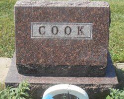
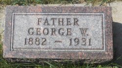
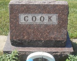
John Clair Cook
| Birth | : | 16 Nov 1920 Ismay, Custer County, Montana, USA |
| Death | : | 12 Jan 1969 Kinsey, Custer County, Montana, USA |
| Burial | : | Calvary Cemetery, Miles City, Custer County, USA |
| Coordinate | : | 46.3816986, -105.8249969 |
| Plot | : | Section LN: Lot 100 |
| Description | : | SOURCE: Death Certificate: '''''''''''''''''''''''''''''' The Billings Gazette, MT. 1/14/1969 Tuesday Page 11 Clair Cook MILES CITY, MT. ---- Clair John Cook, 48, died Monday morning while his truck was stuck on the Kinsey project road, near Miles City. He had not been well, and cause of death is being investigated. Survivors include two brothers, Lyman Cook of Billings, MT., and Bill of Avon, MT., a son, Cletus of Albuquerque, N.M. and a daughter Nilaa of Miles City, MT. |
frequently asked questions (FAQ):
-
Where is John Clair Cook's memorial?
John Clair Cook's memorial is located at: Calvary Cemetery, Miles City, Custer County, USA.
-
When did John Clair Cook death?
John Clair Cook death on 12 Jan 1969 in Kinsey, Custer County, Montana, USA
-
Where are the coordinates of the John Clair Cook's memorial?
Latitude: 46.3816986
Longitude: -105.8249969
Family Members:
Parent
Siblings
Flowers:
Nearby Cemetories:
1. Calvary Cemetery
Miles City, Custer County, USA
Coordinate: 46.3816986, -105.8249969
2. Old Calvary Cemetery
Miles City, Custer County, USA
Coordinate: 46.3807600, -105.8246500
3. Eastern Montana State Veterans Cemetery
Miles City, Custer County, USA
Coordinate: 46.3807564, -105.8246536
4. Custer County Cemetery
Miles City, Custer County, USA
Coordinate: 46.3891983, -105.8264008
5. Pine Hills School Cemetery
Miles City, Custer County, USA
Coordinate: 46.4077988, -105.8167038
6. Fort Keogh Cemetery
Custer County, USA
Coordinate: 46.3800011, -105.8874969
7. Pine Crest Cemetery
Custer County, USA
Coordinate: 46.4564018, -105.7789001
8. Hathaway Cemetery
Rosebud County, USA
Coordinate: 46.2616997, -106.2185974
9. Rosebud Cemetery
Rosebud, Rosebud County, USA
Coordinate: 46.2689018, -106.4381027
10. Powder River Supply Depot Cemetery
Terry, Prairie County, USA
Coordinate: 46.7302900, -105.4350800
11. Rock Springs Cemetery
Rock Springs, Rosebud County, USA
Coordinate: 46.7847800, -106.1411500
12. MacKenzie Family Cemetery
Custer County, USA
Coordinate: 46.1569500, -105.1448000
13. Prairie County Cemetery
Terry, Prairie County, USA
Coordinate: 46.7881012, -105.3443985
14. Knowlton Cemetery
Custer County, USA
Coordinate: 46.3210983, -105.0710983
15. Little Flat Community Cemetery
Fallon, Prairie County, USA
Coordinate: 46.4598000, -105.0291700
16. Forsyth Cemetery
Forsyth, Rosebud County, USA
Coordinate: 46.2689018, -106.6528015
17. Cottonwood Cemetery
Custer County, USA
Coordinate: 46.4294014, -104.9674988
18. North Stacey Cemetery
Powder River County, USA
Coordinate: 45.7569008, -105.8814011
19. Fallon Cemetery
Prairie County, USA
Coordinate: 46.8168983, -105.1327972
20. Little Flat Community Cemetery
Fallon, Prairie County, USA
Coordinate: 46.7659300, -105.0487600
21. Bean Cemetery
Rosebud County, USA
Coordinate: 45.8535995, -106.4011002
22. Lutheran Cemetery
Fallon, Prairie County, USA
Coordinate: 46.8320800, -105.1120100
23. Mildred Cemetery
Mildred, Prairie County, USA
Coordinate: 46.6850204, -104.9543457
24. Brown Cemetery
Colstrip, Rosebud County, USA
Coordinate: 45.8321991, -106.4180984


