
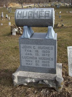
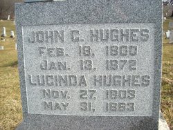
John Crooks “Squire” Hughes
| Birth | : | 18 Feb 1800 Westmoreland County, Pennsylvania, USA |
| Death | : | 13 Jan 1872 Liberty Township, White County, Indiana, USA |
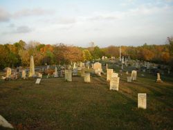
| Burial | : | Hillside Cemetery, Plainwell, Allegan County, USA |
| Coordinate | : | 42.4418983, -85.6235962 |
| Plot | : | sec 1, row 2 |
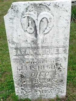
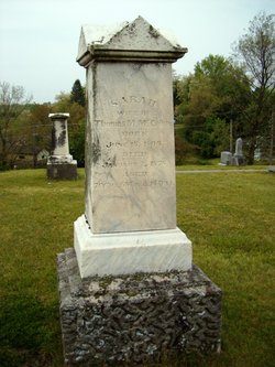
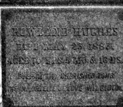
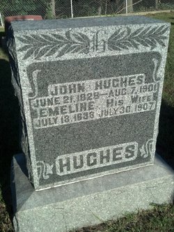
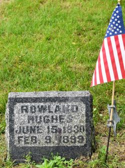
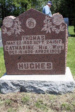
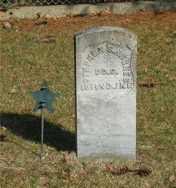
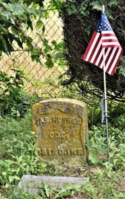
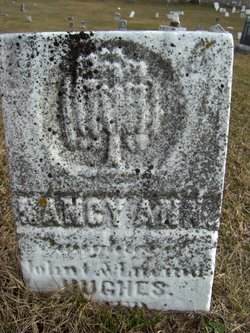
| Description | : | Son of Ellis and Sarah. On October 1, 1820, he married Lucinda Smith. John and Lucinda had seven children all born in Pennsylvania: Phoebe, John, Rowland, Thomas, Stephen James and Nancy Ann. John was a farmer and justice of the peace, known as "Squire" Hughes. His wife Lucinda drowned at Hughes Ford on the Tippecanoe River where now stands Lowe's Bridge. Rowland (paps) Hughes and his mother-in-law Mary Imes are also buried nearby. Source: The Old Monticello Cemetery by Madden Publishing |
frequently asked questions (FAQ):
-
Where is John Crooks “Squire” Hughes's memorial?
John Crooks “Squire” Hughes's memorial is located at: Hillside Cemetery, Plainwell, Allegan County, USA.
-
When did John Crooks “Squire” Hughes death?
John Crooks “Squire” Hughes death on 13 Jan 1872 in Liberty Township, White County, Indiana, USA
-
Where are the coordinates of the John Crooks “Squire” Hughes's memorial?
Latitude: 42.4418983
Longitude: -85.6235962
Family Members:
Parent
Spouse

Siblings

Children
Flowers:


Nearby Cemetories:
1. Hillside Cemetery
Plainwell, Allegan County, USA
Coordinate: 42.4418983, -85.6235962
2. Ives Cemetery
Plainwell, Allegan County, USA
Coordinate: 42.4571991, -85.6224976
3. Woodside Cemetery
Gun Plain Township, Allegan County, USA
Coordinate: 42.4582780, -85.6369650
4. Saint Margaret Cemetery
Otsego, Allegan County, USA
Coordinate: 42.4524994, -85.6821976
5. Saint Margaret's Church Cemetery
Plainwell, Allegan County, USA
Coordinate: 42.4525000, -85.6822000
6. Green Bower Cemetery
Alamo, Kalamazoo County, USA
Coordinate: 42.3974991, -85.6605988
7. Mountain Home Cemetery
Otsego, Allegan County, USA
Coordinate: 42.4672012, -85.6924973
8. West Cooper Cemetery
Cooper, Kalamazoo County, USA
Coordinate: 42.3699989, -85.6093979
9. South Martin Cemetery
Martin, Allegan County, USA
Coordinate: 42.5194016, -85.6421967
10. Pine Creek Cemetery
Otsego, Allegan County, USA
Coordinate: 42.4555560, -85.7305560
11. East Cooper Cemetery
Kalamazoo, Kalamazoo County, USA
Coordinate: 42.3755989, -85.5513992
12. Alamo Center Cemetery
Alamo, Kalamazoo County, USA
Coordinate: 42.3721230, -85.7078750
13. Cressey Cemetery
Prairieville Township, Barry County, USA
Coordinate: 42.4289017, -85.4888992
14. East Martin Cemetery
Martin, Allegan County, USA
Coordinate: 42.5477982, -85.6211014
15. Lindsey Cemetery
Prairieville, Barry County, USA
Coordinate: 42.5079200, -85.5098100
16. Hicks Cemetery
Watson Township, Allegan County, USA
Coordinate: 42.5438995, -85.6808014
17. Brown Cemetery
Orangeville Township, Barry County, USA
Coordinate: 42.5222015, -85.5130997
18. Liberty Street Cemetery
Alamo, Kalamazoo County, USA
Coordinate: 42.3321991, -85.7014008
19. Trowbridge Methodist Cemetery
Trowbridge Township, Allegan County, USA
Coordinate: 42.4464510, -85.7984160
20. Immanuel Lutheran Cemetery
Allegan, Allegan County, USA
Coordinate: 42.5210991, -85.7619019
21. Saint Martin of Tours Episcopal Church Columbarium
Kalamazoo, Kalamazoo County, USA
Coordinate: 42.3108170, -85.6275010
22. Grand Prairie Cemetery
Westwood, Kalamazoo County, USA
Coordinate: 42.3107986, -85.6446991
23. Mount Ever Rest Memorial Park North
Kalamazoo, Kalamazoo County, USA
Coordinate: 42.3074670, -85.6486630
24. Gate of Heaven Cemetery
Parchment, Kalamazoo County, USA
Coordinate: 42.3205986, -85.5410995