
| Birth | : | 8 Sep 1941 Holly Hill, Orangeburg County, South Carolina, USA |
| Death | : | 20 Apr 2014 South Carolina, USA |
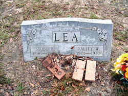
| Burial | : | Clarendon Memorial Gardens, Manning, Clarendon County, USA |
| Coordinate | : | 33.6863922, -80.1952051 |
| Description | : | MANNING - John David "Peanut" Lea, Sr., 72, husband of Bernice Buena Welch Lea, died Sunday, April 20, 2014, at his residence. Born September 8, 1941, in Holly Hill, he was the son of the late Stubo Lea and the late Mary Elizabeth Daniels Lea. He owned and operated Lea's Outlet Store in Manning for many years. He is survived by his wife; a daughter, Lisa Sheppard (Shep); a granddaughter, Cameron Sheppard, all of Manning; a sister, Twettie Hill of Aiken; and a number of nieces and nephews. He was preceded in death by a son, David Lea; and a brother, Jimmy Lea. A... Read More |
frequently asked questions (FAQ):
-
Where is John David “Peanut” Lea Sr.'s memorial?
John David “Peanut” Lea Sr.'s memorial is located at: Clarendon Memorial Gardens, Manning, Clarendon County, USA.
-
When did John David “Peanut” Lea Sr. death?
John David “Peanut” Lea Sr. death on 20 Apr 2014 in South Carolina, USA
-
Where are the coordinates of the John David “Peanut” Lea Sr.'s memorial?
Latitude: 33.6863922
Longitude: -80.1952051
Family Members:
Parent
Siblings

Flowers:


Nearby Cemetories:
1. Clarendon Memorial Gardens
Manning, Clarendon County, USA
Coordinate: 33.6863922, -80.1952051
2. Price-Snyder Cemetery
Manning, Clarendon County, USA
Coordinate: 33.6863670, -80.1948270
3. Manning Cemetery
Manning, Clarendon County, USA
Coordinate: 33.7024994, -80.2061005
4. Oak Grove Methodist Cemetery
Manning, Clarendon County, USA
Coordinate: 33.6660230, -80.1916550
5. Holladay Family Cemetery
Manning, Clarendon County, USA
Coordinate: 33.6763030, -80.2255100
6. Fellowship Missionary Baptist Church Cemetery
Manning, Clarendon County, USA
Coordinate: 33.6906160, -80.2297120
7. Blackwell Grave Site
Manning, Clarendon County, USA
Coordinate: 33.6566730, -80.1888140
8. Scarborough Cemetery
Clarendon County, USA
Coordinate: 33.6591610, -80.1792220
9. Providence Christian Church Cemetery
Manning, Clarendon County, USA
Coordinate: 33.6709470, -80.1621820
10. Freewill Goodwill Baptist Church Cemetery
Manning, Clarendon County, USA
Coordinate: 33.6533690, -80.1947830
11. Saint Matthew Cemetery
Manning, Clarendon County, USA
Coordinate: 33.6809600, -80.1550610
12. Thompson-Juneburn Cemetery
Clarendon County, USA
Coordinate: 33.7124901, -80.1680984
13. Community Deliverance Temple
Alcolu, Clarendon County, USA
Coordinate: 33.7219530, -80.1942370
14. Fair Heaven Baptist Church
Manning, Clarendon County, USA
Coordinate: 33.7119810, -80.1643690
15. Providence AME Church Cemetery
Clarendon County, USA
Coordinate: 33.6628800, -80.1591340
16. Ridgill Cemetery
Manning, Clarendon County, USA
Coordinate: 33.6846140, -80.2429930
17. Grace Christian Fellowship Cemetery
Manning, Clarendon County, USA
Coordinate: 33.6936030, -80.2429600
18. Fellowship Cemetery
Manning, Clarendon County, USA
Coordinate: 33.6660995, -80.2382965
19. Paxville Baptist Church Cemetery
Paxville, Clarendon County, USA
Coordinate: 33.6472244, -80.2154541
20. Fourth Crossroad Baptist Church
Clarendon County, USA
Coordinate: 33.7120510, -80.2394930
21. William Chapel Christian Church
Manning, Clarendon County, USA
Coordinate: 33.6741530, -80.1428600
22. Jayroe Family Cemetery
Clarendon County, USA
Coordinate: 33.7111350, -80.2420010
23. Lees Cemetery
Clarendon County, USA
Coordinate: 33.7127991, -80.1421967
24. Bethel AME Church Cemetery
Manning, Clarendon County, USA
Coordinate: 33.6423660, -80.2331030