
| Birth | : | 8 Sep 1939 Redfield, Spink County, South Dakota, USA |
| Death | : | 30 Nov 2006 Redfield, Spink County, South Dakota, USA |
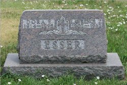
| Burial | : | Wessington Cemetery, Hand County, USA |
| Coordinate | : | 44.4569016, -98.7102966 |
| Description | : | Redfield Press, December 8, 2006 Services for Don Esser, 67, Redfield, were held Monday, Dec. 4, 2006, at the First Congregational United Church of Christ, Redfield, with the Rev. Tim Fugman officiating. Burial was in the Wessington Cemetery. The Thelen Funeral Home, Redfield, was in charge of arrangements. Mr. Esser died Thursday, Nov. 30, 2006, at Community Memorial Hospital, Redfield. He was born Sept. 8, 1939, in Redfield to Lawrence and Dora (Harford) Esser. He graduated from Redfield High School in 1957. After living in Milwaukee, Wis., for a year he returned to Redfield... Read More |
frequently asked questions (FAQ):
-
Where is John Donovan “Don” Donald Esser's memorial?
John Donovan “Don” Donald Esser's memorial is located at: Wessington Cemetery, Hand County, USA.
-
When did John Donovan “Don” Donald Esser death?
John Donovan “Don” Donald Esser death on 30 Nov 2006 in Redfield, Spink County, South Dakota, USA
-
Where are the coordinates of the John Donovan “Don” Donald Esser's memorial?
Latitude: 44.4569016
Longitude: -98.7102966
Family Members:
Parent
Siblings

Flowers:


Nearby Cemetories:
1. Wessington Cemetery
Hand County, USA
Coordinate: 44.4569016, -98.7102966
2. Saint Josephs Catholic Cemetery
Hand County, USA
Coordinate: 44.4574400, -98.7100400
3. McCord Cemetery
Wessington, Beadle County, USA
Coordinate: 44.3998500, -98.6673100
4. Sand Creek Cemetery
Beadle County, USA
Coordinate: 44.3055800, -98.6791200
5. Beulah Cemetery
Vayland, Hand County, USA
Coordinate: 44.6060982, -98.8060989
6. Saint Johns Lutheran Cemetery
Wolsey, Beadle County, USA
Coordinate: 44.3927994, -98.4985962
7. Rosehill Cemetery
Hand County, USA
Coordinate: 44.2980995, -98.7731018
8. Saint Lawrence Cemetery
Saint Lawrence, Hand County, USA
Coordinate: 44.5292015, -98.9321976
9. Wolsey Cemetery
Wolsey, Beadle County, USA
Coordinate: 44.4000015, -98.4546967
10. Saint Ann's Cemetery
Miller, Hand County, USA
Coordinate: 44.5222015, -98.9732971
11. G A R Cemetery
Miller, Hand County, USA
Coordinate: 44.5078011, -98.9858017
12. Bonilla Cemetery
Bonilla, Beadle County, USA
Coordinate: 44.5830994, -98.4835968
13. Molvig Cemetery
Virgil, Beadle County, USA
Coordinate: 44.2552900, -98.6145900
14. Hillcrest Cemetery
Miller, Hand County, USA
Coordinate: 44.5207000, -99.0006100
15. Garfield Cemetery
Spink County, USA
Coordinate: 44.6622009, -98.5535965
16. Buffalo Cemetery
Spink County, USA
Coordinate: 44.6918983, -98.6853027
17. Sunbeam Cemetery
Hand County, USA
Coordinate: 44.6777992, -98.8407974
18. Burdette Cemetery
Burdette, Hand County, USA
Coordinate: 44.7002983, -98.7869034
19. Earlville Cemetery
Beadle County, USA
Coordinate: 44.2118988, -98.6091995
20. Altoona Cemetery
Hitchcock, Beadle County, USA
Coordinate: 44.6108017, -98.4113998
21. New Zion Cemetery
Hand County, USA
Coordinate: 44.2043991, -98.8206024
22. Saint Johns Cemetery
Tulare, Spink County, USA
Coordinate: 44.7202988, -98.6600037
23. Virgil Cemetery
Virgil, Beadle County, USA
Coordinate: 44.2904800, -98.4176700
24. Broadland Catholic Cemetery
Broadland, Beadle County, USA
Coordinate: 44.5005000, -98.3380800