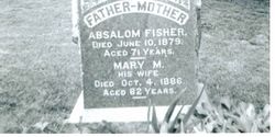
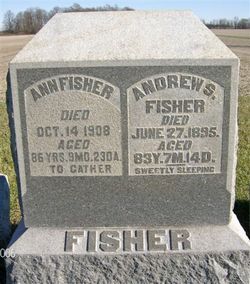
| Birth | : | 1783 New Jersey, USA |
| Death | : | Sep 1850 Fishersburg, Madison County, Indiana, USA |
| Burial | : | St. Andrew's Presbyterian Cemetery, Caledon, Peel Regional Municipality, Canada |
| Description | : | Husband of Barbary Shetterly. He planned to move in the fall of 1850 to Warren County, Iowa. His death was about September. He was born about 1783. He was the son of Benjamin Fisher a pioneer of Goshen Township, Clermont County, Ohio. |
frequently asked questions (FAQ):
-
Where is John Fisher's memorial?
John Fisher's memorial is located at: St. Andrew's Presbyterian Cemetery, Caledon, Peel Regional Municipality, Canada.
-
When did John Fisher death?
John Fisher death on Sep 1850 in Fishersburg, Madison County, Indiana, USA
Family Members:
Spouse
Children
Flowers:
Nearby Cemetories:
1. Centreville Cemetery
Albion, Peel Regional Municipality, Canada
Coordinate: 43.6957420, -79.8457570
2. Columbia Cemetery
Albion, Peel Regional Municipality, Canada
Coordinate: 43.6872680, -79.8086580
3. Godbolt Primitive Methodist Cemetery
Albion, Peel Regional Municipality, Canada
Coordinate: 43.6928400, -79.7546800
4. Saint John the Evangelist Roman Catholic Cemetery
Albion, Peel Regional Municipality, Canada
Coordinate: 43.6877200, -79.8098200
5. Alton Cemetery
Alton, Peel Regional Municipality, Canada
Coordinate: 43.6940300, -79.7706100
6. Blair-Belfountain Cemetery
Belfountain, Peel Regional Municipality, Canada
Coordinate: 43.6580520, -79.7219820
7. Greenlaw-Baker Cemetery
Belfountain, Peel Regional Municipality, Canada
8. Albion Presbyterian Cemetery
Bolton, Peel Regional Municipality, Canada
Coordinate: 43.7000500, -79.7825500
9. Bolton Anglican and Methodist Cemeteries
Bolton, Peel Regional Municipality, Canada
Coordinate: 43.7801530, -79.6909940
10. Laurel Hill Cemetery
Bolton, Peel Regional Municipality, Canada
Coordinate: 43.7499000, -79.7285000
11. Plummer Family Cemetery
Bolton, Peel Regional Municipality, Canada
12. Boston Mills Cemetery
Boston Mills, Peel Regional Municipality, Canada
Coordinate: 43.7306800, -79.7496900
13. Alloa Methodist United Church Cemetery
Brampton, Peel Regional Municipality, Canada
Coordinate: 43.6957420, -79.8457570
14. Brampton Cemetery
Brampton, Peel Regional Municipality, Canada
Coordinate: 43.6872680, -79.8086580
15. Brampton Cemetery
Brampton, Peel Regional Municipality, Canada
Coordinate: 43.6928400, -79.7546800
16. Brampton Memorial Gardens
Brampton, Peel Regional Municipality, Canada
Coordinate: 43.6877200, -79.8098200
17. Brampton Pioneer Cemetery
Brampton, Peel Regional Municipality, Canada
Coordinate: 43.6940300, -79.7706100
18. Cheyne Cemetery
Brampton, Peel Regional Municipality, Canada
Coordinate: 43.6580520, -79.7219820
19. Ebenezer United Church Cemetery
Brampton, Peel Regional Municipality, Canada
20. Eventide Cemetery
Brampton, Peel Regional Municipality, Canada
Coordinate: 43.7000500, -79.7825500
21. Flight 621 Memorial Garden
Brampton, Peel Regional Municipality, Canada
Coordinate: 43.7801530, -79.6909940
22. Harrison United Cemetery
Brampton, Peel Regional Municipality, Canada
Coordinate: 43.7499000, -79.7285000
23. Harrison-Hewgill Pioneer Cemetery
Brampton, Peel Regional Municipality, Canada
24. Lundy Burying Ground
Brampton, Peel Regional Municipality, Canada
Coordinate: 43.7306800, -79.7496900


