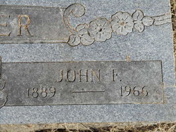
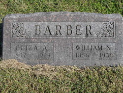
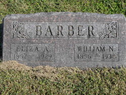
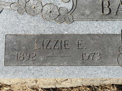
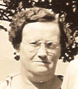
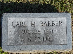
John Franklin Barber
| Birth | : | 17 Jan 1889 Ray County, Missouri, USA |
| Death | : | 30 Mar 1966 Columbia, Boone County, Missouri, USA |
| Burial | : | Greenwich Presbyterian Church Cemetery, Greenwich, Cumberland County, USA |
| Coordinate | : | 39.4126200, -75.3459800 |
| Plot | : | Section 3 |
| Description | : | MO Death Cert # 66-0009595 Father = Wm. Barber Mother = Eliza White Spouse = Lizzie Barber Informant = Hospital Records Occupation = Laborer COD = Heart Disease |
frequently asked questions (FAQ):
-
Where is John Franklin Barber's memorial?
John Franklin Barber's memorial is located at: Greenwich Presbyterian Church Cemetery, Greenwich, Cumberland County, USA.
-
When did John Franklin Barber death?
John Franklin Barber death on 30 Mar 1966 in Columbia, Boone County, Missouri, USA
-
Where are the coordinates of the John Franklin Barber's memorial?
Latitude: 39.4126200
Longitude: -75.3459800
Family Members:
Parent
Spouse
Siblings
Flowers:
Nearby Cemetories:
1. Greenwich Presbyterian Church Cemetery
Greenwich, Cumberland County, USA
Coordinate: 39.4126200, -75.3459800
2. Ambury Hill Cemetery
Cumberland County, USA
Coordinate: 39.4175491, -75.3496552
3. Greenwich Friends Meeting House Cemetery
Greenwich, Cumberland County, USA
Coordinate: 39.4066467, -75.3447189
4. Greenwich Friends Cemetery #02
Greenwich, Cumberland County, USA
Coordinate: 39.3997955, -75.3439865
5. Mount Pleasant Cemetery
Springtown, Cumberland County, USA
Coordinate: 39.4182663, -75.3290863
6. Othello Church Graveyard
Othello, Cumberland County, USA
Coordinate: 39.4182660, -75.3290860
7. Greenwich Baptist Church Cemetery
Greenwich, Cumberland County, USA
Coordinate: 39.3936310, -75.3417587
8. Old Cohansey Graveyard
Sheppards Mill, Cumberland County, USA
Coordinate: 39.4089432, -75.3111649
9. Cohansey Baptist Church Cemetery
Roadstown, Cumberland County, USA
Coordinate: 39.4388630, -75.3143070
10. Holly Corner Cemetery
Fairton, Cumberland County, USA
Coordinate: 39.3717303, -75.3308135
11. Shiloh Seventh Day Baptist Church Cemetery
Shiloh, Cumberland County, USA
Coordinate: 39.4591293, -75.2956696
12. Fernwood Memorial Park
Bridgeton, Cumberland County, USA
Coordinate: 39.4514008, -75.2844009
13. Cumberland County Memorial Cemetery
Bridgeton, Cumberland County, USA
Coordinate: 39.4125600, -75.2638800
14. Cedar Hill Memorial Park
Bridgeton, Cumberland County, USA
Coordinate: 39.4244003, -75.2647018
15. Cumberland County Veterans Cemetery
Bridgeton, Cumberland County, USA
Coordinate: 39.4105186, -75.2588959
16. Cuff Cemetery
Canton, Salem County, USA
Coordinate: 39.4649391, -75.4077988
17. Overlook Cemetery
Bridgeton, Cumberland County, USA
Coordinate: 39.4239006, -75.2536011
18. Marlboro Seventh Day Baptist Church Cemetery
Marlboro, Cumberland County, USA
Coordinate: 39.4899200, -75.3259500
19. Old Broad Street Presbyterian Church Cemetery
Bridgeton, Cumberland County, USA
Coordinate: 39.4295235, -75.2457123
20. Canton Baptist Church Cemetery
Canton, Salem County, USA
Coordinate: 39.4799385, -75.4120789
21. Cohanzick Zoo
Bridgeton, Cumberland County, USA
Coordinate: 39.4395510, -75.2388370
22. First Baptist Church Cemetery
Bridgeton, Cumberland County, USA
Coordinate: 39.4325638, -75.2298355
23. Old Presbyterian Cemetery
Fairton, Cumberland County, USA
Coordinate: 39.3758011, -75.2363968
24. First United Methodist Churchyard
Bridgeton, Cumberland County, USA
Coordinate: 39.4282417, -75.2277298

