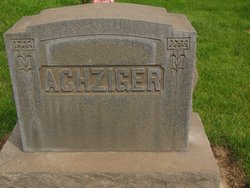
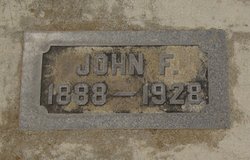
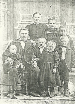
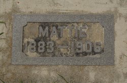
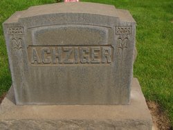
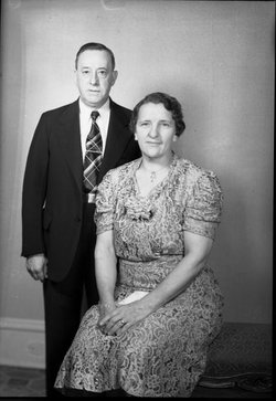
John Frederick Achziger
| Birth | : | 23 Jan 1888 Ritzville, Adams County, Washington, USA |
| Death | : | 13 Apr 1928 Tacoma, Pierce County, Washington, USA |
| Burial | : | Rotorua Crematorium and Cemetery, Rotorua, Rotorua District, New Zealand |
| Coordinate | : | -38.1533100, 176.2630900 |
| Description | : | Ritzville people were shocked last Friday to learn that Fred Achziger, born and raise a Ritzville boy and who numbered his friends by the hundred, had passed away that day at the Veterans' hospital in Tacoma, but four hours after he had been thekn there from the Walla Walla hospital. Mr. Achziger was stricken with a very severe case of influenza the latter part of January and after recovering to some extent he went to Spokane for treatments. Failig to recover from the effects of the attack he became a patient in the Walla Walla hospital on March 12th. For... Read More |
frequently asked questions (FAQ):
-
Where is John Frederick Achziger's memorial?
John Frederick Achziger's memorial is located at: Rotorua Crematorium and Cemetery, Rotorua, Rotorua District, New Zealand.
-
When did John Frederick Achziger death?
John Frederick Achziger death on 13 Apr 1928 in Tacoma, Pierce County, Washington, USA
-
Where are the coordinates of the John Frederick Achziger's memorial?
Latitude: -38.1533100
Longitude: 176.2630900
Family Members:
Parent
Siblings
Flowers:
Nearby Cemetories:
1. Rotorua Crematorium and Cemetery
Rotorua, Rotorua District, New Zealand
Coordinate: -38.1533100, 176.2630900
2. Whakarewarewa Urupā
Rotorua, Rotorua District, New Zealand
Coordinate: -38.1629708, 176.2556791
3. Kauae Cemetery
Ngongotaha, Rotorua District, New Zealand
Coordinate: -38.0915298, 176.2152557
4. Waiteti (Weriwiri Pa) Cemetery
Ngongotaha, Rotorua District, New Zealand
Coordinate: -38.0689500, 176.2132000
5. Ruamano Parekarangi Urupā
Horohoro, Rotorua District, New Zealand
Coordinate: -38.2349430, 176.1912227
6. Puhirua Urupā
Ngongotaha, Rotorua District, New Zealand
Coordinate: -38.0433300, 176.2228820
7. Motutawa Māori Cemetery
Mourea, Rotorua District, New Zealand
Coordinate: -38.0458300, 176.3381400
8. Okere Māori Cemetery
Okere Falls, Rotorua District, New Zealand
Coordinate: -38.0332900, 176.3464800
9. Mamaku Cemetery
Mamaku, Rotorua District, New Zealand
Coordinate: -38.0986200, 176.0726700
10. Ngāti Tarāwhai Ruatō urupa
Rotoiti, Rotorua District, New Zealand
Coordinate: -38.0578310, 176.4334750
11. Punawhakareia Urupa
Rotoiti, Rotorua District, New Zealand
Coordinate: -38.0566969, 176.4451150
12. Ngakuru Cemetery
Rotorua, Rotorua District, New Zealand
Coordinate: -38.3227770, 176.1911950
13. Tokoroa Cemetery
Tokoroa, South Waikato District, New Zealand
Coordinate: -38.2311010, 175.8826160
14. Kawerau Cemetery
Kawerau, Kawerau District, New Zealand
Coordinate: -38.0990990, 176.6762150
15. Te Puke Cemetery
Te Puke, Western Bay of Plenty District, New Zealand
Coordinate: -37.8054430, 176.3078800
16. Old Te Puke Cemetery
Te Puke, Western Bay of Plenty District, New Zealand
Coordinate: -37.7884910, 176.3354700
17. Te Kahika Māori Cemetery
Te Puke, Western Bay of Plenty District, New Zealand
Coordinate: -37.7884600, 176.3445600
18. Domain Road Cemetery
Putaruru, South Waikato District, New Zealand
Coordinate: -38.0603810, 175.7952220
19. Tirau Sreet Cemetery
Putaruru, South Waikato District, New Zealand
Coordinate: -38.0431570, 175.7834490
20. Pyes Pa Memorial Park
Tauranga, Tauranga City, New Zealand
Coordinate: -37.7689800, 176.1162770
21. Maketu Cemetery
Maketu, Western Bay of Plenty District, New Zealand
Coordinate: -37.7634700, 176.4511500
22. St. Thomas's Anglican Churchyard
Maketu, Western Bay of Plenty District, New Zealand
Coordinate: -37.7600849, 176.4555692
23. Tirau Cemetery
Tirau, South Waikato District, New Zealand
Coordinate: -37.9622060, 175.7796770
24. Hairini
Hairini, Tauranga City, New Zealand
Coordinate: -37.7241530, 176.1656207

