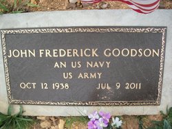
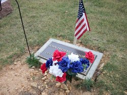
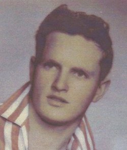
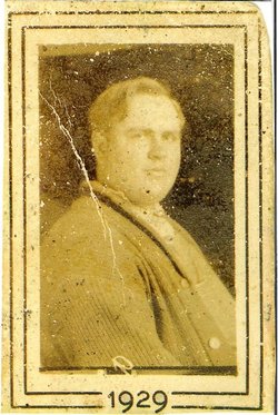
John Frederick “Fred” Goodson Sr.
| Birth | : | 12 Oct 1938 Ruble, Reynolds County, Missouri, USA |
| Death | : | 9 Jul 2011 Piedmont, Wayne County, Missouri, USA |
| Burial | : | Yount Cemetery, Reynolds County, USA |
| Coordinate | : | 37.0657800, -90.9093100 |
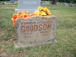
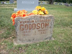
| Description | : | John "Fred" Goodson, age 72, of Piedmont, passed away Saturday, July 9, 2011 at the Clark's Mountin Nursing Center in Piedmont. He was born October 12, 1938 at Ruble, Missouri and had lived in the Piedmont area for many years. He was a veteran, serving in the US Navy and the US Army. He had worked as a lineman for the Libla Company and was of the Baptist faith. He is preceded in death by his parents, Marvin and Helen (Livingston) Goodson, 1 son, Eddie Goodson, 2 brothers, George and Vernon Goodson, and 2 sisters, Edith Montgomery and Opal Murphy.... Read More |
frequently asked questions (FAQ):
-
Where is John Frederick “Fred” Goodson Sr.'s memorial?
John Frederick “Fred” Goodson Sr.'s memorial is located at: Yount Cemetery, Reynolds County, USA.
-
When did John Frederick “Fred” Goodson Sr. death?
John Frederick “Fred” Goodson Sr. death on 9 Jul 2011 in Piedmont, Wayne County, Missouri, USA
-
Where are the coordinates of the John Frederick “Fred” Goodson Sr.'s memorial?
Latitude: 37.0657800
Longitude: -90.9093100
Family Members:
Parent
Siblings
Flowers:
Nearby Cemetories:
1. Sheets Cemetery
Carter County, USA
Coordinate: 37.0522003, -90.9246979
2. Tedder Cemetery
Van Buren, Carter County, USA
Coordinate: 37.0386009, -90.9306030
3. Odell Cemetery
Reynolds County, USA
Coordinate: 37.1086006, -90.9325027
4. Brame Cemetery
Van Buren, Carter County, USA
Coordinate: 37.0297012, -90.9655991
5. Potter Cemetery
Ellington, Reynolds County, USA
Coordinate: 37.1086006, -90.8544006
6. Gresham Cemetery
Carter County, USA
Coordinate: 37.0195540, -90.8574830
7. Harris Cemetery
Carter County, USA
Coordinate: 37.0038986, -90.9182968
8. Copeland Cemetery
Reynolds County, USA
Coordinate: 37.1222000, -90.8711014
9. Helvey Cemetery
Reynolds County, USA
Coordinate: 37.1272011, -90.8707962
10. Hoskins Cemetery
Van Buren, Carter County, USA
Coordinate: 37.0064011, -90.9702988
11. Bethlehem Cemetery
Ellington, Reynolds County, USA
Coordinate: 37.1432991, -90.9344025
12. Webb Cemetery
Reynolds, Reynolds County, USA
Coordinate: 37.0969009, -90.8146973
13. Galbraith Cemetery
Carter County, USA
Coordinate: 37.0731010, -91.0117035
14. Pine Lawn Cemetery
Ellsinore, Carter County, USA
Coordinate: 36.9877700, -90.8740460
15. Skiles Cemetery
Reynolds County, USA
Coordinate: 37.1333008, -90.8432999
16. Clark Cemetery
Van Buren, Carter County, USA
Coordinate: 37.0404470, -91.0171480
17. Aldrich Valley Cemetery
Carter County, USA
Coordinate: 36.9761009, -90.9349976
18. Alwood Cemetery
Reynolds County, USA
Coordinate: 37.0788994, -90.7928009
19. Van Buren City Cemetery
Van Buren, Carter County, USA
Coordinate: 37.0073000, -91.0027330
20. Masonic and Van Buren Cemetery
Van Buren, Carter County, USA
Coordinate: 37.0071030, -91.0027310
21. Smith Pine Valley Cemetery
Reynolds County, USA
Coordinate: 37.1397018, -90.9891968
22. Doe Run Cemetery
Reynolds County, USA
Coordinate: 37.1511002, -90.8486023
23. Maberry Cemetery
Van Buren, Carter County, USA
Coordinate: 37.0505981, -91.0318985
24. Carter Family Cemetery
South Van Buren, Carter County, USA
Coordinate: 36.9804350, -90.9843710

