
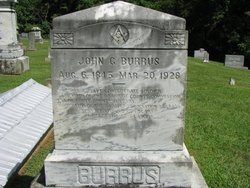
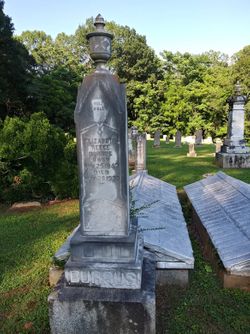
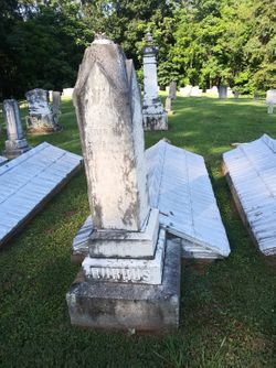
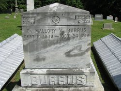
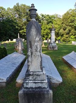
John G Burrus
| Birth | : | 6 Aug 1845 Surry County, North Carolina, USA |
| Death | : | 20 Mar 1928 High Point, Guilford County, North Carolina, USA |
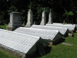
| Burial | : | Rockford Baptist Church Cemetery, Rockford, Surry County, USA |
| Coordinate | : | 36.2757492, -80.6517792 |
| Inscription | : | He Was A Brave Confederate Soldier A Member Of The Board Of County Commissioners Of Surry County 14 Years. Moderator Of The Baptist Association 27 Years Supt. Rockford S.S. 54 Years He Rest From His Labors |
| Description | : | Married Delana (Delania) Reece in Yadkin County, NC on 22 Feb 1872 |
frequently asked questions (FAQ):
-
Where is John G Burrus's memorial?
John G Burrus's memorial is located at: Rockford Baptist Church Cemetery, Rockford, Surry County, USA.
-
When did John G Burrus death?
John G Burrus death on 20 Mar 1928 in High Point, Guilford County, North Carolina, USA
-
Where are the coordinates of the John G Burrus's memorial?
Latitude: 36.2757492
Longitude: -80.6517792
Family Members:
Parent
Spouse
Siblings

Children
Flowers:


Nearby Cemetories:
1. Rockford Baptist Church Cemetery
Rockford, Surry County, USA
Coordinate: 36.2757492, -80.6517792
2. Wesley H. Whitaker Cemetery
Rockford, Surry County, USA
Coordinate: 36.2781670, -80.6558330
3. Freedom Gospel Church Cemetery
Rockford, Surry County, USA
Coordinate: 36.2763330, -80.6415000
4. Hamlin-Dobson Cemetery
Rockford, Surry County, USA
Coordinate: 36.2854200, -80.6363200
5. Chandler-Hudson Cemetery
Rockford, Surry County, USA
Coordinate: 36.2731490, -80.6862910
6. Collins-McCormick-Hudson Cemetery
Stony Knoll, Surry County, USA
Coordinate: 36.2953380, -80.6800080
7. Clarks Memorial Cemetery
Boonville, Yadkin County, USA
Coordinate: 36.2451371, -80.6553412
8. Crissman Family Cemetery
Siloam, Surry County, USA
Coordinate: 36.2909720, -80.6136940
9. Baker-Crowder Cemetery
Stony Knoll, Surry County, USA
Coordinate: 36.2991440, -80.6865850
10. Double Creek Church of Christ Cemetery
Copeland, Surry County, USA
Coordinate: 36.3128640, -80.6437320
11. Stanley Family Cemetery
Stony Knoll, Surry County, USA
Coordinate: 36.2979620, -80.6937210
12. Stony Knoll United Methodist Church Cemetery
Stony Knoll, Surry County, USA
Coordinate: 36.3121109, -80.6739197
13. William Stanley Family Cemetery
Stony Knoll, Surry County, USA
Coordinate: 36.3169920, -80.6579960
14. Butcher Graveyard
Stony Knoll, Surry County, USA
Coordinate: 36.3072710, -80.6855890
15. Richmond Hill Baptist Church Cemetery
Boonville, Yadkin County, USA
Coordinate: 36.2465620, -80.6135130
16. Jenkins-Stanley Family Cemetery
Fairview, Surry County, USA
Coordinate: 36.3011436, -80.6974564
17. Mount Pleasant Baptist Cemetery
Fairview, Surry County, USA
Coordinate: 36.3024960, -80.6999610
18. Crutchfield Family Cemetery
Dobson, Surry County, USA
Coordinate: 36.2765890, -80.7110270
19. Copeland Baptist Church Cemetery
Copeland, Surry County, USA
Coordinate: 36.3255577, -80.6531677
20. Charity Baptist Church Cemetery
Boonville, Yadkin County, USA
Coordinate: 36.2266998, -80.6738968
21. Cundiff-Crissman Cemetery
Siloam, Surry County, USA
Coordinate: 36.2838760, -80.5863900
22. Glory Light Baptist Church Cemetery
Siloam, Surry County, USA
Coordinate: 36.3050280, -80.5940830
23. Mount Pleasant United Methodist Church Cemetery
Boonville, Yadkin County, USA
Coordinate: 36.2220000, -80.6371670
24. Redeeming Grace Baptist Church Cemetery
Siloam, Surry County, USA
Coordinate: 36.3146060, -80.5989000