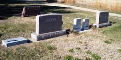
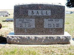
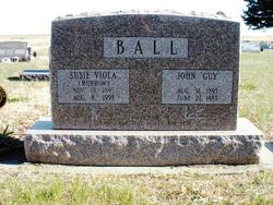
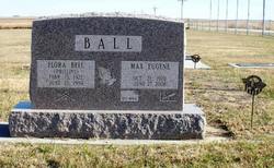
John Guy Ball
| Birth | : | 31 Aug 1895 Otego, Jewell County, Kansas, USA |
| Death | : | 27 Jun 1984 Jewell, Jewell County, Kansas, USA |
| Burial | : | Saint Josephs Cemetery, Stevens County, USA |
| Coordinate | : | 48.1523330, -117.6883330 |
| Description | : | John Guy Ball, 88, of Esbon, died June 27 at the Jewell County Hospital. He was born Aug. 31, 1895 at Otego. Survivors include his wife, Susie, of the home; three daughters, Carol McCormick, Red Cloud, Neb.; June Walker, Kingman, and Mae Beth Brightwell, Cottage Grove, Ore.; a son, Max, Esbon; 11 grandchildren; 20 great-grandchildren and seven great-great-grandchildren. His funeral was June 30 in Mankato at Kramer Funeral Home with burial in the Esbon Cemetery. |
frequently asked questions (FAQ):
-
Where is John Guy Ball's memorial?
John Guy Ball's memorial is located at: Saint Josephs Cemetery, Stevens County, USA.
-
When did John Guy Ball death?
John Guy Ball death on 27 Jun 1984 in Jewell, Jewell County, Kansas, USA
-
Where are the coordinates of the John Guy Ball's memorial?
Latitude: 48.1523330
Longitude: -117.6883330
Family Members:
Parent
Spouse
Siblings
Children
Flowers:
Nearby Cemetories:
1. Saint Josephs Cemetery
Stevens County, USA
Coordinate: 48.1523330, -117.6883330
2. Pine Grove Mennonite Church Cemetery
Valley, Stevens County, USA
Coordinate: 48.1506844, -117.7037888
3. Valley Cemetery
Valley, Stevens County, USA
Coordinate: 48.1790600, -117.7235500
4. Old Valley Indian Cemetery
Valley, Stevens County, USA
Coordinate: 48.1977700, -117.7402800
5. Forest Center Cemetery
Springdale, Stevens County, USA
Coordinate: 48.0937614, -117.7685471
6. Chewelah Memorial Park
Chewelah, Stevens County, USA
Coordinate: 48.2592010, -117.7127991
7. Indian Cemetery
Chewelah, Stevens County, USA
Coordinate: 48.2600300, -117.7102400
8. Loon Lake Community Cemetery
Loon Lake, Stevens County, USA
Coordinate: 48.0550003, -117.6141663
9. Springdale Cemetery
Springdale, Stevens County, USA
Coordinate: 48.0419000, -117.7475200
10. Chewelah Pioneer Cemetery
Chewelah, Stevens County, USA
Coordinate: 48.2802330, -117.6939740
11. Saint Mary of the Rosary Cemetery
Chewelah, Stevens County, USA
Coordinate: 48.2813940, -117.6938990
12. Zion Hill Cemetery
Deer Park, Spokane County, USA
Coordinate: 48.0024986, -117.5297012
13. Addy Cemetery
Addy, Stevens County, USA
Coordinate: 48.3442688, -117.8465576
14. Summit Valley Cemetery
Addy, Stevens County, USA
Coordinate: 48.3086014, -117.9424973
15. Pleasant View Cemetery
Ford, Stevens County, USA
Coordinate: 47.9267006, -117.7755966
16. Saint Mary Catholic Cemetery
Deer Park, Spokane County, USA
Coordinate: 47.9700012, -117.4700012
17. Moses Cemetery
Ford, Stevens County, USA
Coordinate: 47.9365800, -117.8311500
18. Woodland Cemetery
Deer Park, Spokane County, USA
Coordinate: 47.9557991, -117.4918976
19. Williams Valley Hillside Cemetery
Stevens County, USA
Coordinate: 47.9211006, -117.5836029
20. Tanger-Skeels Cemetery
Stevens County, USA
Coordinate: 48.3699400, -117.8522400
21. Hubert Cemetery
Ford, Stevens County, USA
Coordinate: 47.9188881, -117.8033295
22. Old Scotts Valley Cemetery
Tumtum, Stevens County, USA
Coordinate: 47.8973100, -117.6832000
23. Calispell Cemetery
Pend Oreille County, USA
Coordinate: 48.2888300, -117.3644000
24. Scotts Valley Cemetery
Tumtum, Stevens County, USA
Coordinate: 47.8950005, -117.6856003

