
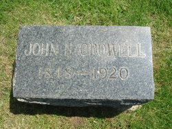


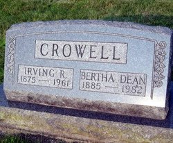
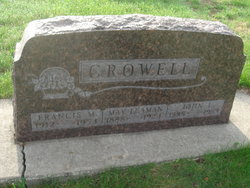
John H Crowell
| Birth | : | 16 Aug 1847 Walworth County, Wisconsin, USA |
| Death | : | 6 Feb 1920 Owen, Cerro Gordo County, Iowa, USA |
| Burial | : | Riverside Cemetery, Rockford, Floyd County, USA |
| Coordinate | : | 43.0578003, -92.9464035 |
| Plot | : | Section 6 |
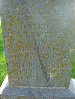
| Description | : | note** History of John and Death certificate both have birth year as 1847; tombstone has wrong year of 1848 ------------------------------------------------------------------------------ History of Floyd County, 1882 Page 1037 John H. Crowell Was born in Walworth County, Wis., in 1847. He is a son of Edward Crowell, who came from Allegany County, N. Y., to Wisconsin about 1844, remaining till 1856, when he came to Iowa, and located upon 240 acres which he had bought the year previous, on sections 30 and 31, Ulster Township, this county, where he made his home till his death, which... Read More |
frequently asked questions (FAQ):
-
Where is John H Crowell's memorial?
John H Crowell's memorial is located at: Riverside Cemetery, Rockford, Floyd County, USA.
-
When did John H Crowell death?
John H Crowell death on 6 Feb 1920 in Owen, Cerro Gordo County, Iowa, USA
-
Where are the coordinates of the John H Crowell's memorial?
Latitude: 43.0578003
Longitude: -92.9464035
Family Members:
Parent

Spouse
Siblings

Children
Flowers:


Nearby Cemetories:
1. Riverside Cemetery
Rockford, Floyd County, USA
Coordinate: 43.0578003, -92.9464035
2. Ulsterville Cemetery
Ulster Township, Floyd County, USA
Coordinate: 43.0936012, -92.8842010
3. Flood Creek Cemetery
Floyd County, USA
Coordinate: 43.0391998, -92.8538971
4. Rock Grove Township Cemetery
Nora Springs, Floyd County, USA
Coordinate: 43.1227989, -92.9880981
5. Rudd Evergreen Cemetery
Rudd, Floyd County, USA
Coordinate: 43.1417007, -92.9214020
6. Park Cemetery
Nora Springs, Floyd County, USA
Coordinate: 43.1444016, -92.9982986
7. Saint Marys Catholic Cemetery
Roseville, Floyd County, USA
Coordinate: 43.0090000, -92.8134000
8. West Saint Charles United Methodist Cemetery
Floyd County, USA
Coordinate: 43.0580597, -92.7897186
9. Westside Cemetery
Marble Rock, Floyd County, USA
Coordinate: 42.9556007, -92.8739014
10. Hillside Cemetery
Marble Rock, Floyd County, USA
Coordinate: 42.9583015, -92.8666992
11. Spring Grove Cemetery
Nora Springs, Floyd County, USA
Coordinate: 43.1631012, -93.0211029
12. Owens Grove Cemetery
Cerro Gordo County, USA
Coordinate: 43.0825005, -93.1144180
13. Saint Patricks Catholic Cemetery
Dougherty, Cerro Gordo County, USA
Coordinate: 42.9227791, -93.0294418
14. Eden Presbyterian Cemetery
Meroa, Mitchell County, USA
Coordinate: 43.2131004, -92.9103012
15. West End Cemetery
Meroa, Mitchell County, USA
Coordinate: 43.2216682, -92.9250031
16. Oakwood Cemetery
Floyd, Floyd County, USA
Coordinate: 43.1178017, -92.7307968
17. Dudley Cemetery
Dudley (historical), Mitchell County, USA
Coordinate: 43.2252998, -92.8743973
18. Rock Creek Cemetery
Meroa, Mitchell County, USA
Coordinate: 43.2352791, -92.9225006
19. Halls Grove Cemetery
Greene, Butler County, USA
Coordinate: 42.8840100, -92.8782300
20. Rock Falls Cemetery
Rock Falls, Cerro Gordo County, USA
Coordinate: 43.2122192, -93.0858307
21. Pleasant Grove Cemetery
Powersville, Floyd County, USA
Coordinate: 42.9441986, -92.7446976
22. Calvary Cemetery
Osage, Mitchell County, USA
Coordinate: 43.2238998, -92.8300018
23. Riverside Cemetery
Charles City, Floyd County, USA
Coordinate: 43.0766983, -92.6881027
24. West Fork Cemetery
Franklin County, USA
Coordinate: 42.8918991, -93.0836029