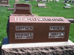
John Henderson
| Birth | : | 12 Mar 1815 Madison County, Kentucky, USA |
| Death | : | 18 Jun 1883 Decatur County, Iowa, USA |
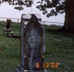
| Burial | : | Greendale Cemetery, Chilliwack, Fraser Valley Regional District, Canada |
| Coordinate | : | 49.1112800, -121.9889800 |
| Plot | : | 1 6-15 |
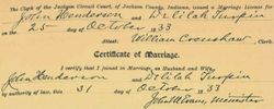
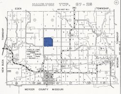
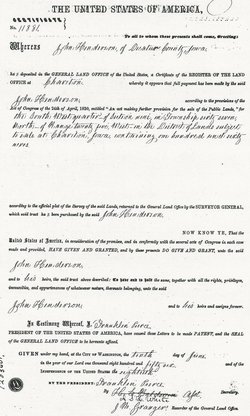
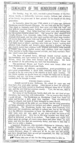
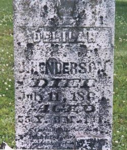
| Description | : | John Henderson and Delilah Turpen Henderson were early settlers in Decatur County Iowa. They were residents of Lawrence County, Indiana when in the early 1850s "Iowa Fever" swept over Indiana, and large numbers of families moved to Iowa to find better land. On Sept 11,1854 John sold his farm in Section 17 Twp. 6N Lawrence Co. IN.,to his brother Tyre Henderson for $1500.00. This farm was land he had inherited from his parents Jeremiah and Hannah Henderson. According to the Decatur County History John Henderson settled in Hamilton township in the early 1850s. John and... Read More |
frequently asked questions (FAQ):
-
Where is John Henderson's memorial?
John Henderson's memorial is located at: Greendale Cemetery, Chilliwack, Fraser Valley Regional District, Canada.
-
When did John Henderson death?
John Henderson death on 18 Jun 1883 in Decatur County, Iowa, USA
-
Where are the coordinates of the John Henderson's memorial?
Latitude: 49.1112800
Longitude: -121.9889800
Family Members:
Parent
Spouse
Children
Nearby Cemetories:
1. Greendale Cemetery
Chilliwack, Fraser Valley Regional District, Canada
Coordinate: 49.1112800, -121.9889800
2. Vedder View Gardens Cemetery
Chilliwack, Fraser Valley Regional District, Canada
Coordinate: 49.1113300, -121.9878800
3. Saint Mary's Cemetery
Chilliwack, Fraser Valley Regional District, Canada
Coordinate: 49.1112100, -121.9494700
4. Carman Cemetery
Chilliwack, Fraser Valley Regional District, Canada
Coordinate: 49.1112140, -121.9494650
5. Soowahlie First Nation Cemetery
Soowahlie, Fraser Valley Regional District, Canada
Coordinate: 49.0866390, -121.9653890
6. Ch'iyàqtel Cemetery
Tzeachten, Fraser Valley Regional District, Canada
Coordinate: 49.1145750, -121.9391710
7. Yarrow Mennonite Cemetery
Yarrow, Fraser Valley Regional District, Canada
Coordinate: 49.0871100, -122.0724900
8. Chilliwack Cemeteries
Chilliwack, Fraser Valley Regional District, Canada
Coordinate: 49.1836128, -121.9063110
9. Deroche First Nations Cemetery
Deroche, Fraser Valley Regional District, Canada
Coordinate: 49.1888400, -122.0747800
10. Saint Peters Cemetery
Whatcom County, USA
Coordinate: 48.9794006, -122.1406021
11. Pretty Family Cemetery
Harrison Mills, Fraser Valley Regional District, Canada
Coordinate: 49.2826900, -121.9483500
12. Kent Municipal Cemetery
Agassiz, Fraser Valley Regional District, Canada
Coordinate: 49.2368800, -121.8034900
13. Musselwhite Cemetery
Abbotsford, Fraser Valley Regional District, Canada
Coordinate: 49.0419100, -122.2448900
14. Hatzic Cemetery
Hatzic, Fraser Valley Regional District, Canada
Coordinate: 49.1599998, -122.2570038
15. Valley View Cemetery
Agassiz, Fraser Valley Regional District, Canada
Coordinate: 49.2602090, -121.8178870
16. Chehalis Cemetery
Agassiz, Fraser Valley Regional District, Canada
Coordinate: 49.2602330, -121.8179150
17. Westminster Abbey Cemetery
Mission, Fraser Valley Regional District, Canada
Coordinate: 49.1564000, -122.2730800
18. Oblates of Mary Immaculate Cemetery
Mission, Fraser Valley Regional District, Canada
Coordinate: 49.1403461, -122.2859594
19. Hazelwood Cemetery
Abbotsford, Fraser Valley Regional District, Canada
Coordinate: 49.0629600, -122.2815200
20. Old Maple Falls Cemetery
Maple Falls, Whatcom County, USA
Coordinate: 48.9207000, -122.0757000
21. Maclure Road Mennonite Cemetery
Abbotsford, Fraser Valley Regional District, Canada
Coordinate: 49.0604553, -122.2841415
22. Maple Falls Cemetery
Maple Falls, Whatcom County, USA
Coordinate: 48.9208320, -122.0817140
23. Sumas Cemetery
Sumas, Whatcom County, USA
Coordinate: 48.9819880, -122.2480330
24. Glacier Cemetery
Glacier, Whatcom County, USA
Coordinate: 48.8900000, -121.9247000

