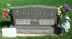
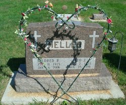
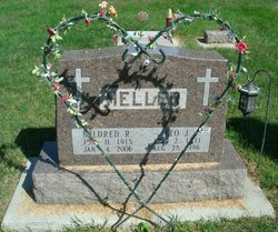
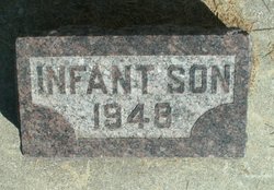
John Henry Heller
| Birth | : | 18 Oct 1936 Dunlap, Harrison County, Iowa, USA |
| Death | : | 31 Aug 2007 Dunlap, Harrison County, Iowa, USA |
| Burial | : | Lulu Falls Cemetery, Kingsville, Ashtabula County, USA |
| Coordinate | : | 41.8857994, -80.6663971 |
| Plot | : | New Section, block 6 |
| Description | : | Obituary John Henry Heller was born October 18, 1936, to Leo and Mildred (Weber) Heller in Dunlap, Iowa. He was raised in Dunlap and graduated from St. Joseph Catholic High School in 1955. John drove a rock truck before purchasing the Dunlap Oil Company from Dean Honaker in 1960. John married Sharon Kay Thiessen on June 12, 1971, in Ashland, Nebraska. John and Sharon built Hellers' Town and Country convenience store in 1983. John also helped Kenneth Barrett at the Barrett Funeral Home and continued helping when the funeral home changed hands and became Fouts Funeral Home. John was... Read More |
frequently asked questions (FAQ):
-
Where is John Henry Heller's memorial?
John Henry Heller's memorial is located at: Lulu Falls Cemetery, Kingsville, Ashtabula County, USA.
-
When did John Henry Heller death?
John Henry Heller death on 31 Aug 2007 in Dunlap, Harrison County, Iowa, USA
-
Where are the coordinates of the John Henry Heller's memorial?
Latitude: 41.8857994
Longitude: -80.6663971
Family Members:
Parent
Spouse
Siblings
Flowers:
Nearby Cemetories:
1. Longview Cemetery
Kingsville, Ashtabula County, USA
Coordinate: 41.8851500, -80.6662360
2. Old Kingsville Corners Cemetery
Kingsville, Ashtabula County, USA
Coordinate: 41.8883930, -80.6775800
3. Greenlawn Memory Gardens
North Kingsville, Ashtabula County, USA
Coordinate: 41.9113960, -80.6741943
4. East Lake Cemetery
North Kingsville, Ashtabula County, USA
Coordinate: 41.9039001, -80.6921997
5. Gageville Cemetery
Sheffield Center, Ashtabula County, USA
Coordinate: 41.8450300, -80.6677600
6. West Lakeville Cemetery
Amboy, Ashtabula County, USA
Coordinate: 41.9257460, -80.6217150
7. Monroe Township Kelloggsville Cemetery
Kelloggsville, Ashtabula County, USA
Coordinate: 41.8525009, -80.6108017
8. Lake Road Cemetery
Ashtabula County, USA
Coordinate: 41.9383011, -80.6496964
9. Old Barn Ring Family Cemetery
Conneaut, Ashtabula County, USA
Coordinate: 41.8335390, -80.6155120
10. Saint Joseph Cemetery
Conneaut, Ashtabula County, USA
Coordinate: 41.9310989, -80.6027985
11. Glenwood Cemetery
Conneaut, Ashtabula County, USA
Coordinate: 41.9324989, -80.5997009
12. Durkee Cemetery
Conneaut, Ashtabula County, USA
Coordinate: 41.8925018, -80.5727997
13. Farnham Cemetery
Conneaut, Ashtabula County, USA
Coordinate: 41.9087900, -80.5706100
14. Reeds Corners Cemetery
Ashtabula County, USA
Coordinate: 41.8563030, -80.5726960
15. Maple Grove Cemetery
Ashtabula, Ashtabula County, USA
Coordinate: 41.8511009, -80.7572021
16. Edgewood Cemetery
Edgewood, Ashtabula County, USA
Coordinate: 41.8707200, -80.7726000
17. Center Cemetery
Conneaut, Ashtabula County, USA
Coordinate: 41.9370100, -80.5817000
18. Harringtons Point Cemetery
Conneaut, Ashtabula County, USA
Coordinate: 41.9537800, -80.5965800
19. Old Ashtabula Cemetery
Ashtabula, Ashtabula County, USA
Coordinate: 41.8675000, -80.7838890
20. Chestnut Grove Cemetery
Ashtabula, Ashtabula County, USA
Coordinate: 41.8549995, -80.7814026
21. Saint Peters Episcopal Church Columbarium
Ashtabula County, USA
Coordinate: 41.8626480, -80.7847100
22. City Cemetery
Conneaut, Ashtabula County, USA
Coordinate: 41.9409100, -80.5620700
23. Clark's Corner Cemetery
Conneaut, Ashtabula County, USA
Coordinate: 41.8950005, -80.5289001
24. Griggs Corners Cemetery
Ashtabula County, USA
Coordinate: 41.7882600, -80.7130700

