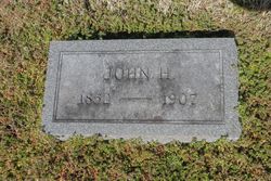
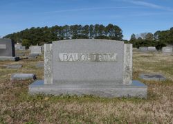
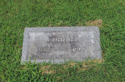
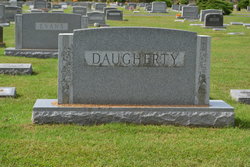
John Henry “Jack Hen” Daugherty
| Birth | : | 22 Mar 1852 Daugherty Town, Somerset County, Maryland, USA |
| Death | : | 28 Jul 1907 Crisfield, Somerset County, Maryland, USA |
| Burial | : | South Perry Olive Cemetery, South Perry, Hocking County, USA |
| Coordinate | : | 39.4933400, -82.6624200 |
| Description | : | Crisfield, MD Police Officer Night Chief Daugherty died of injuries after being shot by suspect James Reed (beaten to death after his arrest.) He left behind a wife and 5 children. Night Chief John Daugherty was shot and killed as he and another officer walked a prisoner to jail. The two officers had just arrested the man for selling whiskey. A friend of the man witnessed the arrest and obtained a .44 caliber revolver. The friend followed the officers and prisoner for about half a block, and shot Night Chief Daugherty in the back of the... Read More |
frequently asked questions (FAQ):
-
Where is John Henry “Jack Hen” Daugherty's memorial?
John Henry “Jack Hen” Daugherty's memorial is located at: South Perry Olive Cemetery, South Perry, Hocking County, USA.
-
When did John Henry “Jack Hen” Daugherty death?
John Henry “Jack Hen” Daugherty death on 28 Jul 1907 in Crisfield, Somerset County, Maryland, USA
-
Where are the coordinates of the John Henry “Jack Hen” Daugherty's memorial?
Latitude: 39.4933400
Longitude: -82.6624200
Family Members:
Parent
Spouse
Siblings
Flowers:
Nearby Cemetories:
1. South Perry Olive Cemetery
South Perry, Hocking County, USA
Coordinate: 39.4933400, -82.6624200
2. Friend Cemetery
Perry Township, Hocking County, USA
Coordinate: 39.4892006, -82.6883011
3. Pleasant Ridge Cemetery
Laurelville, Hocking County, USA
Coordinate: 39.4765816, -82.6817322
4. Davis Cemetery
Laurelville, Hocking County, USA
Coordinate: 39.4919014, -82.7024994
5. Sours Cemetery
Laurel Township, Hocking County, USA
Coordinate: 39.4678001, -82.6216965
6. McClelland Cemetery
Perry Township, Hocking County, USA
Coordinate: 39.5248870, -82.6983300
7. Oak Grove Cemetery
South Perry, Hocking County, USA
Coordinate: 39.4722519, -82.6111603
8. Bethel Church Cemetery
Haynes, Hocking County, USA
Coordinate: 39.4485092, -82.6472092
9. Old Baptist Cemetery
Laurel Township, Hocking County, USA
Coordinate: 39.4901090, -82.5973750
10. Karshner Cemetery
Haynes, Hocking County, USA
Coordinate: 39.4427986, -82.6658020
11. Grant-Moore Cemetery
Laurel Township, Hocking County, USA
Coordinate: 39.4993680, -82.5971620
12. Haynes Cemetery
Salt Creek Township, Hocking County, USA
Coordinate: 39.4411011, -82.6819000
13. Buena Vista Cemetery
Buena Vista, Hocking County, USA
Coordinate: 39.5497017, -82.6736908
14. Homestead Crossing Cemetery
Rockbridge, Hocking County, USA
Coordinate: 39.5212690, -82.5891820
15. Morgan Chapel Cemetery
Rockbridge, Hocking County, USA
Coordinate: 39.5542908, -82.6383438
16. Belleview Cemetery
Adelphi, Ross County, USA
Coordinate: 39.4672852, -82.7434998
17. Old Methodist Cemetery
Adelphi, Ross County, USA
Coordinate: 39.4672900, -82.7446100
18. Betheny Cemetery
Perry Township, Hocking County, USA
Coordinate: 39.5595700, -82.6935900
19. Hansen Cemetery
Laurel Township, Hocking County, USA
Coordinate: 39.5253340, -82.5788750
20. Old Lutheran Cemetery
Adelphi, Ross County, USA
Coordinate: 39.4644585, -82.7487259
21. Stumpf Cemetery
Pickaway County, USA
Coordinate: 39.4968987, -82.7566986
22. Old Gibisonville ME United Brethren Cemetery
Gibisonville, Hocking County, USA
Coordinate: 39.4990770, -82.5651490
23. Pisgah Cemetery
Good Hope Township, Hocking County, USA
Coordinate: 39.5610199, -82.6120224
24. Chambers-Grubb Cemetery
Laurelville, Hocking County, USA
Coordinate: 39.5587600, -82.7206900

